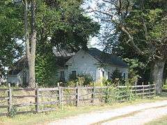
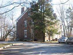
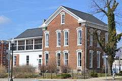
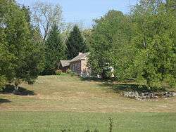
| [3] |
Name on the Register[4] |
Image |
Date listed[5] |
Location |
City or town |
Description |
|---|
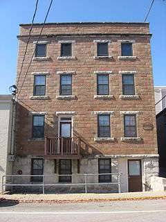
| 1 |
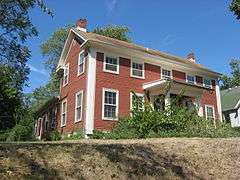
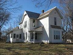
Elias Abel House |
|
000000001982-02-19-0000February 19, 1982
(#82000023) |
317 N. Fairview St.
39°10′09″N 86°32′29″W / 39.169167°N 86.541389°W / 39.169167; -86.541389 (Elias Abel House) |
Bloomington |
|
| 2 |
Blair-Dunning House |
|
000000001983-02-10-0000February 10, 1983
(#83000009) |
608 W. 3rd St.
39°09′52″N 86°32′24″W / 39.164444°N 86.540000°W / 39.164444; -86.540000 (Blair-Dunning House) |
Bloomington |
|
| 3 |
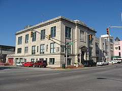
Bloomington City Hall |
|
000000001989-09-14-0000September 14, 1989
(#89001413) |
122 S. Walnut St.
39°09′57″N 86°32′02″W / 39.165833°N 86.533889°W / 39.165833; -86.533889 (Bloomington City Hall) |
Bloomington |
|
| 4 |
Bloomington West Side Historic District |
|
000000001997-02-14-0000February 14, 1997
(#97000055) |
Roughly bounded by W. 10th, N. Morton, W. 4th, and N. Adams Sts.
39°10′07″N 86°32′34″W / 39.168589°N 86.542731°W / 39.168589; -86.542731 (Bloomington West Side Historic District) |
Bloomington |
|
| 5 |
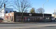
Cantol Wax Company Building |
|
000000001990-05-24-0000May 24, 1990
(#90000812) |
211 N. Washington St.
39°10′04″N 86°31′57″W / 39.167778°N 86.5325°W / 39.167778; -86.5325 (Cantol Wax Company Building) |
Bloomington |
|
| 6 |
Coca-Cola Bottling Company Plant |
|
000000002000-03-15-0000March 15, 2000
(#00000206) |
318 S. Washington St.
39°09′50″N 86°31′57″W / 39.163889°N 86.5325°W / 39.163889; -86.5325 (Coca-Cola Bottling Company Plant) |
Bloomington |
|
| 7 |
Cochran-Helton-Lindley House |
|
000000001979-06-20-0000June 20, 1979
(#79000010) |
405 N. Rogers St.
39°10′11″N 86°32′20″W / 39.169722°N 86.538889°W / 39.169722; -86.538889 (Cochran-Helton-Lindley House) |
Bloomington |
|
| 8 |
Courthouse Square Historic District |
|
000000001990-12-18-0000December 18, 1990
(#90001931) |
Roughly bounded by 7th, Walnut, and 4th Sts. and College Ave.
39°10′00″N 86°32′04″W / 39.166667°N 86.534444°W / 39.166667; -86.534444 (Courthouse Square Historic District) |
Bloomington |
|
| 9 |
Ellettsville Downtown Historic District |
|
000000002006-09-20-0000September 20, 2006
(#06000849) |
Roughly bounded by Main, Sale, Walnut, and Association Sts.
39°14′18″N 86°37′29″W / 39.238333°N 86.624722°W / 39.238333; -86.624722 (Ellettsville Downtown Historic District) |
Ellettsville |
|
| 10 |
Ennis Archaeological Site (12 OW 229) |
|
000000001985-05-30-0000May 30, 1985
(#85001167) |
Address Restricted
|
Richland Township |
Extends into Owen County
|
| 11 |
Epsilon II Archeological Site (12MO133) |
|
000000001986-03-25-0000March 25, 1986
(#86000524) |
Address Restricted
|
Polk Township |
|
| 12 |
Hinkle-Garton Farmstead |
|
000000002007-04-12-0000April 12, 2007
(#07000282) |
2920 E. 10th St.
39°10′16″N 86°29′50″W / 39.171111°N 86.497222°W / 39.171111; -86.497222 (Hinkle-Garton Farmstead) |
Bloomington |
|
| 13 |
Home Laundry Company |
|
000000002000-03-15-0000March 15, 2000
(#00000208) |
300 E. 3rd St.
39°09′52″N 86°31′50″W / 39.164444°N 86.530556°W / 39.164444; -86.530556 (Home Laundry Company) |
Bloomington |
|
| 14 |
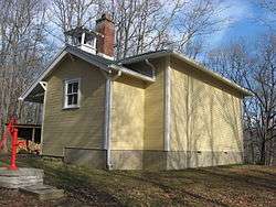
Honey Creek School |
|
000000001978-09-20-0000September 20, 1978
(#78000024) |
Northeast of Bloomington on Low Gap Rd.
39°17′07″N 86°24′32″W / 39.285278°N 86.408889°W / 39.285278; -86.408889 (Honey Creek School) |
Benton Township |
|
| 15 |
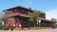
Illinois Central Railroad Freight Depot |
|
000000001983-06-23-0000June 23, 1983
(#83000113) |
301 N. Morton St.
39°10′07″N 86°32′11″W / 39.168611°N 86.536389°W / 39.168611; -86.536389 (Illinois Central Railroad Freight Depot) |
Bloomington |
|
| 16 |
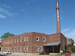
Johnson's Creamery |
|
000000001996-03-14-0000March 14, 1996
(#96000284) |
400 W. 7th St.
39°10′08″N 86°32′14″W / 39.168889°N 86.537222°W / 39.168889; -86.537222 (Johnson's Creamery) |
Bloomington |
|
| 17 |
Kappa V Archeological Site (12MO301) |
|
000000001986-03-31-0000March 31, 1986
(#86000630) |
Address Restricted
|
Polk Township |
|
| 18 |
John F. and Malissa Koontz House |
|
000000002014-03-26-0000March 26, 2014
(#14000075) |
7401 S. Mount Zion Rd., southwest of Bloomington
39°04′05″N 86°37′34″W / 39.067917°N 86.626111°W / 39.067917; -86.626111 (John F. and Malissa Koontz House) |
Indian Creek Township |
|
| 19 |
Legg House |
|
000000002001-04-12-0000April 12, 2001
(#01000359) |
324 S. Henderson
39°09′49″N 86°31′39″W / 39.163611°N 86.5275°W / 39.163611; -86.5275 (Legg House) |
Bloomington |
|
| 20 |
Maple Grove Road Rural Historic District |
|
000000001998-08-21-0000August 21, 1998
(#98001051) |
Roughly Maple Grove Rd. from Beanblossom Creek to State Road 46 northwest of Bloomington, including the eastern half of the Lancaster Park subdivision
39°13′19″N 86°33′46″W / 39.221944°N 86.562778°W / 39.221944; -86.562778 (Maple Grove Road Rural Historic District) |
Bloomington and Richland Townships |
|
| 21 |
Matthews Stone Company Historic District |
|
000000002013-09-18-0000September 18, 2013
(#13000725) |
6293 N. Matthews Dr. and 6445 W. Maple Grove Rd., north of Ellettsville
39°14′42″N 86°37′10″W / 39.245000°N 86.619444°W / 39.245000; -86.619444 (Matthews Stone Company Historic District) |
Richland Township |
|
| 22 |
Leroy Mayfield House |
|
000000001994-06-10-0000June 10, 1994
(#94000583) |
110 N. Oard Rd., west of Bloomington
39°10′03″N 86°37′12″W / 39.1675°N 86.62°W / 39.1675; -86.62 (Leroy Mayfield House) |
Richland Township |
|
| 23 |
Millen House |
|
000000002004-09-29-0000September 29, 2004
(#04001104) |
112 N. Bryan Ave.
39°10′02″N 86°30′28″W / 39.167222°N 86.507778°W / 39.167222; -86.507778 (Millen House) |
Bloomington |
|
| 24 |
Millen-Chase-McCalla House |
|
000000002014-03-26-0000March 26, 2014
(#14000076) |
403 N. Walnut St.
39°10′11″N 86°32′02″W / 39.169722°N 86.533889°W / 39.169722; -86.533889 (Millen-Chase-McCalla House) |
Bloomington |
|
| 25 |
Joseph Mitchell House |
|
000000001986-06-13-0000June 13, 1986
(#86001268) |
7008 Ketcham Rd., west of Smithville
39°04′21″N 86°32′58″W / 39.0725°N 86.549444°W / 39.0725; -86.549444 (Joseph Mitchell House) |
Clear Creek Township |
|
| 26 |
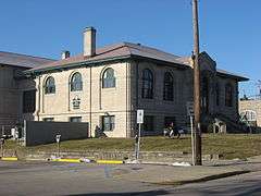
Monroe Carnegie Library |
|
000000001978-03-08-0000March 8, 1978
(#78000025) |
200 E. 6th St.
39°10′03″N 86°31′54″W / 39.1675°N 86.531667°W / 39.1675; -86.531667 (Monroe Carnegie Library) |
Bloomington |
|
| 27 |
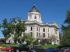
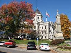
Monroe County Courthouse |
|
000000001976-10-08-0000October 8, 1976
(#76000012) |
Courthouse Sq.
39°10′01″N 86°32′03″W / 39.166944°N 86.534167°W / 39.166944; -86.534167 (Monroe County Courthouse) |
Bloomington |
|
| 28 |
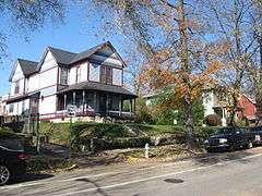
Morgan House |
|
000000001983-03-03-0000March 3, 1983
(#83000140) |
532 N. Walnut St.
39°10′16″N 86°32′00″W / 39.171111°N 86.533333°W / 39.171111; -86.533333 (Morgan House) |
Bloomington |
Designed by architect George Franklin Barber
|
| 29 |
J.L. Nichols House and Studio |
|
000000001984-09-27-0000September 27, 1984
(#84001207) |
820 N. College Ave.
39°10′28″N 86°32′03″W / 39.174444°N 86.534167°W / 39.174444; -86.534167 (J.L. Nichols House and Studio) |
Bloomington |
|
| 30 |
North Washington Street Historic District |
|
000000001991-03-14-0000March 14, 1991
(#91000271) |
Roughly bounded by E. 10th, E. 8th, N. Walnut and N. Lincoln Sts.
39°10′13″N 86°31′57″W / 39.170278°N 86.532500°W / 39.170278; -86.532500 (North Washington Street Historic District) |
Bloomington |
|
| 31 |
The Old Crescent |
|
000000001980-09-08-0000September 8, 1980
(#80000028) |
Indiana University campus
39°09′59″N 86°31′29″W / 39.166389°N 86.524722°W / 39.166389; -86.524722 (The Old Crescent) |
Bloomington |
|
| 32 |
Princess Theatre |
|
000000001983-06-16-0000June 16, 1983
(#83000112) |
206 N. Walnut St.
39°10′04″N 86°32′00″W / 39.167889°N 86.533472°W / 39.167889; -86.533472 (Princess Theatre) |
Bloomington |
|
| 33 |
Prospect Hill Historic District |
|
000000001991-03-14-0000March 14, 1991
(#91000272) |
Roughly bounded by 3rd, Rogers, Smith, and Jackson Sts.
39°09′50″N 86°32′20″W / 39.163889°N 86.538889°W / 39.163889; -86.538889 (Prospect Hill Historic District) |
Bloomington |
|
| 34 |
Second Baptist Church |
|
000000001995-09-14-0000September 14, 1995
(#95001108) |
321 N. Rogers St.
39°10′09″N 86°32′20″W / 39.169167°N 86.538889°W / 39.169167; -86.538889 (Second Baptist Church) |
Bloomington |
|
| 35 |
Secrest Ferry Bridge |
|
000000001996-05-30-0000May 30, 1996
(#96000603) |
County Road 450E over the West Fork of the White River, south of Gosport
39°19′57″N 86°40′35″W / 39.3325°N 86.676389°W / 39.3325; -86.676389 (Secrest Ferry Bridge) |
Bean Blossom Township |
Extends into Owen County
|
| 36 |
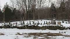
Seminary Square Park |
|
000000001977-09-19-0000September 19, 1977
(#77000012) |
College Ave. and E. 2nd St.
39°09′40″N 86°32′03″W / 39.161111°N 86.534167°W / 39.161111; -86.534167 (Seminary Square Park) |
Bloomington |
|
| 37 |
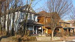
Steele Dunning Historic District |
|
000000002000-09-22-0000September 22, 2000
(#00001140) |
Roughly bounded by Maple St., Kirkwood Ave., Rogers St., and W. 3rd St.
39°09′56″N 86°32′28″W / 39.165556°N 86.541111°W / 39.165556; -86.541111 (Steele Dunning Historic District) |
Bloomington |
|
| 38 |
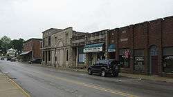
Stinesville Commercial Historic District |
|
000000001995-06-08-0000June 8, 1995
(#95000707) |
8201, 8211, 8223, 8231, and 8237 W. Main St.
39°17′55″N 86°39′03″W / 39.298611°N 86.650833°W / 39.298611; -86.650833 (Stinesville Commercial Historic District) |
Stinesville |
|
| 39 |
Daniel Stout House |
|
000000001973-11-30-0000November 30, 1973
(#73000012) |
Northwest of Bloomington off State Road 46, on Maple Grove Rd.
39°12′13″N 86°33′32″W / 39.203611°N 86.558889°W / 39.203611; -86.558889 (Daniel Stout House) |
Bloomington Township |
|
| 40 |
University Courts Historic District |
|
000000002007-12-26-0000December 26, 2007
(#07001308) |
Roughly bounded by 7th St., Indiana Ave., 10th St., and Woodlawn Ave.
39°10′12″N 86°31′31″W / 39.170000°N 86.525222°W / 39.170000; -86.525222 (University Courts Historic District) |
Bloomington |
|
| 41 |
Vinegar Hill Historic District |
|
000000002005-06-17-0000June 17, 2005
(#05000195) |
E. 1st St. from Woodlawn to Jordan and S. Sheridan to E. Maxwell
39°09′33″N 86°31′10″W / 39.159167°N 86.519444°W / 39.159167; -86.519444 (Vinegar Hill Historic District) |
Bloomington |
|
| 42 |
Wicks Building |
|
000000001983-03-03-0000March 3, 1983
(#83000141) |
116 W. 6th St.
39°10′03″N 86°32′02″W / 39.1675°N 86.533889°W / 39.1675; -86.533889 (Wicks Building) |
Bloomington |
|
| 43 |
Woolery Stone Company |
|
000000002002-12-20-0000December 20, 2002
(#02001563) |
2295 W. Tapp Rd.
39°08′21″N 86°33′38″W / 39.139167°N 86.560556°W / 39.139167; -86.560556 (Woolery Stone Company) |
Bloomington |
|
| 44 |
Andrew Wylie House |
|
000000001977-04-18-0000April 18, 1977
(#77000013) |
307 E. 2nd St.
39°09′42″N 86°31′50″W / 39.161667°N 86.530556°W / 39.161667; -86.530556 (Andrew Wylie House) |
Bloomington |
|

