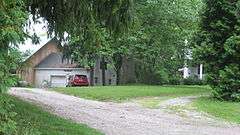
| [3] |
Name on the Register[4] |
Image |
Date listed[5] |
Location |
City or town |
Description |
|---|
| 1 |
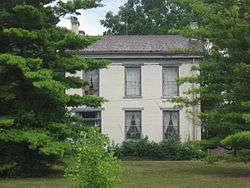
Beechwood (Isaac Kinsey House) |
|
000000001975-02-21-0000February 21, 1975
(#75000031) |
2 miles south of Milton on Sarver Rd.
39°45′15″N 85°09′04″W / 39.754167°N 85.151111°W / 39.754167; -85.151111 (Beechwood (Isaac Kinsey House)) |
Washington Township |
|
| 2 |
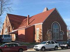
Bethel A.M.E. Church |
|
000000001975-09-05-0000September 5, 1975
(#75000032) |
200 S. 6th St.
39°49′33″N 84°53′41″W / 39.825833°N 84.894722°W / 39.825833; -84.894722 (Bethel A.M.E. Church) |
Richmond |
|
| 3 |
Mary Birdsall House |
|
000000001999-09-23-0000September 23, 1999
(#99001155) |
504 NW. 5th St.
39°50′05″N 84°54′31″W / 39.834722°N 84.908611°W / 39.834722; -84.908611 (Mary Birdsall House) |
Richmond |
|
| 4 |
Cambridge City Historic District |
|
000000001991-06-14-0000June 14, 1991
(#91000787) |
Roughly bounded by Boundary, Maple, High, and 4th Sts.
39°48′41″N 85°10′16″W / 39.811389°N 85.171111°W / 39.811389; -85.171111 (Cambridge City Historic District) |
Cambridge City |
|
| 5 |
Centerville Historic District |
|
000000001971-10-26-0000October 26, 1971
(#71000008) |
Bounded by the corporation limits, 3rd and South Sts., and Willow Grove Rd.
39°49′09″N 84°59′47″W / 39.819167°N 84.996389°W / 39.819167; -84.996389 (Centerville Historic District) |
Centerville |
|
| 6 |
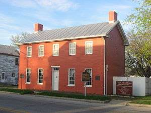
Levi Coffin House |
|
000000001966-10-15-0000October 15, 1966
(#66000009) |
115 N. Main St.
39°57′23″N 84°55′02″W / 39.956389°N 84.917222°W / 39.956389; -84.917222 (Levi Coffin House) |
Fountain City |
|
| 7 |
Conklin-Montgomery House |
|
000000001975-02-24-0000February 24, 1975
(#75000033) |
302 E. Main St.
39°48′45″N 85°09′52″W / 39.8125°N 85.164444°W / 39.8125; -85.164444 (Conklin-Montgomery House) |
Cambridge City |
|
| 8 |
David Worth Dennis House |
|
000000002001-04-25-0000April 25, 2001
(#01000404) |
610 W. Main St.
39°49′45″N 84°54′36″W / 39.829167°N 84.91°W / 39.829167; -84.91 (David Worth Dennis House) |
Richmond |
|
| 9 |
Doddridge Chapel and Cemetery |
|
000000002003-09-28-0000September 28, 2003
(#03000984) |
9471 Chapel Rd., southwest of Centerville
39°45′04″N 85°03′21″W / 39.751111°N 85.055833°W / 39.751111; -85.055833 (Doddridge Chapel and Cemetery) |
Washington Township |
|
| 10 |
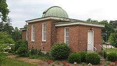
Earlham College Observatory |
|
000000001975-10-21-0000October 21, 1975
(#75000034) |
National Rd. on the Earlham College campus
39°49′28″N 84°54′51″W / 39.824444°N 84.914167°W / 39.824444; -84.914167 (Earlham College Observatory) |
Richmond |
|
| 11 |
East Main Street-Glen Miller Park Historic District |
|
000000001986-03-27-0000March 27, 1986
(#86000612) |
Both sides of E. Main St. from N. 18th to N. 30th Sts. and Glen Miller Park east of 30th St.
39°49′58″N 84°52′04″W / 39.832778°N 84.867778°W / 39.832778; -84.867778 (East Main Street-Glen Miller Park Historic District) |
Richmond |
|
| 12 |
Forest Hills Country Club |
|
000000002015-12-15-0000December 15, 2015
(#15000892) |
2169 S. 23rd St.
39°48′15″N 84°52′11″W / 39.804270°N 84.869644°W / 39.804270; -84.869644 (Forest Hills Country Club) |
Wayne Township |
|
| 13 |
Abram Gaar House and Farm |
|
000000001975-02-20-0000February 20, 1975
(#75000035) |
2411 Pleasant View Rd., northeast of Richmond
39°50′57″N 84°52′00″W / 39.849167°N 84.866667°W / 39.849167; -84.866667 (Abram Gaar House and Farm) |
Wayne Township |
|
| 14 |
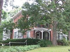
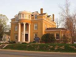
Henry and Alice Gennett House |
|
000000001983-08-11-0000August 11, 1983
(#83000043) |
1829 E. Main St.
39°49′47″N 84°52′37″W / 39.829722°N 84.876944°W / 39.829722; -84.876944 (Henry and Alice Gennett House) |
Richmond |
|
| 15 |
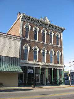
Hagerstown I.O.O.F. Hall |
|
000000001978-01-03-0000January 3, 1978
(#78000041) |
Main and Perry Sts.
39°54′40″N 85°09′37″W / 39.911111°N 85.160278°W / 39.911111; -85.160278 (Hagerstown I.O.O.F. Hall) |
Hagerstown |
|
| 16 |
Hicksite Friends Meetinghouse (Wayne County Museum) |
|
000000001975-10-14-0000October 14, 1975
(#75000036) |
1150 N. A St.
39°49′51″N 84°53′13″W / 39.830833°N 84.886944°W / 39.830833; -84.886944 (Hicksite Friends Meetinghouse (Wayne County Museum)) |
Richmond |
|
| 17 |
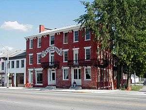
The Huddleston House Tavern |
|
000000001975-06-15-0000June 15, 1975
(#75000037) |
E. U.S. Route 40
39°48′41″N 85°11′03″W / 39.811389°N 85.184167°W / 39.811389; -85.184167 (The Huddleston House Tavern) |
Mount Auburn |
|
| 18 |
Lewis Jones House |
|
000000001984-06-07-0000June 7, 1984
(#84001744) |
5224 College Corner Rd., northeast of Centerville
39°49′52″N 84°58′33″W / 39.831111°N 84.975833°W / 39.831111; -84.975833 (Lewis Jones House) |
Center Township |
|
| 19 |
King-Dennis Farm |
|
000000002000-06-15-0000June 15, 2000
(#00000677) |
2939 King Rd., north of Centerville
39°52′10″N 84°58′34″W / 39.869444°N 84.976111°W / 39.869444; -84.976111 (King-Dennis Farm) |
Center Township |
|
| 20 |
Lackey-Overbeck House |
|
000000001976-05-28-0000May 28, 1976
(#76000030) |
520 E. Church St.
39°48′42″N 85°09′42″W / 39.811667°N 85.161667°W / 39.811667; -85.161667 (Lackey-Overbeck House) |
Cambridge City |
|
| 21 |
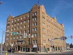
Leland Hotel |
|
000000001985-02-28-0000February 28, 1985
(#85000362) |
900 S. A St.
39°49′39″N 84°53′24″W / 39.827500°N 84.890000°W / 39.827500; -84.890000 (Leland Hotel) |
Richmond |
|
| 22 |
Oliver P. Morton House |
|
000000001975-10-10-0000October 10, 1975
(#75000038) |
319 W. Main St.
39°49′02″N 85°00′02″W / 39.817222°N 85.000556°W / 39.817222; -85.000556 (Oliver P. Morton House) |
Centerville |
|
| 23 |
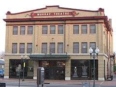
Murray Theater |
|
000000001982-03-25-0000March 25, 1982
(#82000053) |
1003 Main St.
39°49′44″N 84°53′19″W / 39.828889°N 84.888611°W / 39.828889; -84.888611 (Murray Theater) |
Richmond |
|
| 24 |
Old Richmond Historic District |
|
000000001974-06-28-0000June 28, 1974
(#74000025) |
Roughly bounded by the former C&O railroad line, S. 11th, S. A, and the alley south of South E St.; also roughly bounded by A, 11th, and E Sts., and the former C&O railroad tracks
39°49′21″N 84°53′32″W / 39.8225°N 84.892222°W / 39.8225; -84.892222 (Old Richmond Historic District) |
Richmond |
Second set of boundaries represents an increase and decrease of boundaries
|
| 25 |
Reeveston Place Historic District |
|
000000002003-01-17-0000January 17, 2003
(#02001171) |
Bounded by S. B, S. E, S. 16th, and S. 23rd Sts.
39°49′26″N 84°52′32″W / 39.823828°N 84.875456°W / 39.823828; -84.875456 (Reeveston Place Historic District) |
Richmond |
|
| 26 |
Richmond Downtown Historic District |
|
000000002011-12-19-0000December 19, 2011
(#11000918) |
Roughly Main St. between 7th and 10th Sts. and N. 8th St. between Main and A Sts.
39°49′44″N 84°53′30″W / 39.828889°N 84.891667°W / 39.828889; -84.891667 (Richmond Downtown Historic District) |
Richmond |
|
| 27 |
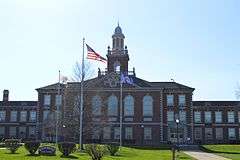
Richmond High School |
|
000000002015-09-22-0000September 22, 2015
(#15000602) |
380 Hub Etchison Parkway
39°49′21″N 84°54′05″W / 39.822500°N 84.901389°W / 39.822500; -84.901389 (Richmond High School) |
Richmond |
|
| 28 |
Richmond Railroad Station Historic District |
|
000000001987-10-08-0000October 8, 1987
(#87001808) |
Roughly bounded by the Norfolk Southern railroad tracks, N. 10th St., Elm Pl., N. D St., and Ft. Wayne Ave.
39°50′03″N 84°53′26″W / 39.834167°N 84.890556°W / 39.834167; -84.890556 (Richmond Railroad Station Historic District) |
Richmond |
|
| 29 |
Andrew F. Scott House |
|
000000001975-10-10-0000October 10, 1975
(#75000039) |
126 N. 10th St.
39°49′53″N 84°53′22″W / 39.831389°N 84.889444°W / 39.831389; -84.889444 (Andrew F. Scott House) |
Richmond |
|
| 30 |
Samuel G. Smith Farm |
|
000000001983-01-14-0000January 14, 1983
(#83000044) |
West of Richmond at 3431 Crowe Rd.
39°50′23″N 84°56′51″W / 39.839722°N 84.9475°W / 39.839722; -84.9475 (Samuel G. Smith Farm) |
Center Township |
|
| 31 |
Starr Historic District |
|
000000001974-06-28-0000June 28, 1974
(#74000026) |
Roughly bounded by N. 16th, E and A Sts., and the alley west of N. 10th St.
39°49′57″N 84°53′05″W / 39.8325°N 84.884722°W / 39.8325; -84.884722 (Starr Historic District) |
Richmond |
|
| 32 |
John & Caroline Stonebraker House |
|
000000002014-12-16-0000December 16, 2014
(#14001040) |
100 S. Washington St.
39°54′35″N 85°09′45″W / 39.909861°N 85.162500°W / 39.909861; -85.162500 (John & Caroline Stonebraker House) |
Hagerstown |
|
| 33 |
Wayne County Courthouse |
|
000000001978-12-08-0000December 8, 1978
(#78000042) |
Bounded by 3rd, 4th, Main, and S. A Sts.
39°49′42″N 84°53′50″W / 39.828333°N 84.897222°W / 39.828333; -84.897222 (Wayne County Courthouse) |
Richmond |
|
| 34 |
Westcott Stock Farm |
|
000000001998-12-17-0000December 17, 1998
(#98001522) |
306 E. North St.
39°49′18″N 84°59′37″W / 39.821667°N 84.993611°W / 39.821667; -84.993611 (Westcott Stock Farm) |
Centerville |
|
| 35 |
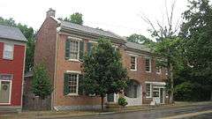
Witt-Champe-Myers House |
|
000000001995-06-09-0000June 9, 1995
(#95000700) |
Southeastern corner of the junction of Spring and Foundry Sts.
39°48′38″N 85°12′07″W / 39.810556°N 85.201944°W / 39.810556; -85.201944 (Witt-Champe-Myers House) |
Dublin |
|

.jpg)
