Nuwe Eersterus
| New Eersterust | |
|---|---|
 New Eersterust  New Eersterust  New Eersterust
| |
| Coordinates: 25°24′39″S 28°8′0″E / 25.41083°S 28.13333°ECoordinates: 25°24′39″S 28°8′0″E / 25.41083°S 28.13333°E | |
| Country | South Africa |
| Province | Gauteng |
| Municipality | City of Tshwane |
| Area[1] | |
| • Total | 23.64 km2 (9.13 sq mi) |
| Population (2011)[1] | |
| • Total | 35,059 |
| • Density | 1,500/km2 (3,800/sq mi) |
| Racial makeup (2011)[1] | |
| • Black African | 99.2% |
| • Coloured | 0.2% |
| • Indian/Asian | 0.2% |
| • White | 0.1% |
| • Other | 0.3% |
| First languages (2011)[1] | |
| • Tswana | 27.6% |
| • Northern Sotho | 22.3% |
| • Tsonga | 21.5% |
| • S. Ndebele | 10.4% |
| • Other | 18.2% |
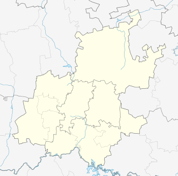
New Eersterust (Nuwe Eersterus) is a township in northwestern Gauteng province, South Africa, about 39 km northwest of Pretoria. It is bordered to the west by Soshanguve and to the east by Hammanskraal. The township is commonly known as "Eestrus".
History
It was incorporated into the Gauteng province in 2004 under the jurisdiction of the Tshwane Metro.
Education
The most widely spoken languages are Tswana, Tsonga and Ndebele.
Subdivisions
The township is divided in blocks A, B, C, D1, D2, E, F1, F2, F3, F4 and Soutpan and Marikana informal settlement. Tswaing Crater Meseum is also located in New Eersterust
References
- 1 2 3 4 "Main Place New Eersterust". Census 2011.
Notable Citizens
This article is issued from Wikipedia - version of the 6/28/2016. The text is available under the Creative Commons Attribution/Share Alike but additional terms may apply for the media files.
.svg.png)