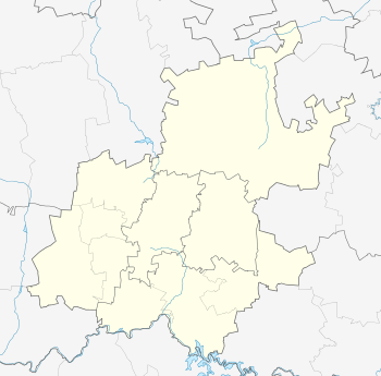
Kleinfontein
| Kleinfontein | |
|---|---|
| Motto: Ons God, Ons Volk, Ons Land[1] | |
 Kleinfontein  Kleinfontein  Kleinfontein
| |
| Coordinates: 25°49′55″S 28°30′04″E / 25.832°S 28.501°ECoordinates: 25°49′55″S 28°30′04″E / 25.832°S 28.501°E | |
| Country | South Africa |
| Province | Gauteng |
| Municipality | City of Tshwane |
| Established | 1992 |
| Area | |
| • Total | 8.6 km2 (3.3 sq mi) |
| Population [2] | |
| • Total | 650 |
| • Density | 76/km2 (200/sq mi) |
| Website | http://www.kleinfontein.net/ |
Kleinfontein (Afrikaans for Small Fountain) is a new settlement near Pretoria, South Africa that was founded by Afrikaners in 1992 as a cultural village. It has only recently been developed and has a limited economy. It was founded by descendants of the original Voortrekkers or Boers, who seek self-determination in an autonomous Volkstaat.[3] The criteria to live in Kleinfontein are based on cultural, linguistic, traditional and religious beliefs and its people associate themselves with the Voortrekker history, the Blood River Covenant and other "historical facts relating to our struggle for independence for the Afrikaner people".[4]
As of 2012, it was one of South Africa's few remaining whites-only settlements.[5] The settlement has been recognised as a cultural community by the Gauteng Legislature.[6]
History
The land which would become Kleinfontein came to the attention of Afrikaner activists in 1988 during a celebration of the 150th anniversary of the Great Trek on a farm east of Pretoria. The farm drew their attention as a location of the Bittereinders and site of the Battle of Diamond Hill, as well as holding a historic Boer War cemetery and memorial. When the farm was put up for sale in 1992, a group of 50 Afrikaners purchased the property,[7] and began to recruit shareholders to develop it.
In 1994, sufficient shareholders were recruited to service the loan and Kleinfontein could begin to provide services. The first two permanent houses were completed in 1996, and the first two families became permanent residents of Kleinfontein. In the ensuing years, Radio Pretoria erected its broadcasting tower on Kleinfontein, sports fields were built, a homegrown school was established and a savings and credit cooperative had emerged. A community hall, care center and retirement homes followed as well as a shopping center with an ATM. The entrance to the town displays a bust of Hendrik Verwoerd,[8] the "father of apartheid"; the community obtained the bust from a neighbouring town which no longer wanted it.[7]
As of 2013, the population of Kleinfontein is about 900 Afrikaners during the day, of which about 650 are residents and about 400 are shareholders. Kleinfontein's area has grown from the original 500 hectares to the current 860 hectares, and stretches just off the N4 highway beyond the Boschkop road.[2] As of November 2013, the Gauteng legislature recognized Kleinfontein as a cultural community.[9][10] The City of Pretoria still refused to declare it a separate development or a formal township, although there is an ongoing process for Kleinfontein to become a separate recognized entity within the City of Pretoria. Following the legislature's investigation into Kleinfontein, there were 450 shareholders and 1,000 residents, living in around 300 homes.[9] Article 185 of the South African Constitution allows citizens of a similar cultural, linguistic, or religious group to associate with each other.
Criticism
Kleinfontein has been criticised for its policy of barring all Jews, Catholics, non-Afrikaans speakers, and blacks from settling in the community. Protests were held in May 2013 when the community denied the application of a black man to buy a home in the community.[8][11][12] The community has also been criticized by the South African government for engaging in practices that once led to a "divided South Africa."[13] Residents of the community defend their practice by saying that they are defending their own separate cultural identity.[14][15]
Some residents of the community have also objected to the "restricted" nature of the community which prevents them from selling their home to the buyer of their choice.[16]
Geography
The town is located roughly halfway between Pretoria and Bronkhorstspruit. It lies just south of the N4, just west of the R515, a few kilometers south of Rayton, on the Magaliesberg mountain range at the historical terrain where the Battle of Diamond Hill (Afrikaans: die slag van Donkerhoek) took place during the Second Boer War.
See also
- Orania, Northern Cape, another Afrikaner-based community
- Balmoral, Mpumalanga
References
- ↑ Official site
- 1 2 Ontstaan en Geskiedenis, Official site
- ↑ "Kleinfontein vir die Boer en Afrikaner, Selfdetermination, Independence, Official web site". Archived from the original on March 16, 2009. (Afrikaans).
- ↑ "Kleinfontein segregation not about race". News24. May 23, 2013. Retrieved 2013-05-23.
- ↑ Trevor Neethling (November 14, 2012). "Gauteng to launch inquiry into whites-only Kleinfontein 'cultural village'". Business Day. Retrieved 2013-03-30.
- ↑ "Kleinfontein settlement recognised as cultural community - FF+". Politicsweb. Retrieved 14 December 2013.
- 1 2 Raghavan, Sudarsan (30 July 2013). "Welcome to Kleinfontein, lingering outpost of apartheid South Africa". Guardian Weekly. Retrieved 4 August 2013.
- 1 2 Bruton, F. Brinley (20 June 2013). "All-white town fights to preserve segregation in Mandela's 'Rainbow Nation'". World News NBC. Retrieved 4 August 2013.
- 1 2
- ↑
- ↑ Protest over reported Kleinfontein racism | News24
- ↑ Ntuli, Mbali (22 May 2013). "DA Youth to protest Kleinfontein racism". Democratic Alliance. Retrieved 4 August 2013.
- ↑ Government shocked by racist Kleinfontein - Politics | IOL News | IOL.co.za
- ↑ Kleinfontein: Pretoria’s own Orania - Gauteng | IOL News | IOL.co.za
- ↑ Kleinfontein segregation not about race | News24
- ↑ This is Kleinfontein - White couple not Afrikaner enough for racist settlement near Pretoria - SundayWorld
.svg.png)