| [3] |
Name on the Register[4] |
Image |
Date listed[5] |
Location |
City or town |
Description |
|---|
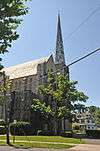
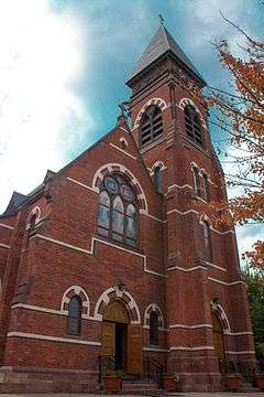
| 1 |
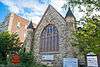
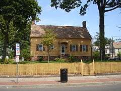
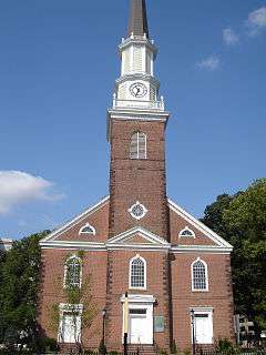
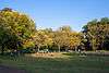
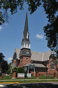
All Souls Church |
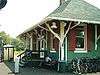
|
000000002009-12-11-0000December 11, 2009
(#09001078) |
724 Park Ave.
40°36′51″N 74°24′58″W / 40.61425°N 74.416128°W / 40.61425; -74.416128 (All Souls Church) |
Plainfield |
|
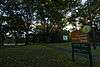
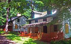
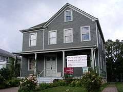
| 2 |
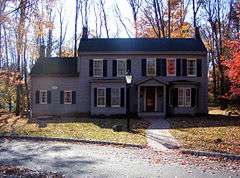
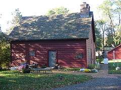
Badgley House and Site |
Upload image |
000000001976-09-27-0000September 27, 1976
(#76001190) |
North of Mountainside off New Providence Rd., Watchung Reservation
40°40′59″N 74°22′37″W / 40.683056°N 74.376944°W / 40.683056; -74.376944 (Badgley House and Site) |
Mountainside |
Destroyed by fire in 1984
|
| 3 |
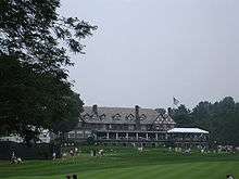
Baltusrol Golf Club |
|
000000002005-05-06-0000May 6, 2005
(#05000374) |
201 Shunpike Road
40°42′18″N 74°19′41″W / 40.705°N 74.328056°W / 40.705; -74.328056 (Baltusrol Golf Club) |
Springfield |
The courses designed 1918–26 brought architect A. W. Tillinghast to prominence as a course designer; club has been host to many men's and women's majors since then.
|
| 4 |
Belcher-Ogden Mansion-Price, Benjamin-Price-Brittan Houses District |
|
000000001986-08-28-0000August 28, 1986
(#86001969) |
Corner of E. Jersey and Catherine Sts.
40°39′48″N 74°12′32″W / 40.663333°N 74.208889°W / 40.663333; -74.208889 (Belcher-Ogden Mansion-Price, Benjamin-Price-Brittan Houses District) |
Elizabeth |
|
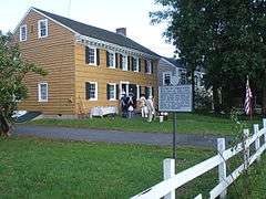
| 5 |
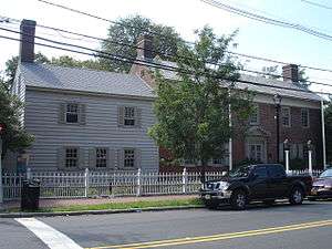
Belcher-Ogden House |
|
000000001978-11-02-0000November 2, 1978
(#78001799) |
1046 E. Jersey St.
40°39′47″N 74°12′34″W / 40.663056°N 74.209444°W / 40.663056; -74.209444 (Belcher-Ogden House) |
Elizabeth |
|
| 6 |
Boxwood Hall |
|
000000001970-12-18-0000December 18, 1970
(#70000397) |
1073 E. Jersey St.
40°39′49″N 74°12′37″W / 40.663611°N 74.210278°W / 40.663611; -74.210278 (Boxwood Hall) |
Elizabeth |
|
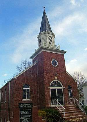
| 7 |
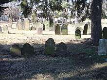
Burial Ground of the Presbyterian Church in the West Fields of Elizabethtown |
|
000000002007-10-25-0000October 25, 2007
(#07001108) |
W. side of Mountain Ave. N. of Drift Way opposite 140 Mountain Ave.
40°39′12″N 74°20′57″W / 40.653333°N 74.349167°W / 40.653333; -74.349167 (Burial Ground of the Presbyterian Church in the West Fields of Elizabethtown) |
Westfield |
|
| 8 |
Caldwell Parsonage |
|
000000001982-08-12-0000August 12, 1982
(#82004785) |
909 Caldwell Ave.
40°41′42″N 74°16′43″W / 40.695°N 74.278611°W / 40.695; -74.278611 (Caldwell Parsonage) |
Union |
|
| 9 |
Cedar Brook Park |
|
000000002007-08-28-0000August 28, 2007
(#07000878) |
Roughly bounded Stelle Ave., Arlington Ave., Park Ave., Rose St. and Laramie Rd., Kenyon Ave., Parkside Rd.
40°36′17″N 74°24′31″W / 40.604603°N 74.408647°W / 40.604603; -74.408647 (Cedar Brook Park) |
Plainfield |
|
| 10 |
Central Railroad of New Jersey |
|
000000001980-07-17-0000July 17, 1980
(#80002521) |
238 North Ave.
40°38′46″N 74°21′43″W / 40.646111°N 74.361944°W / 40.646111; -74.361944 (Central Railroad of New Jersey) |
Fanwood |
|
| 11 |
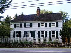
Crane-Phillips House |
|
000000001997-08-14-0000August 14, 1997
(#97000842) |
125 N. Union Ave.
40°39′27″N 74°17′26″W / 40.6575°N 74.290556°W / 40.6575; -74.290556 (Crane-Phillips House) |
Cranford |
|
| 12 |
Crescent Area Historic District |
|
000000001980-12-12-0000December 12, 1980
(#80002523) |
Roughly bounded by Park, Prospect, and Carnegie Aves., 7th and Richmond Sts.
40°36′59″N 74°24′49″W / 40.616389°N 74.413611°W / 40.616389; -74.413611 (Crescent Area Historic District) |
Plainfield |
|
| 13 |
John De Camp House |
|
000000001973-12-04-0000December 4, 1973
(#73001136) |
2101 Raritan Rd.
40°37′38″N 74°20′27″W / 40.627222°N 74.340833°W / 40.627222; -74.340833 (John De Camp House) |
Scotch Plains |
|
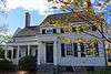
| 14 |
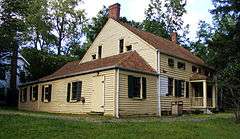
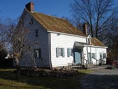
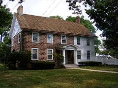
Nathaniel Drake House |
|
000000001973-06-19-0000June 19, 1973
(#73001135) |
602 W. Front St.
40°36′49″N 74°25′56″W / 40.613611°N 74.432222°W / 40.613611; -74.432222 (Nathaniel Drake House) |
Plainfield |
|
| 15 |
Droeschers Mill |
|
000000001974-01-08-0000January 8, 1974
(#74001192) |
347 Lincoln Ave. E.
40°39′01″N 74°18′06″W / 40.650278°N 74.301667°W / 40.650278; -74.301667 (Droeschers Mill) |
Cranford |
|
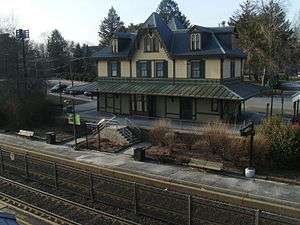
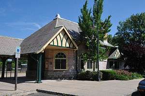
| 16 |
Elizabeth Station |
|
000000001984-09-29-0000September 29, 1984
(#84002825) |
Morris Ave., and Broad St.
40°40′01″N 74°13′01″W / 40.666944°N 74.216944°W / 40.666944; -74.216944 (Elizabeth Station) |
Elizabeth |
part of the Operating Passenger Railroad Stations Thematic Resource (TR)
|
| 17 |
Evergreen Cemetery |
|
000000001991-07-09-0000July 9, 1991
(#91000882) |
1137 N. Broad St.
40°41′32″N 74°12′39″W / 40.692222°N 74.210833°W / 40.692222; -74.210833 (Evergreen Cemetery) |
Hillside and Elizabeth |
|
| 18 |
Fanwood Park Historic District |
|
000000002004-05-27-0000May 27, 2004
(#04000516) |
North Ave. and North Martine Ave.
40°38′39″N 74°23′21″W / 40.644167°N 74.389167°W / 40.644167; -74.389167 (Fanwood Park Historic District) |
Fanwood |
|
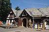
| 19 |
Feltville Historic District |
|
000000001980-06-06-0000June 6, 1980
(#80002522) |
South of New Providence
40°40′53″N 74°23′16″W / 40.681389°N 74.387778°W / 40.681389; -74.387778 (Feltville Historic District) |
New Providence |
|
| 20 |
Firehouse No. 4 |
|
000000001993-03-11-0000March 11, 1993
(#93000133) |
1015 South Ave.
40°37′42″N 74°24′14″W / 40.628333°N 74.403889°W / 40.628333; -74.403889 (Firehouse No. 4) |
Plainfield |
|
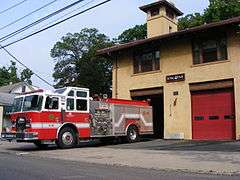
| 21 |
Elizabeth and Gershom Frazee House |
|
000000002009-12-07-0000December 7, 2009
(#09000971) |
1451 Raritan Road
40°37′00″N 74°22′02″W / 40.6167°N 74.3671°W / 40.6167; -74.3671 (Elizabeth and Gershom Frazee House) |
Scotch Plains |
|
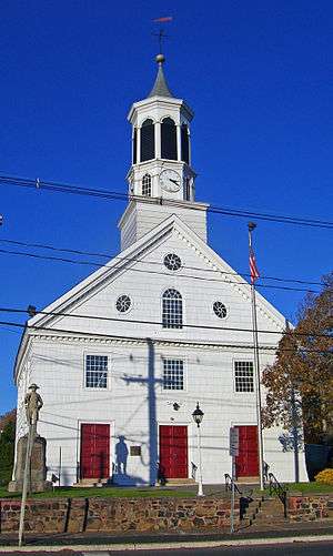
| 22 |
First Congregation of the Presbyterian Church at Springfield |
|
000000001990-05-07-0000May 7, 1990
(#90000668) |
201 Morris Ave. and 11-41 Church Mall
40°42′41″N 74°18′39″W / 40.711389°N 74.310833°W / 40.711389; -74.310833 (First Congregation of the Presbyterian Church at Springfield) |
Springfield |
|
| 23 |
First Presbyterian Church of Elizabeth |
|
000000001977-05-06-0000May 6, 1977
(#77000914) |
14-44 Broad St.
40°39′45″N 74°12′56″W / 40.6625°N 74.215556°W / 40.6625; -74.215556 (First Presbyterian Church of Elizabeth) |
Elizabeth |
|
| 24 |
First Presbyterian Congregation of Connecticut Farms |
|
000000001970-04-03-0000April 3, 1970
(#70000398) |
Stuyvesant Ave. at Chestnut St.
40°41′36″N 74°16′26″W / 40.693333°N 74.273889°W / 40.693333; -74.273889 (First Presbyterian Congregation of Connecticut Farms) |
Union |
|
| 25 |
Charles N. Fowler House |
|
000000001986-03-13-0000March 13, 1986
(#86000389) |
518 Salem Ave.
40°40′35″N 74°12′53″W / 40.676389°N 74.214722°W / 40.676389; -74.214722 (Charles N. Fowler House) |
Elizabeth |
|
| 26 |
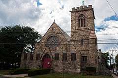
Grace Episcopal Church |
|
000000002002-05-10-0000May 10, 2002
(#02000106) |
600 Cleveland Ave.
40°37′05″N 74°25′02″W / 40.618056°N 74.417222°W / 40.618056; -74.417222 (Grace Episcopal Church) |
Plainfield |
|
| 27 |
Green Brook Park |
|
000000002004-05-14-0000May 14, 2004
(#04000437) |
All parkland from Clinton Ave. to west of West End Ave., and the junction of Lawrence and Parkview Ave., Fisk and Townsend Pls.
40°36′38″N 74°26′39″W / 40.610556°N 74.444167°W / 40.610556; -74.444167 (Green Brook Park) |
Plainfield |
|
| 28 |
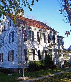
Deacon Andrew Hetfield House |
|
000000001989-07-27-0000July 27, 1989
(#89001004) |
Constitution Plaza
40°40′19″N 74°21′29″W / 40.671944°N 74.358056°W / 40.671944; -74.358056 (Deacon Andrew Hetfield House) |
Mountainside |
|
| 29 |
Hillside Avenue Historic District |
|
000000001982-06-01-0000June 1, 1982
(#82003307) |
Hillside Ave. from Watchung Ave. to Martine Ave.
40°36′55″N 74°24′18″W / 40.615278°N 74.405°W / 40.615278; -74.405 (Hillside Avenue Historic District) |
Plainfield |
|
| 30 |
Homestead Farm at Oak Ridge |
|
000000001995-10-25-0000October 25, 1995
(#95001185) |
Junction of Oak Ridge Rd. and Feather Bed Ln., Clark and Edison Townships
40°36′28″N 74°20′56″W / 40.607778°N 74.348889°W / 40.607778; -74.348889 (Homestead Farm at Oak Ridge) |
Clark |
|
| 31 |
Hutchings Homestead |
|
000000001977-09-16-0000September 16, 1977
(#77000915) |
126 Morris Ave.
40°42′37″N 74°18′26″W / 40.710278°N 74.307222°W / 40.710278; -74.307222 (Hutchings Homestead) |
Springfield |
|
| 32 |
Littel-Lord Farmstead |
|
000000001979-03-07-0000March 7, 1979
(#79001528) |
23 and 31 Horseshoe Rd.
40°40′05″N 74°25′41″W / 40.668056°N 74.428056°W / 40.668056; -74.428056 (Littel-Lord Farmstead) |
Berkeley Heights |
|
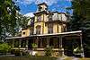
| 33 |
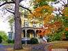
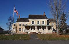
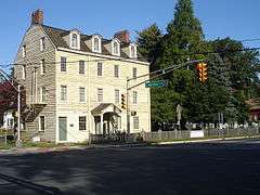
William Livingston House |
|
000000001972-11-28-0000November 28, 1972
(#72000807) |
Morris and North Aves.
40°40′40″N 74°13′41″W / 40.677778°N 74.228056°W / 40.677778; -74.228056 (William Livingston House) |
Union |
Liberty Hall, Kean University
|
| 34 |
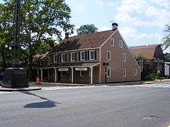
Merchants' and Drovers' Tavern |
|
000000001978-11-21-0000November 21, 1978
(#78001801) |
1632 St. Georges Ave.
40°36′59″N 74°17′09″W / 40.616389°N 74.285833°W / 40.616389; -74.285833 (Merchants' and Drovers' Tavern) |
Rahway |
|
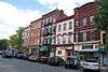
| 35 |
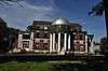
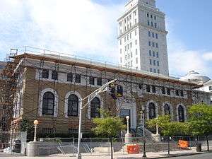
Mid-Town Historic District |
|
000000001995-10-05-0000October 5, 1995
(#95001143) |
Bounded by Broad, N. Broad, Dickinson, E. Grand, E. Jersey Sts., Commerce Place, Elizabeth Ave. and Martin L. King Plaza
40°39′56″N 74°12′52″W / 40.665556°N 74.214444°W / 40.665556; -74.214444 (Mid-Town Historic District) |
Elizabeth |
image shows Elizabeth Public Library and Union County Courthouse
|
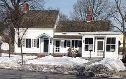
| 36 |
Miller-Cory House |
|
000000001972-11-03-0000November 3, 1972
(#72000808) |
614 Mountain Ave.
40°39′45″N 74°21′02″W / 40.6625°N 74.350556°W / 40.6625; -74.350556 (Miller-Cory House) |
Westfield |
|
| 37 |
Murray Hill Station |
|
000000001984-06-22-0000June 22, 1984
(#84002826) |
The Circle
40°41′41″N 74°24′13″W / 40.694722°N 74.403611°W / 40.694722; -74.403611 (Murray Hill Station) |
Murray Hill |
part of the Operating Passenger Railroad Stations TR
|
| 38 |
Netherwood Station |
|
000000001984-06-22-0000June 22, 1984
(#84002830) |
Between North and South Aves.
40°37′45″N 74°24′13″W / 40.629167°N 74.403611°W / 40.629167; -74.403611 (Netherwood Station) |
Plainfield |
part of the Operating Passenger Railroad Stations TR
|
| 39 |
Oswald J. Nitschke House |
|
000000002008-01-17-0000January 17, 2008
(#07001406) |
49 S. 21 St.
40°40′36″N 74°17′28″W / 40.676667°N 74.291111°W / 40.676667; -74.291111 (Oswald J. Nitschke House) |
Kenilworth |
|
| 40 |
North Avenue Commercial Historic District |
|
000000001984-03-29-0000March 29, 1984
(#84002836) |
Park, North, and Watchung Aves.
40°37′07″N 74°25′17″W / 40.618611°N 74.421389°W / 40.618611; -74.421389 (North Avenue Commercial Historic District) |
Plainfield |
|
| 41 |
Old Baptist Parsonage |
|
000000001973-01-18-0000January 18, 1973
(#73001137) |
547 Park Ave.
40°39′06″N 74°23′59″W / 40.651667°N 74.399722°W / 40.651667; -74.399722 (Old Baptist Parsonage) |
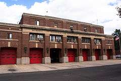
Scotch Plains |
|
| 42 |
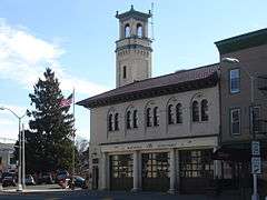
Plainfield Central Fire Headquarters |
|
000000001993-03-04-0000March 4, 1993
(#93000131) |
315 Central Ave.
40°36′54″N 74°25′26″W / 40.615°N 74.423889°W / 40.615; -74.423889 (Plainfield Central Fire Headquarters) |
Plainfield |
|
| 43 |
Plainfield Civic District |
|
000000001993-06-17-0000June 17, 1993
(#93000533) |
Roughly, Watchung Ave. between E. Fifth and E. Seventh Sts.
40°37′03″N 74°25′03″W / 40.6175°N 74.4175°W / 40.6175; -74.4175 (Plainfield Civic District) |
Plainfield |
|
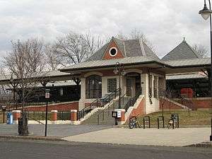
| 44 |
Plainfield Station |
|
000000001984-06-22-0000June 22, 1984
(#84002837) |
North Ave.
40°37′06″N 74°25′15″W / 40.618333°N 74.420833°W / 40.618333; -74.420833 (Plainfield Station) |
Plainfield |
part of the Operating Passenger Railroad Stations TR
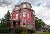
|
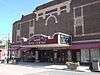
| 45 |
Rahway Theatre |
|
000000001986-08-13-0000August 13, 1986
(#86001509) |
1601 Irving St.
40°36′37″N 74°16′39″W / 40.610278°N 74.2775°W / 40.610278; -74.2775 (Rahway Theatre) |
Rahway |
|
| 46 |
William Edgar Reeve House |
|
000000002006-02-01-0000February 1, 2006
(#05001565) |
314 Mountain Ave.
40°39′34″N 74°20′58″W / 40.659444°N 74.349444°W / 40.659444; -74.349444 (William Edgar Reeve House) |
Westfield |
|
| 47 |
Saint Mary's Catholic Church Complex |
|
000000001985-04-11-0000April 11, 1985
(#85000785) |
Liberty and W. 6th Sts.
40°36′39″N 74°25′26″W / 40.610833°N 74.423889°W / 40.610833; -74.423889 (Saint Mary's Catholic Church Complex) |
Plainfield |
|
| 48 |
Sayre Homestead |
|
000000001979-08-24-0000August 24, 1979
(#79001529) |
Sayre Homestead Lane
40°42′13″N 74°20′50″W / 40.703611°N 74.347222°W / 40.703611; -74.347222 (Sayre Homestead) |
Springfield |
|
| 49 |
Scotch Plains Baptist Church, Parsonage, and Cemetery |
|
000000002013-06-14-0000June 14, 2013
(#13000386) |
333-334 Park Ave.,
Coordinates missing |
Scotch Plains, New Jersey |
|
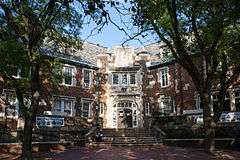
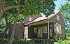
| 50 |
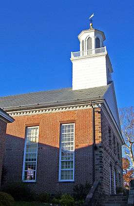
Scotch Plains School |
Upload image |
000000001978-12-12-0000December 12, 1978
(#78001802) |
Park Ave.
40°38′58″N 74°23′47″W / 40.649444°N 74.396389°W / 40.649444; -74.396389 (Scotch Plains School) |
Scotch Plains |
|
| 51 |
Seventeenth Century Clark House |
|
000000001974-11-19-0000November 19, 1974
(#74001193) |
593 Madison Hill Rd.
40°36′49″N 74°18′36″W / 40.613611°N 74.31°W / 40.613611; -74.31 (Seventeenth Century Clark House) |
Clark |
|
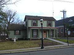
| 52 |
Nathaniel Smith House |
|
000000001989-09-28-0000September 28, 1989
(#89001584) |
105 Springfield Ave.
40°41′33″N 74°25′47″W / 40.6925°N 74.429722°W / 40.6925; -74.429722 (Nathaniel Smith House) |
Berkeley Heights |
|
| 53 |
St. John's Parsonage |
|
000000001982-09-16-0000September 16, 1982
(#82003306) |
633 Pearl St.
40°39′37″N 74°12′45″W / 40.660278°N 74.2125°W / 40.660278; -74.2125 (St. John's Parsonage) |
Elizabeth |
|
| 54 |
Stage House Inn |
|
000000001982-04-15-0000April 15, 1982
(#82003308) |
Park Ave. and Front St.
40°39′03″N 74°23′59″W / 40.650833°N 74.399722°W / 40.650833; -74.399722 (Stage House Inn) |
Scotch Plains |
|
| 55 |
Stoneleigh Park Historic District |
|
000000001988-10-28-0000October 28, 1988
(#88002020) |
Roughly bounded by Westfield Ave., Shackamaxon Dr., Rahway and Dorian Rd.
40°38′34″N 74°20′49″W / 40.642778°N 74.346944°W / 40.642778; -74.346944 (Stoneleigh Park Historic District) |
Westfield |
|
| 56 |
George A. Strong House |
|
000000002012-08-28-0000August 28, 2012
(#12000570) |
1030 Central Ave.
40°36′18″N 74°25′01″W / 40.604912°N 74.417054°W / 40.604912; -74.417054 (George A. Strong House) |
Plainfield |
now the duCret School of Art
|
| 57 |
Summit Downtown Historic District |
|
000000002011-06-30-0000June 30, 2011
(#10001116) |
Roughly bounded by Springfield Ave, the Village Green, Summit Ave, and Waldron Ave.
40°43′04″N 74°21′27″W / 40.717778°N 74.3575°W / 40.717778; -74.3575 (Summit Downtown Historic District) |
Summit |
Civic and commercial core of early railroad suburb
|
| 58 |
Summit Playhouse |
|
000000002009-12-30-0000December 30, 2009
(#09001177) |
10 New England Ave.
40°42′54″N 74°21′55″W / 40.7151°N 74.3653°W / 40.7151; -74.3653 (Summit Playhouse) |
Summit |
|
| 59 |
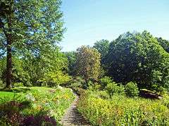
The Clearing |
|
000000001993-04-09-0000April 9, 1993
(#93000233) |
165 Hobart Ave.
40°43′36″N 74°20′53″W / 40.726667°N 74.348056°W / 40.726667; -74.348056 (The Clearing) |
Summit |
Now known as Reeves-Reed Arboretum
|
| 60 |
James Townley House |
|
000000001979-05-14-0000May 14, 1979
(#79001530) |
Morris Ave. and Green Lane
40°40′54″N 74°14′07″W / 40.681667°N 74.235278°W / 40.681667; -74.235278 (James Townley House) |
Union |
On the campus of Kean University
|
| 61 |
Twin Maples |
|
000000001997-08-29-0000August 29, 1997
(#97000977) |
8 Edgewood Rd.
40°43′02″N 74°21′00″W / 40.717222°N 74.35°W / 40.717222; -74.35 (Twin Maples) |
Summit |
|
| 62 |
Union County Park Commission Administration Buildings |
|
000000001985-11-25-0000November 25, 1985
(#85002976) |
Acme and Canton Sts.
40°39′31″N 74°14′17″W / 40.658611°N 74.238056°W / 40.658611; -74.238056 (Union County Park Commission Administration Buildings) |
Elizabeth |
|
| 63 |
Van Wyck Brooks Historic District |
|
000000001985-12-10-0000December 10, 1985
(#85003337) |
Roughly bounded by Plainfield Ave., W. Eighth St., Park Ave., W. Ninth St. and Madison Ave., and Randolph Rd.
40°36′35″N 74°25′06″W / 40.609722°N 74.418333°W / 40.609722; -74.418333 (Van Wyck Brooks Historic District) |
Plainfield |
|
| 64 |
Wallace Chapel AME Zion Church |
|
000000002007-08-28-0000August 28, 2007
(#07000877) |
138-142 Broad St.
40°42′49″N 74°20′38″W / 40.713611°N 74.343889°W / 40.713611; -74.343889 (Wallace Chapel AME Zion Church) |
Summit |
|
| 65 |
Waring T. Orville House |
|
000000001979-05-14-0000May 14, 1979
(#79003252) |
900 Park Ave.
40°36′46″N 74°24′53″W / 40.612778°N 74.414722°W / 40.612778; -74.414722 (Waring T. Orville House) |
Plainfield |
|
| 66 |
Westfield Fire Headquarters |
|
000000001980-12-08-0000December 8, 1980
(#80002524) |
405 North Ave., W.
40°39′00″N 74°20′56″W / 40.65°N 74.348889°W / 40.65; -74.348889 (Westfield Fire Headquarters) |
Westfield |
|
| 67 |
Whyman House |
|
000000001986-04-10-0000April 10, 1986
(#86000705) |
705 Newark Ave.
40°40′49″N 74°12′29″W / 40.680278°N 74.208056°W / 40.680278; -74.208056 (Whyman House) |
Elizabeth |
|
| 68 |
Woodruff House |
|
000000001978-12-11-0000December 11, 1978
(#78001800) |
111-113 Conant St.
40°41′14″N 74°13′12″W / 40.687222°N 74.22°W / 40.687222; -74.22 (Woodruff House) |
Hillside |
|
| 69 |
Young Women's Christian Association of Plainfield and North Plainfield |
|
000000001998-03-12-0000March 12, 1998
(#98000232) |
232 W. Front St.
40°37′15″N 74°25′16″W / 40.620833°N 74.421111°W / 40.620833; -74.421111 (Young Women's Christian Association of Plainfield and North Plainfield) |
Plainfield |
|


%3B_Plainfield%2C_NJ.jpg)