Union Square (Washington, D.C.)


Union Square is an 11-acre public plaza at the foot of Capitol Hill in Washington, D.C., USA.[1] It encompasses the Ulysses S. Grant Memorial (1924) and the 6-acre Capitol Reflecting Pool (1971) and is just west of the United States Capitol building. Views differ as to whether the Square is just east of the National Mall or is itself the eastern end.
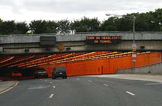
Interstate 395 transits the Third Street Tunnel just beneath Union Square.[2] The George Gordon Meade Memorial (1927) formerly stood in the northwest section of Union Square; that memorial now stands near the intersection of Constitution Avenue and Pennsylvania Avenue, NW.
History
The area constituting Union Square was originally part of the U.S. Capitol complex, but beginning in the 1930s the National Park Service assumed jurisdiction over the site.[3] In 2011, the 112th United States Congress enacted the Legislative Branch Appropriations Act, 2012, which transferred to the Architect of the Capitol the NPS "property which is bounded on the north by Pennsylvania Avenue Northwest, on the east by First Street Northwest and First Street Southwest, on the south by Maryland Avenue Southwest, and on the west by Third Street Southwest and Third Street Northwest".[4]
The Act removed Union Square from NPS jurisdiction.[3] The transfer of ownership occasioned some controversy as the NPS had planned to enhance the area to accommodate political demonstrations, gatherings and entertainment events.[5] The NPS expressed surprise at the move and some advocates for protest groups complained, asserting that the Architect of the Capitol and the United States Capitol Police (who were now responsible for security) were likely to be less tactful and accommodating to demonstrators than the Park Police. A Washington Post writer stated: “Although definitions of what constitutes the [National] Mall vary, the [2011] provision, in a sense, moves its easternmost boundary west — from First Street to Third Street.”[3]
References
- ↑ "Union Square Cultural Landscape Inventory". National Mall Plan: History. National Park Service. 2006. Archived from the original on 2013-06-19. Retrieved 2010-11-10.
- ↑ (1) Willinger, Douglas Andrew (2007-03-18). "I-95 Center Leg (today's I-395 3rd Street Tunnel)". A Trip Within the Beltway: About the Roads of Disconnect and Connect Within and Near Washington, D.C. Archived from the original on 2013-06-05. Retrieved 2015-02-22. External link in
|work=(help)
Google map of Union Square area - 1 2 3 Ruane, Michael E. (2011-12-27). "Control of the Mall's Union Square changes hands". PostLocal. The Washington Post. Retrieved 2012-01-05. External link in
|work=(help) - ↑ "Legislative Branch Appropriations Act, 2012" (PDF). Public Law 112-74, Consolidated Appropriations Act, 2012. United States Government Printing Office. 2011-12-23. p. 125 STAT. 1129. Retrieved 2012-03-02.
TRANSFER TO ARCHITECT OF THE CAPITOL
Sec. 1202. (a) Transfer.—To the extent that the Director of the National Park Service has jurisdiction and control over any portion of the area described in subsection (b) and any monument or other facility which is located within such area, such jurisdiction and control is hereby transferred to the Architect of the Capitol as of the date of the enactment of this Act.
(b) Area Described.—The area described in this subsection is the property which is bounded on the north by Pennsylvania Avenue Northwest, on the east by First Street Northwest and First Street Southwest, on the south by Maryland Avenue Southwest, and on the west by Third Street Southwest and Third Street Northwest. - ↑ "Update on the National Mall Plan" (PDF). Enriching Your American Experience: The National Mall Plan. National Park Service, U.S. Department of the Interior. 2010. p. 13. Archived from the original on 2012-11-07. Retrieved 2015-12-22. External link in
|publisher=, |work=(help)
| Wikimedia Commons has media related to Union Square (Washington, D.C.). |
Coordinates: 38°53′23″N 77°00′49″W / 38.8898°N 77.0137°W