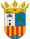
San Antonio de Benagéber
| Sant Antoni de Benaixeve | ||
|---|---|---|
| Municipality | ||
| San Antonio de Benagéber | ||
| ||
 Sant Antoni de Benaixeve Location in Spain | ||
| Coordinates: 39°33.7′N 0°30′W / 39.5617°N 0.500°WCoordinates: 39°33.7′N 0°30′W / 39.5617°N 0.500°W | ||
| Province | Valencia | |
| Comarca | Camp de Túria | |
| Judicial district | Paterna | |
| Founded | 1957 | |
| Government | ||
| • Alcalde | Enrique Santafosta Giner (AISAB) | |
| Area | ||
| • Total | 8.74 km2 (3.37 sq mi) | |
| Population (2015) | ||
| • Total | 7,981 | |
| • Density | 910/km2 (2,400/sq mi) | |
| Demonym(s) | Sanantoniano/a | |
| Time zone | CET (UTC+1) | |
| • Summer (DST) | CEST (UTC+2) | |
| Postal code | 46184 | |
| Official language(s) | Spanish | |
| Website | Official website | |
San Antonio de Benagéber, Valencian: Sant Antoni de Benaixeve, is a municipality in the comarca of Camp de Túria in the Valencian Community, Spain.
Geography
The municipality of San Antonio de Benagéber it is located at 14 km. of the city of Valencia.
Neighborhoods and districts
In the municipality of San Antonio de Benagéber are also the following towns:
- Urbanización Montesano.
- Urbanización Colinas de San Antonio.
- Urbanización Cumbres de San Antonio.
- Urbanización de San Vicente.
- Zona del Pla del Pou
This article is issued from Wikipedia - version of the 3/21/2016. The text is available under the Creative Commons Attribution/Share Alike but additional terms may apply for the media files.
