Sale Creek, Tennessee
| Sale Creek, Tennessee | |
|---|---|
| Census-designated place | |
|
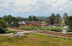
View from Reavley Road | |
 Sale Creek, Tennessee | |
| Coordinates: 35°22′56″N 85°06′32″W / 35.38222°N 85.10889°WCoordinates: 35°22′56″N 85°06′32″W / 35.38222°N 85.10889°W | |
| Country | United States |
| State | Tennessee |
| County | Hamilton |
| Area[1] | |
| • Total | 32.684 sq mi (84.65 km2) |
| • Land | 30.205 sq mi (78.23 km2) |
| • Water | 2.479 sq mi (6.42 km2) |
| Elevation | 725 ft (221 m) |
| Population (2010)[2] | |
| • Total | 2,845 |
| • Density | 87/sq mi (34/km2) |
| Time zone | Eastern (EST) (UTC-5) |
| • Summer (DST) | EDT (UTC-4) |
| Area code(s) | 423 |
| GNIS feature ID | 1300533[3] |
Sale Creek is an unincorporated community and census-designated place (CDP) in northern Hamilton County, Tennessee, United States. It is located along U.S. Route 27 between Chattanooga and Dayton, Tennessee.
Sale Creek's population was 2,845 as of the 2010 census.[2] Sale Creek is home to Sale Creek High School. A local curiosity, the reportedly "haunted" Shipley Hollow Road, is in Sale Creek.
History
The community takes its name from the creek which runs through it. The creek got its name from the auction held along its banks consisting of the goods and arms taken from the eleven towns of the militant Cherokee in the region before they were burned during the raid of Evan Shelby's troops in 1779 during the Cherokee–American wars.[4]
The area was occupied by the 6th Tennessee Infantry US from September to December 1863 during the Civil War.
MSA
Sale Creek is part of the Chattanooga, TN–GA Metropolitan Statistical Area.
References
- ↑ "US Gazetteer files: 2010, 2000, and 1990". United States Census Bureau. 2011-02-12. Retrieved 2011-04-23.
- 1 2 "American FactFinder". United States Census Bureau. Retrieved 2011-05-14.
- ↑ "Sale Creek". Geographic Names Information System. United States Geological Survey.
- ↑ Larry Miller, Tennessee Place Names; Indiana University Press; Indianapolis, 2001; p. 183.
