Sântana de Mureș
| Sântana de Mureş Marosszentanna | |
|---|---|
| Commune | |
|
Reformed (Presbyterian) Church | |
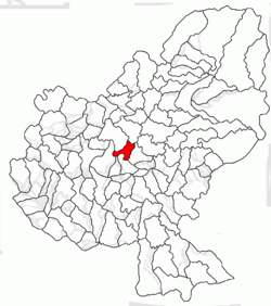
 Location of Sântana de Mureş | |
| Country |
|
| County | Mureş County |
| Status | Commune |
| Government | |
| • Mayor | Ráduly György (UDMR) |
| Population (2011) | |
| • Total | 5,616 |
| Ethnicity | |
| • Romanians | 50.97% |
| • Hungarians | 41.27% |
| Time zone | EET (UTC+2) |
| • Summer (DST) | EEST (UTC+3) |
Sântana de Mureş (Hungarian: Marosszentanna, Hungarian pronunciation: [ˈmɒroʃsɛntɒnnɒ]; German: Sankt Anna an der Mieresch) is a commune in Mureş County, Romania, composed of four villages:
| In Romanian | In Hungarian | In German |
|---|---|---|
| Bărdeşti | Marosbárdos | |
| Chinari | Várhegy | Schlossberg |
| Curteni | Udvarfalva | |
| Sântana de Mureş | Marosszentanna | Sankt Anna an der Mieresch |
History
Ancient times
The Sântana de Mureș-Chernyakhov culture which flourished between the 2nd and 5th centuries AD in Eastern Europe was named after the sites discovered at Sântana de Mureș in Romania and Cherniakhiv in Ukraine. The culture was spread across what today constitutes Ukraine, Romania, Moldova, and parts of Belarus. It probably corresponds to the Gothic kingdom of Oium as described by Jordanes in his work Getica, but it is nonetheless the result of a poly-ethnic cultural mélange of the Gothic, Getae-Dacian, Sarmatian and Slavic populations of the area.[1][2]
Modern times
Sântana de Mureș was part of the Székely Land region of Transylvania. Until 1918, the village belonged to the Maros-Torda County of the Kingdom of Hungary. After the Treaty of Trianon of 1920, it became part of Romania.
Demographics
The commune has an ethnically mixed population, with a Romanian majority. According to the 2011 Romanian Census, it has a population of 5,616 of which 50.97% or 2,863 are Romanians and 41.27% or 2,318 are Hungarians.
See also
Gallery
References
- ↑ “In the past, the association of this [Černjachov] culture with the Goths was highly contentious, but important methodological advances have made it irresistible.” The Cambridge Ancient History, Vol. 13: The Late Empire, p. 488 (1998)
- ↑ Peter J. Heather, John Matthews, 1991, The Goths in the Fourth Century, pp. 88-92.
Coordinates: 46°34′N 24°33′E / 46.57°N 24.55°E
