Plešivec, Slovakia
| Plešivec | |
| Village | |
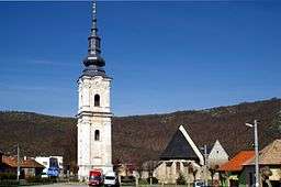
 Church in the main square of Plešivec | |
| Country | Slovakia |
|---|---|
| Region | Košice |
| District | Rožňava |
| Tourism region | Gemer |
| Elevation | 216 m (709 ft) |
| Coordinates | SK 48°32′50″N 20°24′10″E / 48.54722°N 20.40278°ECoordinates: SK 48°32′50″N 20°24′10″E / 48.54722°N 20.40278°E |
| Area | 62.14 km2 (24 sq mi) |
| Population | 2,405 (31 December 2010) |
| Density | 39/km2 (101/sq mi) |
| First mentioned | 1243 |
| Mayor | Gabriel Gergely |
| Timezone | CET (UTC+1) |
| - summer (DST) | CEST (UTC+2) |
| Postal code | 04911 |
| Phone prefix | 421-58 |
| Car plate | RV |
  Location of Plešivec in Slovakia | |
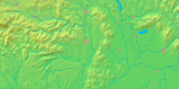
  Location of Plešivec in the Košice Region | |
| Wikimedia Commons: Dobšiná | |
| Statistics: | |
| Website: http://www.plesivec.ocu.sk | |
Plešivec is a large village and municipality in the Rožňava District in the Košice Region of middle-eastern Slovakia.
History
In historical records the village was first mentioned in 1243.
Geography
The village lies at an altitude of 218 metres and covers an area of 62,142 km². It has a population of about 2440 people.
Economy and facilities
The village has a petrol station and a guesthouse. It also has a number of quality medical facilities including a pharmacy, a doctors surgery and outpatient facilities for children and adolescents. The village also has a commercial bank, an insurance company and a cashomat.
Government
The village has its own birth registry office and its own police force
Culture
The village has a public library, a gymnasium and a football pitch.
Transport
The village has its own railway station.