Njivice, Radeče
| Njivice | |
|---|---|
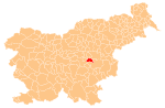
 Njivice Location in Slovenia | |
| Coordinates: 46°3′50.93″N 15°8′39.29″E / 46.0641472°N 15.1442472°ECoordinates: 46°3′50.93″N 15°8′39.29″E / 46.0641472°N 15.1442472°E | |
| Country |
|
| Traditional region | Lower Carniola |
| Statistical region | Lower Sava |
| Municipality | Radeče |
| Area | |
| • Total | 0.48 km2 (0.19 sq mi) |
| Elevation | 251.2 m (824.1 ft) |
| Population (2002) | |
| • Total | 119 |
| [1] | |
Njivice (pronounced [ˈnjiːʋitsɛ]; German: Niwitz[2]) is a small settlement in the Municipality of Radeče in eastern Slovenia. It lies on Sopota Creek west of the town of Radeče. The area is part of the historical region of Lower Carniola. The municipality is now included in the Lower Sava Statistical Region; until January 2014 it was part of the Savinja Statistical Region.[3]
References
- ↑ Statistical Office of the Republic of Slovenia Archived November 18, 2008, at the Wayback Machine.
- ↑ Leksikon občin kraljestev in dežel zastopanih v državnem zboru, vol. 6: Kranjsko. 1906. Vienna: C. Kr. Dvorna in Državna Tiskarna, p. 88.
- ↑ Radeče municipal site
External links
| Settlements | Administrative centre: Radeče
|  | ||||||
|---|---|---|---|---|---|---|---|---|
| Landmarks |
| |||||||
This article is issued from Wikipedia - version of the 11/14/2016. The text is available under the Creative Commons Attribution/Share Alike but additional terms may apply for the media files.