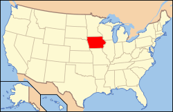
| [3] |
Name on the Register[4] |
Image |
Date listed[5] |
Location |
City or town |
Description |
|---|
| 1 |
Robert and Esther Armstrong House |
|
000000001989-11-16-0000November 16, 1989
(#89002009) |
370 34th St., SE.
41°59′05″N 91°37′02″W / 41.984722°N 91.617222°W / 41.984722; -91.617222 (Robert and Esther Armstrong House) |
Cedar Rapids |
|
| 2 |
Ash Park Historic District |
|
000000001993-09-13-0000September 13, 1993
(#93000899) |
5th-8th Aves. N., between 6th and 8th Sts., NW.
41°55′40″N 91°25′15″W / 41.927778°N 91.420833°W / 41.927778; -91.420833 (Ash Park Historic District) |
Mount Vernon |
|
| 3 |
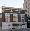
Ausadie Building |
|
000000002004-12-06-0000December 6, 2004
(#04001324) |
845 1st Ave., SE.
41°58′59″N 91°39′37″W / 41.983056°N 91.660278°W / 41.983056; -91.660278 (Ausadie Building) |
Cedar Rapids |
|
| 4 |
A. T. Averill House |
|
000000001978-11-28-0000November 28, 1978
(#78001236) |
1120 2nd Ave., SE
41°59′03″N 91°39′25″W / 41.984167°N 91.656944°W / 41.984167; -91.656944 (A. T. Averill House) |
Cedar Rapids |
|
| 5 |
Glenn M. and Edith Averill House |
|
000000002015-07-27-0000July 27, 2015
(#15000472) |
616 4th Ave., SE
41°58′45″N 91°39′40″W / 41.979213°N 91.661222°W / 41.979213; -91.661222 (Glenn M. and Edith Averill House) |
Cedar Rapids |
|
| 6 |
B Avenue NE Historic District |
|
000000002013-09-11-0000September 11, 2013
(#13000692) |
Along B Avenue, NE, from 15th to 21st Streets
41°59′35″N 91°38′54″W / 41.993181°N 91.648330°W / 41.993181; -91.648330 (B Avenue NE Historic District) |
Cedar Rapids |
|
| 7 |
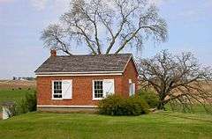
Beach School |
|
000000001982-09-16-0000September 16, 1982
(#82002630) |
Northwest of Mount Vernon off U.S. Route 30
41°59′28″N 91°28′45″W / 41.991111°N 91.479167°W / 41.991111; -91.479167 (Beach School) |
Mount Vernon |
|
| 8 |
Best Oil and Refining Company Service Station |
|
000000002014-06-27-0000June 27, 2014
(#14000359) |
624 12th Ave., SE
41°58′22″N 91°39′15″W / 41.972770°N 91.654117°W / 41.972770; -91.654117 (Best Oil and Refining Company Service Station) |
Cedar Rapids |
|
| 9 |
Bethel African Methodist Episcopal Church |
|
000000002013-12-18-0000December 18, 2013
(#13000927) |
512 6th Street, SE
41°58′39″N 91°39′37″W / 41.977628°N 91.660174°W / 41.977628; -91.660174 (Bethel African Methodist Episcopal Church) |
Cedar Rapids |
|
| 10 |
Bohemian Commercial Historic District |
|
000000002002-12-20-0000December 20, 2002
(#02001539) |
1000 to 1300 blocks of 3rd St., SE. and the 100 and 200 blocks of 14th Ave., SE.
• Boundary increase (listed 000000002012-03-12-0000March 12, 2012, refnum 12000096): Roughly bounded by 9th Ave. SE., 4th St. SE., 14th Ave. SE., 15th Ave. SW., C St. SW., 17th Ave SW. & A St. SW.
41°58′10″N 91°38′49″W / 41.969444°N 91.646944°W / 41.969444; -91.646944 (Bohemian Commercial Historic District) |
Cedar Rapids |
Cedar Rapids, Iowa Multiple Property Submission
|
| 11 |
James W. and Ida G. Bowman House |
|
000000002002-09-14-0000September 14, 2002
(#02001015) |
1372 8th Ave.
42°02′03″N 91°35′40″W / 42.034167°N 91.594444°W / 42.034167; -91.594444 (James W. and Ida G. Bowman House) |
Marion |
|
| 12 |
Braska House |
|
000000001979-03-21-0000March 21, 1979
(#79000911) |
889 2nd Ave.
42°01′43″N 91°36′02″W / 42.028611°N 91.600556°W / 42.028611; -91.600556 (Braska House) |
Marion |
|
| 13 |
Brown Apartments |
|
000000002010-03-17-0000March 17, 2010
(#10000075) |
1234 4th Ave. SE
41°58′57″N 91°39′17″W / 41.982625°N 91.654806°W / 41.982625; -91.654806 (Brown Apartments) |
Cedar Rapids |
|
| 14 |
Burlington, Cedar Rapids, and Minnesota Railroad: Walker Station |
Upload image |
000000001978-02-14-0000February 14, 1978
(#78001242) |
Between Rowley and Washington Sts.
42°17′03″N 91°42′52″W / 42.284167°N 91.714444°W / 42.284167; -91.714444 (Burlington, Cedar Rapids, and Minnesota Railroad: Walker Station) |
Walker |
|
| 15 |
C.S.P.S. Hall |
|
000000001978-11-29-0000November 29, 1978
(#78001237) |
1105 3rd St., SE.
41°58′15″N 91°39′31″W / 41.970833°N 91.658611°W / 41.970833; -91.658611 (C.S.P.S. Hall) |
Cedar Rapids |
A building of the Czech-Slovak Protective Society, built in 1891.
|
| 16 |
Calder Houses |
|
000000001978-01-18-0000January 18, 1978
(#78001238) |
1214 and 1216 2nd Ave., SE.
41°59′04″N 91°39′23″W / 41.984444°N 91.656389°W / 41.984444; -91.656389 (Calder Houses) |
Cedar Rapids |
|
| 17 |
Cedar Rapids 2nd Avenue SE. Automobile Row Historic District |
|
000000002015-10-23-0000October 23, 2015
(#15000749) |
Roughly 2nd to 3rd Aves., SE., from 6th to 8th Sts., SE.
41°58′49″N 91°39′45″W / 41.9803°N 91.6624°W / 41.9803; -91.6624 (Cedar Rapids 2nd Avenue SE. Automobile Row Historic District) |
Cedar Rapids |
|
| 18 |
Cedar Rapids Central Business District Commercial Historic District |
|
000000002015-11-02-0000November 2, 2015
(#15000757) |
Roughly bounded by 1st & 5th Aves., SE. & 5th & 2nd Sts., SE.
41°58′39″N 91°39′56″W / 41.9775°N 91.6655°W / 41.9775; -91.6655 (Cedar Rapids Central Business District Commercial Historic District) |
Cedar Rapids |
|
| 19 |
Cedar Rapids Central Fire Station |
|
000000002014-04-29-0000April 29, 2014
(#14000175) |
427 1st St., SE
41°58′29″N 91°40′00″W / 41.974747°N 91.666746°W / 41.974747; -91.666746 (Cedar Rapids Central Fire Station) |
Cedar Rapids |
|
| 20 |
Cedar Rapids Post Office and Public Building |
|
000000001982-11-10-0000November 10, 1982
(#82000413) |
305 2nd Ave., SE.
41°58′42″N 91°39′58″W / 41.978333°N 91.666111°W / 41.978333; -91.666111 (Cedar Rapids Post Office and Public Building) |
Cedar Rapids |
|
| 21 |
Cedar Rapids Pump Company Factory and Warehouse |
|
000000002012-11-06-0000November 6, 2012
(#12000907) |
605 G Avenue NW
41°58′48″N 91°40′53″W / 41.97993°N 91.68138°W / 41.97993; -91.68138 (Cedar Rapids Pump Company Factory and Warehouse) |
Cedar Rapids |
|
| 22 |
Central City Commercial Historic District |
|
000000002003-03-18-0000March 18, 2003
(#02001027) |
300 and 400 blocks of E. Main St., N. 4th St. to Commercial
42°12′15″N 91°31′28″W / 42.204167°N 91.524444°W / 42.204167; -91.524444 (Central City Commercial Historic District) |
Central City |
|
| 23 |
Chain Lakes Bridge |
Upload image |
000000001998-05-15-0000May 15, 1998
(#98000529) |
Pedestrian trail over the Cedar River
42°02′59″N 91°46′32″W / 42.049722°N 91.775556°W / 42.049722; -91.775556 (Chain Lakes Bridge) |
Hiawatha |
|
| 24 |
Coggon Public School |
Upload image |
000000002016-09-12-0000September 12, 2016
(#16000605) |
408 E. Linn St.
42°16′51″N 91°31′40″W / 42.280850°N 91.527688°W / 42.280850; -91.527688 (Coggon Public School) |
Coggon |
|
| 25 |
Consistory Building No. 2 |
|
000000001998-11-20-0000November 20, 1998
(#98001327) |
616 A Ave., NE.
41°58′58″N 91°39′52″W / 41.982778°N 91.664444°W / 41.982778; -91.664444 (Consistory Building No. 2) |
Cedar Rapids |
Also known as Scottish Rite Temple
|
| 26 |
Cornell College-Mount Vernon Historic District |
|
000000001980-07-18-0000July 18, 1980
(#80001456) |
Roughly bounded by railroad tracks, College Boulevard, N. 10th, N. 8th, and S. 3rd Aves., and N. 2nd and S. 4th Sts.
41°55′34″N 91°25′29″W / 41.926111°N 91.424722°W / 41.926111; -91.424722 (Cornell College-Mount Vernon Historic District) |
Mount Vernon |
|
| 27 |
William and Sue Damour House |
|
000000001997-01-16-0000January 16, 1997
(#96001586) |
1844 2nd Ave., SE.
41°59′30″N 91°38′38″W / 41.991667°N 91.643889°W / 41.991667; -91.643889 (William and Sue Damour House) |
Cedar Rapids |
|
| 28 |
Dewitt-Harman Archeological Site |
Upload image |
000000002000-09-14-0000September 14, 2000
(#00001077) |
Address Restricted
|
Cedar Rapids |
|
| 29 |
George B. Douglas House |
|
000000001982-09-09-0000September 9, 1982
(#82002628) |
800 2nd Ave., SE.
41°58′56″N 91°39′39″W / 41.982222°N 91.660833°W / 41.982222; -91.660833 (George B. Douglas House) |
Cedar Rapids |
|
| 30 |
Dows Street Historic District |
|
000000002003-11-14-0000November 14, 2003
(#02001026) |
Dows St. between State and Main Sts.
41°52′23″N 91°35′10″W / 41.873122°N 91.586117°W / 41.873122; -91.586117 (Dows Street Historic District) |
Ely |
|
| 31 |
William and Phebe C. Dunn House |
|
000000002013-09-04-0000September 4, 2013
(#13000663) |
524 10th St.
42°01′54″N 91°35′58″W / 42.031747°N 91.599326°W / 42.031747; -91.599326 (William and Phebe C. Dunn House) |
Marion |
|
| 32 |
Ely School House |
|
000000002006-09-20-0000September 20, 2006
(#06000859) |
1570 Rowley St.
41°52′17″N 91°35′05″W / 41.871389°N 91.584722°W / 41.871389; -91.584722 (Ely School House) |
Ely |
|
| 33 |
Evans Manufacturing Company Building |
|
000000001999-04-15-0000April 15, 1999
(#99000450) |
301 6th Ave., SE.
41°58′32″N 91°39′46″W / 41.975556°N 91.662778°W / 41.975556; -91.662778 (Evans Manufacturing Company Building) |
Cedar Rapids |
|
| 34 |
First Avenue Bridge |
|
000000001998-05-15-0000May 15, 1998
(#98000530) |
U.S. Route 151 over the Cedar River
41°58′36″N 91°40′20″W / 41.976667°N 91.672222°W / 41.976667; -91.672222 (First Avenue Bridge) |
Cedar Rapids |
|
| 35 |
First Presbyterian Church of Marion, Iowa |
|
000000001992-07-24-0000July 24, 1992
(#92000924) |
802 12th St.
42°02′04″N 91°35′50″W / 42.03441111°N 91.59709444°W / 42.03441111; -91.59709444 (First Presbyterian Church of Marion, Iowa) |
Marion |
|
| 36 |
First Universalist Church of Cedar Rapids |
|
000000001978-08-24-0000August 24, 1978
(#78001239) |
600 3rd Ave., SE.
41°58′48″N 91°39′44″W / 41.98°N 91.662222°W / 41.98; -91.662222 (First Universalist Church of Cedar Rapids) |
Cedar Rapids |
Demolished in 2011.[6]
|
| 37 |
Granger House |
|
000000001976-08-13-0000August 13, 1976
(#76000781) |
970 10th St.
42°02′09″N 91°35′59″W / 42.03596389°N 91.59966389°W / 42.03596389; -91.59966389 (Granger House) |
Marion |
|
| 38 |
Grant Vocational High School |
|
000000002015-10-13-0000October 13, 2015
(#15000728) |
346 2nd Ave., SW.
41°58′27″N 91°40′38″W / 41.9742°N 91.6772°W / 41.9742; -91.6772 (Grant Vocational High School) |
Cedar Rapids |
|
| 39 |
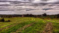
Grant Wood's "Fall Plowing" Rural Historic Landscape District |
|
000000002003-05-30-0000May 30, 2003
(#03000476) |
0.5 miles (0.80 km) north of the junction of Matsell Ln. and Stone City Rd.
42°06′55″N 91°23′20″W / 42.115278°N 91.388889°W / 42.115278; -91.388889 (Grant Wood's "Fall Plowing" Rural Historic Landscape District) |
Viola |
|
| 40 |
Douglas and Charlotte Grant House |
|
000000001988-11-09-0000November 9, 1988
(#88002145) |
3400 Adel St., SE.
42°00′42″N 91°37′20″W / 42.011667°N 91.622222°W / 42.011667; -91.622222 (Douglas and Charlotte Grant House) |
Marion |
|
| 41 |
Hamilton Brothers Building |
|
000000001994-09-08-0000September 8, 1994
(#94001098) |
401 1st St., SE.
41°58′30″N 91°40′02″W / 41.975°N 91.667222°W / 41.975; -91.667222 (Hamilton Brothers Building) |
Cedar Rapids |
|
| 42 |
Harper and McIntire Company Warehouse |
|
000000002015-11-02-0000November 2, 2015
(#15000758) |
411 6th Ave., SE.
41°58′34″N 91°39′42″W / 41.9760°N 91.6617°W / 41.9760; -91.6617 (Harper and McIntire Company Warehouse) |
Cedar Rapids |
|
| 43 |
Highwater Rock |
|
000000001977-11-17-0000November 17, 1977
(#77000535) |
Cedar River near 1st Ave. and 1st St., NE.
41°58′43″N 91°40′19″W / 41.978611°N 91.671944°W / 41.978611; -91.671944 (Highwater Rock) |
Cedar Rapids |
|
| 44 |
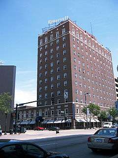
Hotel Roosevelt |
|
000000001991-05-01-0000May 1, 1991
(#91000534) |
200 1st Ave., NE.
41°58′45″N 91°40′06″W / 41.979167°N 91.668333°W / 41.979167; -91.668333 (Hotel Roosevelt) |
Cedar Rapids |
|
| 45 |
IANR Railroad Underpass |
|
000000001998-05-15-0000May 15, 1998
(#98000528) |
Ely Rd.
41°56′40″N 91°38′12″W / 41.944444°N 91.636667°W / 41.944444; -91.636667 (IANR Railroad Underpass) |
Cedar Rapids |
|
| 46 |
Indian Creek Bridge |
|
000000001998-05-15-0000May 15, 1998
(#98000514) |
Artesian Rd. over Indian Creek
41°58′02″N 91°34′52″W / 41.967222°N 91.581111°W / 41.967222; -91.581111 (Indian Creek Bridge) |
Cedar Rapids |
|
| 47 |
Iowa Building |
|
000000001983-02-17-0000February 17, 1983
(#83000385) |
221 4th Ave., SE.
41°58′36″N 91°39′53″W / 41.976667°N 91.664722°W / 41.976667; -91.664722 (Iowa Building) |
Cedar Rapids |
|
| 48 |
Iowa Wind Mill and Pump Company Office and Warehouse |
|
000000002012-10-31-0000October 31, 2012
(#12000890) |
42 7th Ave., SW.
41°58′19″N 91°40′03″W / 41.972062°N 91.667608°W / 41.972062; -91.667608 (Iowa Wind Mill and Pump Company Office and Warehouse) |
Cedar Rapids |
|
| 49 |
Jan F. and Antonie Janko Farmstead District |
|
000000002000-09-14-0000September 14, 2000
(#00001079) |
4021 Vista Rd.
41°52′25″N 91°36′18″W / 41.873611°N 91.605°W / 41.873611; -91.605 (Jan F. and Antonie Janko Farmstead District) |
Ely |
|
| 50 |
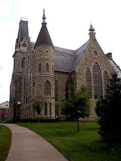
King Memorial Chapel |
|
000000001976-11-07-0000November 7, 1976
(#76000782) |
Cornell College campus
41°55′30″N 91°25′25″W / 41.925°N 91.423611°W / 41.925; -91.423611 (King Memorial Chapel) |
Mount Vernon |
|
| 51 |
Samuel M. Lane House |
|
000000002002-09-14-0000September 14, 2002
(#02001014) |
1776 8th Ave.
42°02′03″N 91°35′31″W / 42.034167°N 91.591944°W / 42.034167; -91.591944 (Samuel M. Lane House) |
Marion |
|
| 52 |
Lattner Auditorium Building |
|
000000001983-02-17-0000February 17, 1983
(#83000386) |
217 4th Ave., SE.
41°58′35″N 91°39′55″W / 41.976389°N 91.665278°W / 41.976389; -91.665278 (Lattner Auditorium Building) |
Cedar Rapids |
|
| 53 |
Lesinger Block |
|
000000001997-12-24-0000December 24, 1997
(#97001544) |
1317 3rd St., SE.
41°57′46″N 91°39′34″W / 41.962778°N 91.659444°W / 41.962778; -91.659444 (Lesinger Block) |
Cedar Rapids |
|
| 54 |
Lisbon Methodist Church |
|
000000002016-01-05-0000January 5, 2016
(#15000952) |
200 E. Market St.
41°55′21″N 91°23′00″W / 41.922540°N 91.383472°W / 41.922540; -91.383472 (Lisbon Methodist Church) |
Lisbon |
|
| 55 |
Lustron Home No. 02102 |
|
000000002004-08-25-0000August 25, 2004
(#04000898) |
2009 Williams Boulevard, SW.
41°58′15″N 91°42′03″W / 41.970833°N 91.700833°W / 41.970833; -91.700833 (Lustron Home No. 02102) |
Cedar Rapids |
|
| 56 |
Marion Carnegie Public Library |
|
000000001994-03-25-0000March 25, 1994
(#94000260) |
1298 7th Ave.
42°02′01″N 91°35′45″W / 42.03355°N 91.59597222°W / 42.03355; -91.59597222 (Marion Carnegie Public Library) |
Marion |
|
| 57 |
Marion Commercial Historic District |
|
000000002009-11-18-0000November 18, 2009
(#09000930) |
560-748 10th St., 958-1298 7th Ave., 760-96 11th St., 766-76 13th St., 1108 8th Ave., and 969 6th Ave.
42°02′00″N 91°35′58″W / 42.033358°N 91.599314°W / 42.033358; -91.599314 (Marion Commercial Historic District) |
Marion |
|
| 58 |
Matsell Bridge |
|
000000001998-05-15-0000May 15, 1998
(#98000534) |
Natsell Park Rd. over the Wapsipinicon River
42°07′49″N 91°23′01″W / 42.130278°N 91.383611°W / 42.130278; -91.383611 (Matsell Bridge) |
Springville |
|
| 59 |
May's Island Historic District |
|
000000001978-10-19-0000October 19, 1978
(#78001240) |
Between 1st and 5th Aves. on May Island
41°58′54″N 91°40′10″W / 41.981667°N 91.669444°W / 41.981667; -91.669444 (May's Island Historic District) |
Cedar Rapids |
|
| 60 |
Joseph P. Mentzer House |
|
000000001982-04-12-0000April 12, 1982
(#82002629) |
2233 3rd Ave.
42°01′49″N 91°35′26″W / 42.030278°N 91.590556°W / 42.030278; -91.590556 (Joseph P. Mentzer House) |
Marion |
|
| 61 |
Josias L. and Elizabeth A. Minor Farmstead District |
|
000000002000-09-14-0000September 14, 2000
(#00001080) |
7500 Ely Rd.
41°54′19″N 91°36′51″W / 41.905278°N 91.614167°W / 41.905278; -91.614167 (Josias L. and Elizabeth A. Minor Farmstead District) |
Ely |
|
| 62 |
Monroe Elementary School Historic District |
|
000000002015-10-23-0000October 23, 2015
(#15000751) |
3200 Pioneer Ave., SE.
41°58′11″N 91°37′12″W / 41.9697°N 91.6199°W / 41.9697; -91.6199 (Monroe Elementary School Historic District) |
Cedar Rapids |
|
| 63 |
Joseph and Clara Amanda H. Moorhead House |
|
000000002000-09-14-0000September 14, 2000
(#00001081) |
88 Palisades Access Rd.
41°51′59″N 91°32′08″W / 41.866389°N 91.535556°W / 41.866389; -91.535556 (Joseph and Clara Amanda H. Moorhead House) |
Ely |
|
| 64 |
Mosque Temple |
|
000000001996-05-15-0000May 15, 1996
(#96000516) |
1335 9th St., NW.
41°59′11″N 91°41′02″W / 41.986389°N 91.683889°W / 41.986389; -91.683889 (Mosque Temple) |
Cedar Rapids |
|
| 65 |
Mount Vernon Commercial Historic District |
|
000000001993-09-13-0000September 13, 1993
(#93000898) |
1st St. between 2nd and 1st Aves., N.
41°55′20″N 91°25′01″W / 41.922222°N 91.416944°W / 41.922222; -91.416944 (Mount Vernon Commercial Historic District) |
Mount Vernon |
|
| 66 |
Notbohm Mill Archaeological District |
Upload image |
000000002000-03-29-0000March 29, 2000
(#99001383) |
Address Restricted
|
Alburnett |
|
| 67 |
Oak Hill Cemetery Historic District |
|
000000002013-05-08-0000May 8, 2013
(#13000243) |
Roughly bounded by Mt. Vernon Rd., SE., 15th St., SE., S.& E. lot lines
41°58′33″N 91°38′45″W / 41.975908°N 91.645767°W / 41.975908; -91.645767 (Oak Hill Cemetery Historic District) |
Cedar Rapids |
|
| 68 |
Odd Fellows Hall |
Upload image |
000000001985-10-10-0000October 10, 1985
(#85003008) |
Troy Mills Rd.
42°17′20″N 91°40′57″W / 42.288889°N 91.6825°W / 42.288889; -91.6825 (Odd Fellows Hall) |
Troy Mills |
|
| 69 |
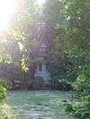
Our Mother of Sorrows Grotto Historic District |
|
000000002015-01-21-0000January 21, 2015
(#14000213) |
1330 Elmhurst Dr., NE. (on the Mount Mercy University campus)
42°00′10″N 91°39′12″W / 42.0028°N 91.6534°W / 42.0028; -91.6534 (Our Mother of Sorrows Grotto Historic District) |
Cedar Rapids |
|
| 70 |
Paramount Theater Building |
|
000000001976-08-26-0000August 26, 1976
(#76000778) |
121-127 3rd Ave., SE.
41°58′36″N 91°40′00″W / 41.976667°N 91.666667°W / 41.976667; -91.666667 (Paramount Theater Building) |
Cedar Rapids |
|
| 71 |
People's Savings Bank |
|
000000001978-03-29-0000March 29, 1978
(#78001241) |
101 3rd Ave., SW.
41°58′28″N 91°40′18″W / 41.974444°N 91.671667°W / 41.974444; -91.671667 (People's Savings Bank) |
Cedar Rapids |
|
| 72 |
Charles W. and Nellie Perkins House |
|
000000002002-05-09-0000May 9, 2002
(#02000456) |
1228 3rd Ave., SE.
41°59′02″N 91°39′18″W / 41.983889°N 91.655°W / 41.983889; -91.655 (Charles W. and Nellie Perkins House) |
Cedar Rapids |
|
| 73 |
Podhajsky-Jansa Farmstead District |
Upload image |
000000002000-09-14-0000September 14, 2000
(#00001082) |
Hoosier Creek Rd.
41°51′41″N 91°36′30″W / 41.861389°N 91.608333°W / 41.861389; -91.608333 (Podhajsky-Jansa Farmstead District) |
Ely |
|
| 74 |
Pucker Street Historic District |
|
000000002002-09-14-0000September 14, 2002
(#02001013) |
Bounded by 13th St., 9th Ave., 20th St., and 8th Ave.
42°02′03″N 91°35′34″W / 42.034167°N 91.592778°W / 42.034167; -91.592778 (Pucker Street Historic District) |
Marion |
|
| 75 |
Glenn O. and Lucy O. Pyle House |
|
000000002002-09-14-0000September 14, 2002
(#02001016) |
1540 8th Ave.
42°02′03″N 91°35′35″W / 42.034167°N 91.593056°W / 42.034167; -91.593056 (Glenn O. and Lucy O. Pyle House) |
Marion |
|
| 76 |
Redmond Park-Grande Avenue Historic District |
Upload image |
000000002001-09-10-0000September 10, 2001
(#01000994) |
Roughly bounded by U.S. Route 151, 19th St., and Washington Ave.
41°59′16″N 91°38′42″W / 41.987778°N 91.645°W / 41.987778; -91.645 (Redmond Park-Grande Avenue Historic District) |
Cedar Rapids |
|
| 77 |
St. James United Methodist Church |
|
000000002015-12-15-0000December 15, 2015
(#15000894) |
1430 Ellis Blvd., NW
41°59′15″N 91°40′57″W / 41.987453°N 91.682555°W / 41.987453; -91.682555 (St. James United Methodist Church) |
Cedar Rapids |
|
| 78 |
St. Paul Methodist Episcopal Church |
|
000000001985-06-27-0000June 27, 1985
(#85001376) |
1340 3rd Ave., SE
41°59′08″N 91°39′10″W / 41.985556°N 91.652778°W / 41.985556; -91.652778 (St. Paul Methodist Episcopal Church) |
Cedar Rapids |
|
| 79 |
Second and Third Avenue Historic District |
|
000000002000-08-10-0000August 10, 2000
(#00000926) |
1400 to 1800 blocks of 2nd Ave., SE. and 3rd Ave., SE.
41°59′14″N 91°38′12″W / 41.987222°N 91.636667°W / 41.987222; -91.636667 (Second and Third Avenue Historic District) |
Cedar Rapids |
|
| 80 |
Security Building |
|
000000001977-12-07-0000December 7, 1977
(#77000536) |
2nd Ave. and 2nd St., SE
41°58′40″N 91°40′03″W / 41.977778°N 91.6675°W / 41.977778; -91.6675 (Security Building) |
Cedar Rapids |
|
| 81 |
Seminole Valley Farmstead |
Upload image |
000000001976-10-08-0000October 8, 1976
(#76000779) |
West of Cedar Rapids
42°00′13″N 91°43′38″W / 42.003611°N 91.727222°W / 42.003611; -91.727222 (Seminole Valley Farmstead) |
Cedar Rapids |
|
| 82 |
Sinclair Building-Smulekoffs Furniture Store |
|
000000002016-05-03-0000May 3, 2016
(#16000214) |
97 3rd Ave., SE
41°58′34″N 91°40′05″W / 41.976134°N 91.668179°W / 41.976134; -91.668179 (Sinclair Building-Smulekoffs Furniture Store) |
Cedar Rapids |
|
| 83 |
T.M. Sinclair Mansion |
|
000000001976-12-12-0000December 12, 1976
(#76000780) |
2160 Linden Dr., SE
41°59′31″N 91°38′19″W / 41.991944°N 91.638611°W / 41.991944; -91.638611 (T.M. Sinclair Mansion) |
Cedar Rapids |
|
| 84 |
Sokol Gymnasium |
|
000000002013-05-14-0000May 14, 2013
(#13000274) |
417 3rd St., SE
41°58′34″N 91°39′53″W / 41.976164°N 91.664609°W / 41.976164; -91.664609 (Sokol Gymnasium) |
Cedar Rapids |
|
| 85 |
Harrison Stuckslager House |
|
000000001979-10-01-0000October 1, 1979
(#79000910) |
207 N. Jackson St.
41°55′25″N 91°23′05″W / 41.923611°N 91.384722°W / 41.923611; -91.384722 (Harrison Stuckslager House) |
Lisbon |
|
| 86 |
Sumner School |
|
000000002013-05-08-0000May 8, 2013
(#13000242) |
877 W. Mount Vernon Rd.
41°56′32″N 91°27′05″W / 41.942145°N 91.451327°W / 41.942145; -91.451327 (Sumner School) |
Mount Vernon vicinity |
|
| 87 |
Taylor-Van Note |
|
000000001985-10-10-0000October 10, 1985
(#85003009) |
4600 Blairs Ferry Rd.
42°02′31″N 91°43′42″W / 42.041944°N 91.728333°W / 42.041944; -91.728333 (Taylor-Van Note) |
Cedar Rapids |
|
| 88 |
Terrace Park Historic District |
|
000000002006-10-25-0000October 25, 2006
(#06000953) |
Roughly bounded by 10th Ave., 9th Ave., 11th St., and the eastern side of 12th St.
42°02′15″N 91°35′50″W / 42.0375°N 91.597222°W / 42.0375; -91.597222 (Terrace Park Historic District) |
Marion |
|
| 89 |
Torrance House |
Upload image |
000000001983-07-07-0000July 7, 1983
(#83000387) |
South of Lisbon
41°53′44″N 91°23′48″W / 41.895556°N 91.396667°W / 41.895556; -91.396667 (Torrance House) |
Lisbon |
|
| 90 |
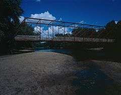
Upper Paris Bridge |
|
000000001998-05-15-0000May 15, 1998
(#98000532) |
Sutton Rd. over the Wapsipinicon River
42°14′40″N 91°35′04″W / 42.244444°N 91.584444°W / 42.244444; -91.584444 (Upper Paris Bridge) |
Coggon |
|
| 91 |
Wesley West House |
|
000000001985-06-27-0000June 27, 1985
(#85001380) |
Palisades Rd.
41°55′04″N 91°25′43″W / 41.917778°N 91.428611°W / 41.917778; -91.428611 (Wesley West House) |
Mount Vernon |
|
| 92 |
West Side Third Avenue SW Commercial Historic District |
|
000000002014-06-13-0000June 13, 2014
(#14000323) |
3rd Avenue SW, between 1st and 3rd streets SW
41°58′27″N 91°40′24″W / 41.974201°N 91.673201°W / 41.974201; -91.673201 (West Side Third Avenue SW Commercial Historic District) |
Cedar Rapids |
|
| 93 |
Whittier Friends Meeting House |
|
000000001993-07-29-0000July 29, 1993
(#93000653) |
Junction of County Roads E34 and X20
42°05′35″N 91°27′50″W / 42.093056°N 91.463889°W / 42.093056; -91.463889 (Whittier Friends Meeting House) |
Whittier |
|
| 94 |
Witwer Grocery Company Building |
|
000000001998-05-01-0000May 1, 1998
(#98000386) |
905 3rd St., SE.
41°58′21″N 91°39′38″W / 41.9725°N 91.660556°W / 41.9725; -91.660556 (Witwer Grocery Company Building) |
Cedar Rapids |
|
| 95 |
Philip A. Wolff House and Carriage House |
|
000000001982-10-07-0000October 7, 1982
(#82000414) |
1420 Seminole Ave., NW.
41°58′43″N 91°41′30″W / 41.978611°N 91.691667°W / 41.978611; -91.691667 (Philip A. Wolff House and Carriage House) |
Cedar Rapids |
Restored property now Belmont Hill Victorian Bed & Breakfast |
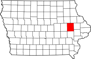
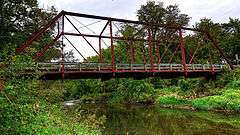


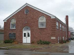











_NW_View.jpg)












.jpg)
.jpg)




.jpg)

