National Register of Historic Places listings in Lake County, Minnesota

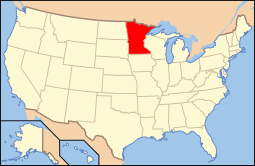
Location of Lake County in Minnesota
This is a list of the National Register of Historic Places listings in Lake County, Minnesota. It is intended to be a complete list of the properties and districts on the National Register of Historic Places in Lake County, Minnesota, United States. The locations of National Register properties and districts for which the latitude and longitude coordinates are included below, may be seen in an online map.
There are 20 properties and districts listed on the National Register in the county.
- This National Park Service list is complete through NPS recent listings posted December 16, 2016.[1]
Current listings
| [2] | Name on the Register | Image | Date listed[3] | Location | City or town | Description |
|---|---|---|---|---|---|---|
| 1 | Benjamin Noble (Shipwreck) | Upload image | (#07000984) |
Address Restricted |
Knife River vicinity | 1909 steel bulk freighter steamship, sank in 1914.[4] |
| 2 | Bridge No. 3589-Silver Creek Township | |
(#98000686) |
U.S. Route 61 over the Stewart River 47°02′52″N 91°37′50″W / 47.047846°N 91.630687°W |
Silver Creek Township vicinity | 1924 reinforced-concrete arch bridge with Classical Revival details.[5] |
| 3 | Duluth and Iron Range Railroad Company Depot | |
(#83000910) |
6th St. off South Ave. 47°01′08″N 91°40′12″W / 47.01879°N 91.670083°W |
Two Harbors | 1907 brick depot and headquarters of the Duluth and Iron Range Railroad. Now houses a Lake County Historical Society museum.[6] |
| 4 | John Dwan Office Building |  |
(#92000700) |
201 Waterfront Dr. 47°01′15″N 91°40′16″W / 47.020857°N 91.671229°W |
Two Harbors | Site where Minnesota Mining and Manufacturing (now 3M) was incorporated in 1902. Now houses the Lake County Historical Society's 3M Museum.[7] |
| 5 | Edna G (tugboat) |  |
(#75002144) |
Home port at the southern end of Poplar St. in Agate Bay 47°01′01″N 91°40′21″W / 47.016831°N 91.672577°W |
Two Harbors | 1896 steam-powered tugboat used to guide ore ships. Operated until 1981, now a Lake County Historical Society ship museum.[8] |
| 6 | Gooseberry Falls State Park CCC/WPA/Rustic Style Historic Resources | |
(#89001672) |
Off U.S. Route 61 northeast of Two Harbors 47°08′29″N 91°27′33″W / 47.141362°N 91.459272°W |
Two Harbors vicinity | 88 Rustic Style park structures built by the Civilian Conservation Corps from 1934 to 1941. Notable for distinctive multi-colored granite masonry.[9] |
| 7 | Halfway Ranger Station | Upload image | (#11000782) |
Minnesota State Highway 1 47°48′49″N 91°44′16″W / 47.813533°N 91.737817°W |
Fall Lake Township | Log Rustic Style administrative complex mostly built in the mid-1930s by the Civilian Conservation Corps for Superior National Forest. Now the Kawishiwi Field Laboratory.[10] |
| 8 | Hesper Shipwreck Site | |
(#94000343) |
Along the west breakwall in Silver Bay Harbor.[11] 47°16′17″N 91°16′18″W / 47.271389°N 91.271667°W |
Silver Bay vicinity | Well-preserved wreck of an 1890 bulk freighter steamship sunk in a 1905 spring snowstorm.[12] |
| 9 | Isabella Ranger Station | Upload image | (#05001611) |
9420 Minnesota State Highway 1 47°37′06″N 91°22′39″W / 47.618433°N 91.377631°W |
Isabella vicinity | 1935 log Rustic Style residential complex built by the Civilian Conservation Corps for Superior National Forest workers.[13] |
| 10 | Lake County Courthouse and Sheriff's Residence | 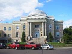 |
(#83000912) |
601 3rd Ave. 47°01′20″N 91°40′17″W / 47.02209°N 91.671402°W |
Two Harbors | 1906 domed Beaux-Arts courthouse of brick and stone.[5] |
| 11 | Larsmont School | |
(#92000799) |
County Highway 61 46°58′52″N 91°44′39″W / 46.981083°N 91.744243°W |
Two Harbors vicinity | 1914 frame school built to serve a Scandinavian American community.[5] |
| 12 | Madeira (Schooner-Barge) Shipwreck | 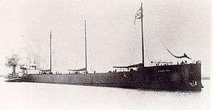 |
(#92000843) |
Address Restricted 47°12′22″N 91°21′29″W / 47.206111°N 91.358056°W |
Beaver Bay vicinity | 1900 schooner-barge sunk during the 1905 Mataafa Storm near the future site of the Split Rock Lighthouse.[14] |
| 13 | Edward and Lisa Mattson House and Fish House | |
(#90001152) |
Off U.S. Route 61 at the Beaver Bay shore near Wieland Island 47°16′02″N 91°16′57″W / 47.267119°N 91.282555°W |
East Beaver Bay | c. 1902 log house and c. 1930 processing house of a small, family-owned commercial fishing outfit.[5] |
| 14 | Niagara Shipwreck Site | Upload image | (#94000344) |
500 feet (150 m) south of Knife Island[11] 46°56′45″N 91°46′16″W / 46.945751°N 91.771245°W |
Knife River vicinity | Unusual 1872 timber rafting tugboat. Sank after running aground in 1904.[15] |
| 15 | Onoko (Bulk Freight Steamer) Shipwreck | Upload image | (#92000845) |
13.5 miles (21.7 km) east of Duluth and 6.5 miles (10.5 km) south of Knife Island[11] Coordinates missing |
Knife River vicinity | 1882 iron-hulled steamship, largest vessel on the Great Lakes for a decade and prototype of all bulk freighters. Sprang a leak and sank in 1915.[16] |
| 16 | Samuel P. Ely Shipwreck | 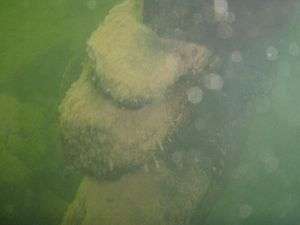 |
(#92000694) |
Along Two Harbors' west breakwall[11] 47°00′42″N 91°40′40″W / 47.011667°N 91.677778°W |
Two Harbors vicinity | 1869 schooner-barge, wrecked in 1896. The most complete specimen of its type.[17] |
| 17 | Split Rock Lighthouse |  |
(#69000073) |
About 20 miles northeast of Two Harbors on U.S. Route 61 47°12′00″N 91°22′01″W / 47.200072°N 91.366945°W |
Two Harbors vicinity | 1910 lighthouse complex built atop a remote cliff. Now a Minnesota Historical Society museum.[18] |
| 18 | Tettegouche Camp Historic District | 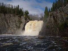 |
(#88003084) |
Off County Highway 4 47°20′50″N 91°15′38″W / 47.347222°N 91.260556°W |
Silver Bay vicinity | c. 1910 private fishing retreat.[5] |
| 19 | Two Harbors Carnegie Library | 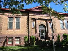 |
(#86002121) |
4th Ave. and Waterfront Dr. 47°01′21″N 91°40′15″W / 47.022522°N 91.670721°W |
Two Harbors | 1909 Classical Revival Carnegie library.[5] |
| 20 | Two Harbors Light Station | 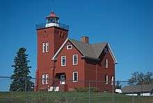 |
(#84001483) |
Agate and Burlington Bays 47°00′50″N 91°39′50″W / 47.013898°N 91.663935°W |
Two Harbors | 1892 lighthouse—oldest still operating on the North Shore—which made Two Harbors the initial primary Lake Superior ore port. Now a Lake County Historical Society museum and bed & breakfast.[19] |
See also
- List of National Historic Landmarks in Minnesota
- National Register of Historic Places listings in Minnesota
References
- ↑ "National Register of Historic Places: Weekly List Actions". National Park Service, United States Department of the Interior. Retrieved on December 16, 2016.
- ↑ Numbers represent an ordering by significant words. Various colorings, defined here, differentiate National Historic Landmarks and historic districts from other NRHP buildings, structures, sites or objects.
- ↑ The eight-digit number below each date is the number assigned to each location in the National Register Information System database, which can be viewed by clicking the number.
- ↑ "Benjamin Noble (shipwreck)". Minnesota National Register Properties Database. Minnesota Historical Society. Retrieved 2012-09-19.
- 1 2 3 4 5 6 Nord, Mary Ann (2003). The National Register of Historic Places in Minnesota. Minnesota Historical Society. ISBN 0-87351-448-3.
- ↑ "Depot Museum". Lake County Historical Society. Retrieved 2012-10-20.
- ↑ "3M Museum". Lake County Historical Society. Retrieved 2012-09-19.
- ↑ >"Edna G. Tugboat". Lake County Historical Society. Retrieved 2012-09-19.
- ↑ "Gooseberry Falls State Park". Rustic Style Resources in Minnesota State Parks. Minnesota Historical Society. Retrieved 2012-08-26.
- ↑ Ferguson, John (2009-10-28). "Halfway Ranger Station Historic District" (PDF). Heritage Stewardship Group, USDA Forest Service. Retrieved 2012-10-20.
- 1 2 3 4 Location given in Kohl, Cris (2001). The Great Lakes Diving Guide. West Chicago, Ill.: Seawolf Communications, Inc. NRIS lists site as "address restricted".
- ↑ "Hesper". Lake Superior Shipwrecks. Minnesota Historical Society. Retrieved 2012-08-28.
- ↑ "Isabella Ranger Station". Minnesota National Register Properties Database. Minnesota Historical Society. Retrieved 2012-09-19.
- ↑ "Madeira". Lake Superior Shipwrecks. Minnesota Historical Society. Retrieved 2012-08-28.
- ↑ "Niagara". Lake Superior Shipwrecks. Minnesota Historical Society. Retrieved 2012-08-28.
- ↑ "Onoko". Lake Superior Shipwrecks. Minnesota Historical Society. Retrieved 2012-08-28.
- ↑ "Samuel P. Ely". Lake Superior Shipwrecks. Minnesota Historical Society. Retrieved 2012-08-28.
- ↑ "Split Rock Lighthouse". Minnesota Historical Society. Retrieved 2012-09-19.
- ↑ "Two Harbors Light Station". Lake County Historical Society. Retrieved 2012-10-20.
External links
| Wikimedia Commons has media related to National Register of Historic Places in Lake County, Minnesota. |
- Minnesota National Register Properties Database—Minnesota Historical Society
This article is issued from Wikipedia - version of the 9/15/2016. The text is available under the Creative Commons Attribution/Share Alike but additional terms may apply for the media files.

