| [3] |
Name on the Register[4] |
Image |
Date listed[5] |
Location |
City or town |
Description |
|---|
| 1 |
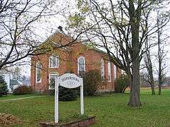
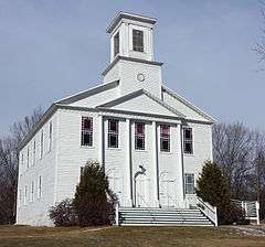
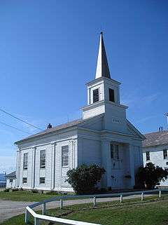
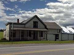
Addison Baptist Church |
|
000000001978-11-02-0000November 2, 1978
(#78003202) |
Junction of VT 22A and VT 17
44°05′19″N 73°18′10″W / 44.088664°N 73.302697°W / 44.088664; -73.302697 (Addison Baptist Church) |
Addison |
|
| 2 |
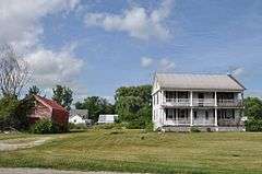
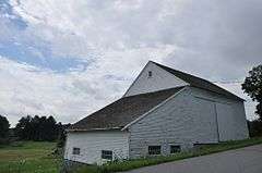
Bottum Farm |
|
000000002008-03-07-0000March 7, 2008
(#08000157) |
1423 North St.
44°08′41″N 73°09′29″W / 44.144722°N 73.158056°W / 44.144722; -73.158056 (Bottum Farm) |
New Haven |
|
| 3 |
Bridge 26 |
|
000000002006-06-07-0000June 7, 2006
(#06000488) |
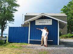
Town Highway 11, Morgan Horse Farm Rd., over Otter Creek
44°04′23″N 73°11′39″W / 44.073056°N 73.194167°W / 44.073056; -73.194167 (Bridge 26) |
Weybridge |
|
| 4 |
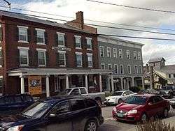
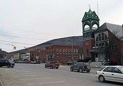
Bristol Downtown Historic District |
|
000000001983-02-03-0000February 3, 1983
(#83003203) |
Main St.
44°07′57″N 73°04′40″W / 44.1325°N 73.077778°W / 44.1325; -73.077778 (Bristol Downtown Historic District) |
Bristol |
|
| 5 |
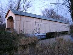
Cedar Swamp Covered Bridge |
|
000000001974-09-10-0000September 10, 1974
(#74000386) |
West of West Salisbury over Otter Creek
43°55′06″N 73°10′28″W / 43.918333°N 73.174444°W / 43.918333; -73.174444 (Cedar Swamp Covered Bridge) |
West Salisbury |
|
| 6 |
Chimney Point Tavern |
|
000000001971-03-31-0000March 31, 1971
(#71000073) |
VT 125
44°02′04″N 73°25′18″W / 44.034444°N 73.421667°W / 44.034444; -73.421667 (Chimney Point Tavern) |
Addison |
|
| 7 |
Chipman's Point |
|
000000001996-12-26-0000December 26, 1996
(#96001519) |
Chipman Point Rd.
43°47′59″N 73°22′32″W / 43.799722°N 73.375556°W / 43.799722; -73.375556 (Chipman's Point) |
Orwell |
|
| 8 |
Cornwall General Store |
|
000000002005-08-06-0000August 6, 2005
(#05000804) |
2635 VT 30, Seth Warner Highway
43°57′40″N 73°12′34″W / 43.961111°N 73.209444°W / 43.961111; -73.209444 (Cornwall General Store) |
Cornwall |
Demolished c. 2013.
|
| 9 |
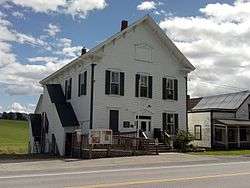
Cornwall Town Hall |
|
000000001986-05-08-0000May 8, 1986
(#86001035) |
VT 30
43°57′41″N 73°12′52″W / 43.961389°N 73.214444°W / 43.961389; -73.214444 (Cornwall Town Hall) |
Cornwall |
|
| 10 |
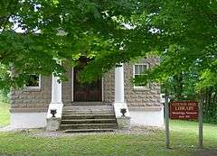
Cotton Free Library |
|
000000001996-04-04-0000April 4, 1996
(#96000388) |
Quaker Village Rd., near the junction of Baker Ct. and Quaker Village Rd.
44°03′54″N 73°12′57″W / 44.065°N 73.215833°W / 44.065; -73.215833 (Cotton Free Library) |
Weybridge |
|
| 11 |
Capts. Louis and Philomene Daniels House |
Upload image |
000000002001-07-11-0000July 11, 2001
(#01000733) |
50 Macdonough Dr.
44°10′12″N 73°15′28″W / 44.1699°N 73.2578°W / 44.1699; -73.2578 (Capts. Louis and Philomene Daniels House) |
Vergennes |
|
| 12 |
District School No. 1 |
Upload image |
000000001980-04-17-0000April 17, 1980
(#80000323) |
Lake Rd.
44°07′37″N 73°21′53″W / 44.126944°N 73.364722°W / 44.126944; -73.364722 (District School No. 1) |
Panton |
|
| 13 |
District Six Schoolhouse |
Upload image |
000000001977-08-18-0000August 18, 1977
(#77000093) |
Elmendorf Road
43°55′52″N 73°17′48″W / 43.931001°N 73.296707°W / 43.931001; -73.296707 (District Six Schoolhouse) |
Shoreham |
|
| 14 |
Colonel Ephraim and Sarah Doolittle Farm |
|
000000001995-01-06-0000January 6, 1995
(#94001523) |
1 mi (1.6 km) east of VT 22A on Doolittle Rd.
43°56′19″N 73°18′16″W / 43.938611°N 73.304444°W / 43.938611; -73.304444 (Colonel Ephraim and Sarah Doolittle Farm) |
Shoreham |
|
| 15 |
East Shoreham Covered Railroad Bridge |
|
000000001974-06-13-0000June 13, 1974
(#74000198) |
Southeast of Shoreham over the Lemon Fair River
43°51′33″N 73°15′22″W / 43.859167°N 73.256111°W / 43.859167; -73.256111 (East Shoreham Covered Railroad Bridge) |
Shoreham |
|
| 16 |
Fenn Farm |
|
000000001995-01-06-0000January 6, 1995
(#94001518) |
Western side of VT 116 (Case St.)
43°58′46″N 73°06′16″W / 43.979444°N 73.104444°W / 43.979444; -73.104444 (Fenn Farm) |
Middlebury |
|
| 17 |
Field Farm |
Upload image |
000000001995-03-10-0000March 10, 1995
(#95000214) |
Fuller Mountain Rd.
44°13′34″N 73°11′56″W / 44.226111°N 73.198889°W / 44.226111; -73.198889 (Field Farm) |
Ferrisburgh |
|
| 18 |
First Congregational Church |
|
000000002001-03-02-0000March 2, 2001
(#01000210) |
464 Main St.
43°48′15″N 73°18′03″W / 43.804167°N 73.300833°W / 43.804167; -73.300833 (First Congregational Church) |
Orwell |
|
| 19 |
First Congregational Church of Cornwall Parsonage |
|
000000002015-06-29-0000June 29, 2015
(#15000376) |
18 VT 74
43°57′39″N 73°12′36″W / 43.9608°N 73.2100°W / 43.9608; -73.2100 (First Congregational Church of Cornwall Parsonage) |
Cornwall |
|
| 20 |
Paris and Anna Fletcher House |
|
000000001999-02-12-0000February 12, 1999
(#99000218) |
VT 22A, north of its junction with Middle Rd.
43°59′07″N 73°18′48″W / 43.985278°N 73.313333°W / 43.985278; -73.313333 (Paris and Anna Fletcher House) |
Bridport |
|
| 21 |
Robert Frost Farm |
|
000000001968-05-23-0000May 23, 1968
(#68000046) |
1 mi (1.6 km) north of VT 125, 3 mi (4.8 km) east of Ripton
43°58′08″N 72°59′49″W / 43.968889°N 72.996944°W / 43.968889; -72.996944 (Robert Frost Farm) |
Ripton |
Homestead of author Robert Frost; now owned by Middlebury College.
|
| 22 |
Glen Dale |
|
000000002002-07-11-0000July 11, 2002
(#02000776) |
1455 Cider Mill Rd.
44°00′10″N 73°12′34″W / 44.002778°N 73.209444°W / 44.002778; -73.209444 (Glen Dale) |
Cornwall |
|
| 23 |
Halpin Covered Bridge |
|
000000001974-09-10-0000September 10, 1974
(#74000199) |
Northeast of Middlebury
44°03′00″N 73°08′28″W / 44.05°N 73.141111°W / 44.05; -73.141111 (Halpin Covered Bridge) |
Middlebury |
|
| 24 |
John Hamilton Farmstead |
|
000000001993-06-17-0000June 17, 1993
(#93000531) |
VT 125 west of the Lemon Fair River
43°59′18″N 73°16′33″W / 43.988333°N 73.275833°W / 43.988333; -73.275833 (John Hamilton Farmstead) |
Bridport |
|
| 25 |
Hand's Cove |
|
000000001980-05-22-0000May 22, 1980
(#80000324) |
Southwest of Shoreham on Hands Cove Rd.
43°52′02″N 73°21′56″W / 43.867222°N 73.365556°W / 43.867222; -73.365556 (Hand's Cove) |
Shoreham |
|
| 26 |
Hawley's Ferry House |
Upload image |
000000001978-11-02-0000November 2, 1978
(#78000224) |
Northwest of Ferrisburg on Kingsland Bay
44°14′26″N 73°17′52″W / 44.240556°N 73.297778°W / 44.240556; -73.297778 (Hawley's Ferry House) |
Ferrisburg |
|
| 27 |
The Heights |
|
000000001988-12-29-0000December 29, 1988
(#88003082) |
South St./VT 30
44°00′18″N 73°10′54″W / 44.005°N 73.181667°W / 44.005; -73.181667 (The Heights) |
Middlebury |
Also known as Thaddeus Chapman House
|
| 28 |
Hoag Gristmill and Knight House Complex |
Upload image |
000000001980-04-22-0000April 22, 1980
(#80000325) |
Northwest of Starksboro on State Prison Hollow Rd.
44°14′37″N 73°04′08″W / 44.243611°N 73.068889°W / 44.243611; -73.068889 (Hoag Gristmill and Knight House Complex) |
Starksboro |
|
| 29 |
House at 215 School Street |
Upload image |
000000002005-12-16-0000December 16, 2005
(#05001423) |
215 School St.
43°53′33″N 73°18′55″W / 43.8925°N 73.315278°W / 43.8925; -73.315278 (House at 215 School Street) |
Shoreham |
|
| 30 |
Lampson School |
|
000000002001-12-21-0000December 21, 2001
(#01001363) |
44 Summer Rd.
44°05′30″N 73°06′35″W / 44.091667°N 73.109722°W / 44.091667; -73.109722 (Lampson School) |
New Haven |
|
| 31 |
Larrabee's Point Complex |
|
000000001980-05-01-0000May 1, 1980
(#80000423) |
Southwest of Shoreham
43°51′20″N 73°22′36″W / 43.855556°N 73.376667°W / 43.855556; -73.376667 (Larrabee's Point Complex) |
Shoreham |
|
| 32 |
Leicester Meeting House |
|
000000001988-07-28-0000July 28, 1988
(#88001043) |
U.S. Route 7 and Town Highway 1
43°51′58″N 73°06′32″W / 43.866111°N 73.108889°W / 43.866111; -73.108889 (Leicester Meeting House) |
Leicester |
|
| 33 |
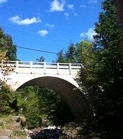
Middlebury Gorge Concrete Arch Bridge |
|
000000001991-11-14-0000November 14, 1991
(#91001604) |
Vermont 125 over the Middlebury River
43°58′12″N 73°05′11″W / 43.97°N 73.086389°W / 43.97; -73.086389 (Middlebury Gorge Concrete Arch Bridge) |
East Middlebury |
|
| 34 |
Middlebury Village Historic District |
|
000000001976-11-13-0000November 13, 1976
(#76000223) |
U.S. Route 7; also VT 30 and VT 125
44°00′51″N 73°10′04″W / 44.014167°N 73.167778°W / 44.014167; -73.167778 (Middlebury Village Historic District) |
Middlebury |
Vermont highway addresses represent a boundary increases
|
| 35 |
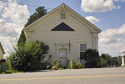
Monkton Borough Baptist Church |
|
000000001989-01-05-0000January 5, 1989
(#88003121) |
Town Highway 1 (Monkton Rd.)
44°14′18″N 73°08′42″W / 44.238444°N 73.145123°W / 44.238444; -73.145123 (Monkton Borough Baptist Church) |
Monkton |
Now used as a Grange hall.
|
| 36 |
Monkton Town Hall |
|
000000001978-01-03-0000January 3, 1978
(#78000225) |
North of Monkton on Monkton Ridge Rd.
44°15′13″N 73°07′30″W / 44.253611°N 73.125°W / 44.253611; -73.125 (Monkton Town Hall) |
Monkton |
|
| 37 |
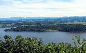
Mount Independence |
|
000000001971-09-03-0000September 3, 1971
(#71000079) |
On Lake Champlain opposite Fort Ticonderoga, northwest of Orwell
43°49′33″N 73°23′02″W / 43.825833°N 73.383889°W / 43.825833; -73.383889 (Mount Independence) |
Orwell |
Site of Fort Independence, an American Revolutionary War fortification built opposite Fort Ticonderoga.
|
| 38 |
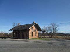
New Haven Junction Depot |
|
000000001978-10-19-0000October 19, 1978
(#78000226) |
Junction of U.S. Route 7 and VT 17
44°07′24″N 73°11′00″W / 44.123333°N 73.183333°W / 44.123333; -73.183333 (New Haven Junction Depot) |
New Haven |
|
| 39 |
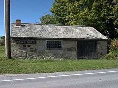
Old Stone Blacksmith Shop |
|
000000001975-04-21-0000April 21, 1975
(#75000136) |
North of Cornwall on VT 30
43°58′39″N 73°12′21″W / 43.9775°N 73.205833°W / 43.9775; -73.205833 (Old Stone Blacksmith Shop) |
Cornwall |
|
| 40 |
Orwell Site |
|
000000001977-04-11-0000April 11, 1977
(#77000094) |
Address Restricted
|
Orwell |
|
| 41 |
Pulp Mill Covered Bridge |
|
000000001974-09-10-0000September 10, 1974
(#74000200) |
Northwest of Middlebury off VT 23
44°01′29″N 73°10′41″W / 44.024722°N 73.178056°W / 44.024722; -73.178056 (Pulp Mill Covered Bridge) |
Middlebury |
|
| 42 |
Ripton Community House |
|
000000001973-07-03-0000July 3, 1973
(#73000180) |
On VT 125
43°58′30″N 73°02′14″W / 43.975°N 73.037222°W / 43.975; -73.037222 (Ripton Community House) |
Ripton |
|
| 43 |
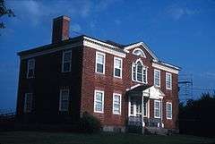
Rokeby |
|
000000001974-06-20-0000June 20, 1974
(#74000201) |
North of Ferrisburg off U.S. Route 7
44°13′21″N 73°14′17″W / 44.2225°N 73.238056°W / 44.2225; -73.238056 (Rokeby) |
Ferrisburg |
Robinson family farmstead significant for its role in the Underground Railroad
|
| 44 |
Salisbury Congregational Church |
|
000000002001-03-02-0000March 2, 2001
(#01000212) |
West Salisbury Rd.
43°53′49″N 73°06′10″W / 43.896944°N 73.102778°W / 43.896944; -73.102778 (Salisbury Congregational Church) |
Salisbury |
|
| 45 |
Salisbury Fish Hatchery |
|
000000001994-03-24-0000March 24, 1994
(#94000176) |
VT 53, southeast of its junction with Smead Rd.
43°55′29″N 73°05′47″W / 43.924722°N 73.096389°W / 43.924722; -73.096389 (Salisbury Fish Hatchery) |
Salisbury |
|
| 46 |
Salisbury Town Hall |
|
000000001995-11-07-0000November 7, 1995
(#95001262) |
West of the junction of Maple and Prospect Sts.
43°53′46″N 73°06′08″W / 43.896111°N 73.102222°W / 43.896111; -73.102222 (Salisbury Town Hall) |
Salisbury |
|
| 47 |
School House and Town Hall |
|
000000001988-06-14-0000June 14, 1988
(#88001045) |
U.S. Route 7 and Town Highway 1
43°51′58″N 73°06′33″W / 43.866111°N 73.109167°W / 43.866111; -73.109167 (School House and Town Hall) |
Leicester |
|
| 48 |
Shard Villa |
Upload image |
000000001989-10-30-0000October 30, 1989
(#89001789) |
Junction of Shard Villa and Columbus Smith Rds.
43°56′22″N 73°09′13″W / 43.939444°N 73.153611°W / 43.939444; -73.153611 (Shard Villa) |
Salisbury |
|
| 49 |
Shoreham Congregational Church |
|
000000002001-03-02-0000March 2, 2001
(#01000211) |
School St.
43°53′36″N 73°18′59″W / 43.893287°N 73.316401°W / 43.893287; -73.316401 (Shoreham Congregational Church) |
Shoreham |
|
| 50 |
South Starksboro Friends Meeting House and Cemetery |
|
000000001985-11-07-0000November 7, 1985
(#85002769) |
Dan Sargent Rd.
44°10′02″N 73°00′53″W / 44.167222°N 73.014722°W / 44.167222; -73.014722 (South Starksboro Friends Meeting House and Cemetery) |
Starksboro |
|
| 51 |
Stagecoach Inn |
|
000000001984-11-15-0000November 15, 1984
(#84000674) |
U.S. Route 7
43°51′57″N 73°06′27″W / 43.865833°N 73.1075°W / 43.865833; -73.1075 (Stagecoach Inn) |
Leicester |
|
| 52 |
Starksboro Village Meeting House |
|
000000001985-11-07-0000November 7, 1985
(#85002768) |
VT 116
44°13′32″N 73°03′28″W / 44.225556°N 73.057778°W / 44.225556; -73.057778 (Starksboro Village Meeting House) |
Starksboro Village |
|
| 53 |
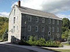
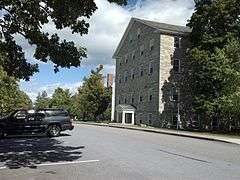
Stone Mill |
|
000000001973-04-11-0000April 11, 1973
(#73000181) |
Mill St.
44°01′05″N 73°10′15″W / 44.018056°N 73.170833°W / 44.018056; -73.170833 (Stone Mill) |
Middlebury |
|
| 54 |
Old Stone Row |
|
000000001997-09-18-0000September 18, 1997
(#97001162) |
Junction of S. Main St. and Old Chapel Rd.
44°00′32″N 73°10′34″W / 44.008889°N 73.176111°W / 44.008889; -73.176111 (Old Stone Row) |
Middlebury |
|
| 55 |
Gen. Samuel Strong House |
|
000000001973-04-11-0000April 11, 1973
(#73000182) |
64 W. Main St.
44°09′50″N 73°15′30″W / 44.163889°N 73.258333°W / 44.163889; -73.258333 (Gen. Samuel Strong House) |
Vergennes |
|
| 56 |
John Strong House |
|
000000001980-05-15-0000May 15, 1980
(#80000326) |
6656 VT 17
44°03′17″N 73°24′43″W / 44.054722°N 73.411944°W / 44.054722; -73.411944 (John Strong House) |
Addison |
Surrounded by D.A.R. State Park; itself a historic house museum.
|
| 57 |
Samuel Paddock Strong House |
|
000000001979-08-15-0000August 15, 1979
(#79000216) |
82 W. Main St.
44°09′41″N 73°15′41″W / 44.161389°N 73.261389°W / 44.161389; -73.261389 (Samuel Paddock Strong House) |
Vergennes |
|
| 58 |
Union Church |
|
000000002000-07-20-0000July 20, 2000
(#00000829) |
Junction of River Rd. and East St.
44°05′33″N 73°06′34″W / 44.0925°N 73.109444°W / 44.0925; -73.109444 (Union Church) |
New Haven |
|
| 59 |
Union Meetinghouse |
|
000000001978-02-23-0000February 23, 1978
(#78000227) |
U.S. Route 7
44°12′22″N 73°14′45″W / 44.206111°N 73.245833°W / 44.206111; -73.245833 (Union Meetinghouse) |
Ferrisburg |
|
| 60 |
University of Vermont Morgan Horse Farm |
|
000000001973-04-11-0000April 11, 1973
(#73000183) |
Mogan Horse Farm Rd., off U.S. Route 7
44°02′40″N 73°11′10″W / 44.044444°N 73.186111°W / 44.044444; -73.186111 (University of Vermont Morgan Horse Farm) |
Weybridge |
|
| 61 |
Vergennes Historic District |
|
000000001976-09-03-0000September 3, 1976
(#76000136) |
U.S. Route 7 (at time of listing, now Vermont Route 22A)
44°10′07″N 73°15′15″W / 44.168611°N 73.254167°W / 44.168611; -73.254167 (Vergennes Historic District) |
Vergennes |
|
| 62 |
Vergennes Residential Historic District |
Upload image |
000000002003-05-08-0000May 8, 2003
(#03000395) |
S. Water St., Green St., S. Maple St., all south of Main St.
44°09′57″N 73°15′09″W / 44.165833°N 73.2525°W / 44.165833; -73.2525 (Vergennes Residential Historic District) |
Vergennes |
|
| 63 |
Waybury Inn |
|
000000001983-07-14-0000July 14, 1983
(#83003204) |
VT 125
43°58′19″N 73°05′35″W / 43.971944°N 73.093056°W / 43.971944; -73.093056 (Waybury Inn) |
East Middlebury |
|
| 64 |
Wesleyan Methodist Church |
|
000000001996-04-12-0000April 12, 1996
(#96000387) |
Quaker Village Rd., near the junction of Baker Ct. and Quaker Village Rd.
44°03′53″N 73°12′57″W / 44.064722°N 73.215833°W / 44.064722; -73.215833 (Wesleyan Methodist Church) |
Weybridge |
|
| 65 |
Wilcox-Cutts House |
|
000000001974-12-02-0000December 2, 1974
(#74000202) |
2 mi (3.2 km) south of Orwell on VT 22A
43°47′05″N 73°18′29″W / 43.784722°N 73.308056°W / 43.784722; -73.308056 (Wilcox-Cutts House) |
Orwell |
|
| 66 |
Emma Willard House |
|
000000001966-10-15-0000October 15, 1966
(#66000798) |
Middlebury College campus
44°00′27″N 73°10′29″W / 44.0075°N 73.174722°W / 44.0075; -73.174722 (Emma Willard House) |
Middlebury |
Home of Emma Willard, pioneer in women's education in the United States
|
| 67 |
Witherell Farm |
|
000000001993-04-01-0000April 1, 1993
(#93000241) |
Town Highway 74 (Witherell Rd.) west of Lakeview and St. Genevieve cemeteries
43°53′02″N 73°20′23″W / 43.883889°N 73.339722°W / 43.883889; -73.339722 (Witherell Farm) |
Shoreham |
|


.jpg)


.jpg)
