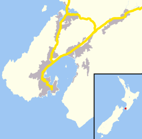
Mana, New Zealand
For the electorate, see Mana (New Zealand electorate).
| Mana | |
|---|---|
 Mana | |
| Basic information | |
| Local authority | Porirua |
| Coordinates | 41°05′51″S 174°52′10″E / 41.097548°S 174.869463°ECoordinates: 41°05′51″S 174°52′10″E / 41.097548°S 174.869463°E |
| Facilities | |
| Train station(s) | Mana Railway Station |
| Surrounds | |
| North | Camborne |
| East | Porirua Harbour |
| South | Paremata |
| West | Porirua Harbour |
Mana is a suburb of Porirua City in New Zealand. It is a narrow isthmus bounded to the west by the entrance to Porirua Harbour, and to the east by the Pauatahanui inlet of the Porirua Harbour. Mana Island lies about three kilometres west of the isthmus.
State Highway 1 and the North Island Main Trunk Railway both pass through the centre of Mana. A significant increase in the traffic capacity through Mana occurred in 2005-2006 when a second bridge on SH1 was added at the southern end, transit lanes were introduced and several sets of traffic lights were added as part of the Plimmerton to Paremata upgrade.
History
Mana was known as Dolly Varden (after a ship) until 1960 when local pressure resulted in the area being renamed Mana.[1][2]
Notes
- ↑ Hoy 1970, pp. 93–95.
- ↑ Churchman 1995, p. 27.
References
- Hoy, Douglas George (1970). Rails Out of the Capital. Wellington: The New Zealand Railway and Locomotive Society.
- Churchman, Geoffrey Basil (1998) [1988]. The Story of The Wellington to Johnsonville Railway (Second ed.). Wellington: IPL Books. ISBN 0-908876-05-X.
External links
This article is issued from Wikipedia - version of the 11/28/2016. The text is available under the Creative Commons Attribution/Share Alike but additional terms may apply for the media files.