List of heritage sites near Cape Town
This is a list of the heritage sites near Cape Town as recognized by the South African Heritage Resources Agency.[1]
For additional provincial heritage sites declared by Heritage Western Cape, the provincial heritage resources authority of the Western Cape Province of South Africa, please see the entries at the end of the list. These sites have been declared subsequent to the implementation of the new legislation on 1 April 2000 and unlike those in the SAHRA portion of the list are not former national monuments declared by the former National Monuments Council, the predecessor of both SAHRA and Heritage Western Cape.[2] In the instance of these sites the "identifier" code used is that of Heritage Western Cape rather than SAHRA.
| SAHRA identifier | Site name | Description | Town | District | NHRA status | Coordinates | Image |
|---|---|---|---|---|---|---|---|
| 9/2/018/0001 | Fort Wynyard, Green Point, Cape Town | Fort Wynyard was erected in 1860 near the site where the Dutch East India Company's battery "Kyk in de Pot", which was dismantled between 1825 and 1827, stood. The fort was named after Lt-Gen. R. H. Wynyard, the then Lieutenant-Governor of the Cape Colony Type of site: Fort. | Cape Town, Green Point | The Cape | Provincial Heritage Site | 33°54′12″S 18°24′50″E / 33.903345°S 18.413875°E | 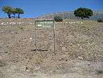 |
| 9/2/018/0002 | Valkenberg, Observatory, Cape Town | Built on land granted in 1661, the Valkenburg Homestead is one of the only original homesteads still standing on the Liesbeeck River. It was named after Cornelius Valck who became the owner in 1720. The north wing, with its curvilinear parapet, was added later Type of site: Farmstead |
Cape Town, Observatory | The Cape | Provincial Heritage Site | 33°56′31″S 18°28′46″E / 33.942075°S 18.479581°E | 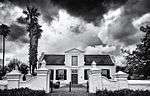 |
| 9/2/018/0002/01 | Black River/Liesbeeck River, Confluence Area, Observatory | 33°55′48″S 18°28′42″E / 33.929863°S 18.478250°E | | ||||
| 9/2/018/0004 | Robben Island, Table Bay | "Throughout documented history, Robben Island has been associated with banishment, suffering and the subjugation of the human spirit. From the earliest days of colonial rule, it was used as a place of banishment and exile for those opposing colonial author | Robben Island, Cape Town | The Cape | National Heritage Site | 33°48′21″S 18°22′13″E / 33.805910°S 18.370261°ERobben Island, Table Bay) |  |
| 9/2/018/0004/02 | Robben Island Lighthouse, Robben Island | Cape Town |  | ||||
| 9/2/018/0004/03 | Church of the Good Shepherd, Robben Island | 33°48′20″S 18°22′36″E / 33.805521°S 18.376628°E | 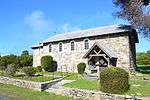 | ||||
| 9/2/018/0004/04 | Millennium facility, Robben Island | Cape Town | 
| ||||
| 9/2/018/0004/05 | Robben Island, IEM System, Robben Island | Cape Town |
| ||||
| 9/2/018/0005 | Melbourne Terrace, 1-13 Melbourne Road, Woodstock, Cape Town | Type of site: Terrace. | Cape Town, Woodstock | The Cape | Provincial Heritage Site | 33°55′53″S 18°26′49″E / 33.931455°S 18.446966°E |
|
| 9/2/018/0005/001 | 1 Melbourne Road, Woodstock, Cape Town | Type of site: Terraced House. | Cape Town, Woodstock | The Cape | Provincial Heritage Site | 33°55′51″S 18°26′50″E / 33.930807°S 18.447249°E |
|
| 9/2/018/0005/002 | 3 Melbourne Road, Woodstock, Cape Town | Type of site: Terraced House. | Cape Town, Woodstock | The Cape | Provincial Heritage Site | 33°55′51″S 18°26′50″E / 33.930841°S 18.447179°E |
|
| 9/2/018/0005/003 | 5 Melbourne Road, Woodstock, Cape Town | Type of site: Terraced House. | Cape Town, Woodstock | The Cape | Provincial Heritage Site | 33°55′51″S 18°26′50″E / 33.930891°S 18.447159°E |
|
| 9/2/018/0005/004 | 7 Melbourne Road, Woodstock, Cape Town | Type of site: Terraced House. | Cape Town, Woodstock | The Cape | Provincial Heritage Site | 33°55′51″S 18°26′50″E / 33.930955°S 18.447154°E |
|
| 9/2/018/0005/005 | 9 Melbourne Road, Woodstock, Cape Town | Type of site: Terraced House. | Cape Town, Woodstock | The Cape | Provincial Heritage Site | 33°55′52″S 18°26′50″E / 33.930998°S 18.447133°E |
|
| 9/2/018/0005/006 | 11 Melbourne Road, Woodstock, Cape Town | Type of site: Terraced House. | Cape Town, Woodstock | The Cape | Provincial Heritage Site | 33°55′52″S 18°26′50″E / 33.931069°S 18.447116°E |
|
| 9/2/018/0005/007 | 13 Melbourne Road, Woodstock, Cape Town | Cape Town, Woodstock | The Cape | Provincial Heritage Site | 33°55′53″S 18°26′49″E / 33.931450°S 18.446963°E |
| |
| 9/2/018/0006 | see 9/2/018/0256/1 | Cape Town |
| ||||
| 9/2/018/0010 | Clifton, Glen Beach, The Ridge and Bakoven, Cape Town | Cape Town, Clifton | The Cape | Heritage Area | 33°56′30″S 18°22′25″E / 33.941653°S 18.373695°E |  | |
| 9/2/018/0010/01 | Bungalow 97, The Ridge, Clifton, Cape Town | Cape Town |
| ||||
| 9/2/018/0010/02 | Bungalow 25, Clifton, Cape Town | Cape Town |
| ||||
| 9/2/018/0010/03 | Bungalow 61, Clifton, Cape Town | Cape Town |
| ||||
| 9/2/018/0010/04 | Bungalow 64, Clifton, Cape Town | Cape Town |
| ||||
| 9/2/018/0010/05 | Bungalow 14, Glen Beach, Cape Town | Cape Town |
| ||||
| 9/2/018/0010/06 | Bungalow 76, Clifton, Cape Town | Cape Town |
| ||||
| 9/2/018/0010/07 | Bungalow 58, Clifton, Cape Town | Cape Town |
| ||||
| 9/2/018/0010/08 | Bungalow 31, Bakoven, Cape Town | Cape Town |
| ||||
| 9/2/018/0010/09 | Bungalow 2, Glen Beach, Cape Town | Cape Town |
| ||||
| 9/2/018/0010/10 | Bungalow 42, Clifton, Cape Town | Cape Town |
| ||||
| 9/2/018/0010/11 | Bungalow 1, Glen Beach, Cape Town | Cape Town |
| ||||
| 9/2/018/0010/13 | Bungalow 8, Second Beach, Clifton, Cape Town | Cape Town |
| ||||
| 9/2/018/0010/14 | Bungalow 71, Clifton, Cape Town | Cape Town |
| ||||
| 9/2/018/0010/15 | Bungalow 8, Beta Road, Bakoven, Cape Town | Cape Town |
| ||||
| 9/2/018/0010/16 | Bungalow 91, The Ridge, Clifton, Cape Town | Cape Town |
| ||||
| 9/2/018/0010/17 | Bungalow 2, First Beach, Clifton, Cape Town | Cape Town |
| ||||
| 9/2/018/0010/18 | Bungalow 7, Beta Road, Bakoven, Cape Town | Cape Town |
| ||||
| 9/2/018/0010/19 | Bungalow 5, Glen Beach, Cape Town | Cape Town |
| ||||
| 9/2/018/0010/20 | Bungalow 11, Beta Road, Bakoven, Cape Town | Cape Town |
| ||||
| 9/2/018/0010/21 | Bungalow 23, Beta Road, Bakoven, Cape Town | Cape Town |
| ||||
| 9/2/018/0010/22 | Bungalow 94, The Ridge, Fourth Beach, Clifton, Cape Town | Cape Town |
| ||||
| 9/2/018/0010/23 | Bungalow 30, Clifton, Cape Town | Cape Town |
| ||||
| 9/2/018/0010/24 | Bungalow 10, Bakoven, Cape Town | Cape Town |
| ||||
| 9/2/018/0010/25 | Bungalow 15, Bakoven, Cape Town | Cape Town |
| ||||
| 9/2/018/0010/26 | Bungalow 54, Fourth Beach, Clifton, Cape Town | Cape Town |
| ||||
| 9/2/018/0010/27 | Bungalow 73, Fourth Beach, Clifton, Cape Town | Cape Town |
| ||||
| 9/2/018/0010/28 | Bungalow 35, Third Beach, Clifton, Cape Town | Cape Town |
| ||||
| 9/2/018/0010/29 | Bungalow 14, Beta Road, Bakoven, Cape Town | Cape Town |
| ||||
| 9/2/018/0010/30 | Bungalow 27, Third Beach, Clifton, Cape Town | Cape Town |
| ||||
| 9/2/018/0010/31 | Bungalow 13, Bakoven, Cape Town | Cape Town |
| ||||
| 9/2/018/0010/32 | Dellville, Site 29, Third Beach, Clifton, Cape Town | Cape Town |
| ||||
| 9/2/018/0010/33 | Bungalow 3, Clifton, Cape Town | Cape Town |
| ||||
| 9/2/018/0010/34 | Bungalow 75, The Ridge, Clifton, Cape Town | Cape Town |
| ||||
| 9/2/018/0010/35 | Bungalow 12, Victoria Road, Clifton | Cape Town |
| ||||
| 9/2/018/0010/36 | Bungalow 40A, Beta Road, Bakoven | Cape Town |
| ||||
| 9/2/018/0010/37 | Bungalow 26, Beta Road, Bakoven | Cape Town |
| ||||
| 9/2/018/0010/38 | Bungalow 62, Fourth Beach, Clifton | Cape Town |
| ||||
| 9/2/018/0010/39 | Bungalow 83, The Ridge, Clifton | Cape Town |
| ||||
| 9/2/018/0010/40 | Bungalow 57, Fourth Beach, Clifton | Cape Town |
| ||||
| 9/2/018/0010/41 | Bungalow 24, Beta Road, Bakoven | Cape Town |
| ||||
| 9/2/018/0010/42 | Bungalow 81, The Ridge, Clifton | Cape Town |
| ||||
| 9/2/018/0010/43 | Bungalow 46, Fourth Beach, Clifton | Cape Town |
| ||||
| 9/2/018/0010/44 | see 9/2/018/0010/016 | Cape Town |
| ||||
| 9/2/018/0010/45 | Bungalow 22, Beta Road, Bakoven, Cape Town | Cape Town |
| ||||
| 9/2/018/0010/46 | Bungalow 47, Fourth Beach, Clifton, Cape Town | Cape Town |
| ||||
| 9/2/018/0010/47 | Bungalow 80A, Clifton, Cape Town | Cape Town |
| ||||
| 9/2/018/0010/48 | Bungalow 39, 3rd Beach, Clifton, Cape Town | Cape Town |
| ||||
| 9/2/018/0010/49 | Bungalow 51, Brooke Street, Bakoven, Cape Town | Cape Town |
| ||||
| 9/2/018/0010/50 | Bungalow 87, Clifton, Cape Town | Cape Town |
| ||||
| 9/2/018/0010/51 | Bungalow 47, Bakoven, Cape Town | Cape Town |
| ||||
| 9/2/018/0010/52 | Bungalow 37, Clifton, Cape Town | Cape Town |
| ||||
| 9/2/018/0010/53 | Bungalow 31, Third Beach, Clifton, Cape Town | Cape Town |
| ||||
| 9/2/018/0010/54 | Bungalow 72, Clifton, Cape Town | Cape Town |
| ||||
| 9/2/018/0010/55 | Bungalow 32, Clifton, Cape Town | Cape Town |
| ||||
| 9/2/018/0010/56 | Bungalow 86, The Ridge, Cliff Road, Clifton, Cape Town | Cape Town |
| ||||
| 9/2/018/0010/57 | Bungalow 82, Erf 479, Clifton, Cape Town | Cape Town |
| ||||
| 9/2/018/0010/58 | Bungalow 34, Erf 412, Clifton, Cape Town | Cape Town |
| ||||
| 9/2/018/0010/59 | Bungalow 63, Fourth Beach, Clifton, Cape Town | Cape Town |
| ||||
| 9/2/018/0010/60 | Bungalow 9, Beta Close, Bakoven, Clifton, Cape Town | Cape Town |
| ||||
| 9/2/018/0010/61 | 16 Beta Road, Clifton, Cape Town | 33°57′39″S 18°22′24″E / 33.960959°S 18.373254°E |
| ||||
| 9/2/018/0010/62 | Bungalow 80, The Ridge, Clifton, Cape Town | Cape Town |
| ||||
| 9/2/018/0010/63 | 1 Beta Road, Erf 2667, Bakoven, Cape Town | 33°57′39″S 18°22′28″E / 33.960828°S 18.374445°E |
| ||||
| 9/2/018/0010/64 | Bungalow 49, Erf 2716, Bakoven, Cape Town | Cape Town |
| ||||
| 9/2/018/0010/65 | Bungalow 40, Fourth Beach, Clifton, Cape Town | Cape Town |
| ||||
| 9/2/018/0010/66 | Bungalow 89, The Ridge, Clifton, Cape Town | Cape Town |
| ||||
| 9/2/018/0010/67 | Bungalow 10, Glen Beach Clifton, Cape Town | Cape Town |
| ||||
| 9/2/018/0010/68 | Bungalow 18, Beta Road, Bakoven, Clifton, Cape Town | Cape Town |
| ||||
| 9/2/018/0022-125 | Erf 1446, Camps Bay | Cape Town, Camps Bay | The Cape | Provincial Heritage Site | 33°57′00″S 18°23′00″E / 33.950000°S 18.383333°E |
| |
| 9/2/018/0022-126 | Erf 1559, Camps Bay | Cape Town, Camps Bay | The Cape | Provincial Heritage Site | 33°57′00″S 18°23′00″E / 33.950000°S 18.383333°E |
| |
| 9/2/018/0022/004 | Land adjoining Earles Dyke, The Glen, Camps Bay, Cape Town | Just above the Clifton Nature Reserve, between Victoria and Kloof Roads, this vacant piece of land, about eight hectares in extent, is situated. It was proclaimed a natural monument for various reasons. The natural vegetation of the slopes of Table Mounta Type of site: Vacant Site. The natural vegetation of the slopes of Table Mountain has been preserved here; it forms a link between the proclaimed area of Table Mountain on the slope of Lion’s Head and the Clifton Nature Reserve as a result of which a strip of land, still in its nat | Cape Town, Camps Bay | The Cape | Provincial Heritage Site | 33°56′33″S 18°22′34″E / 33.942628°S 18.376174°E |
|
| 9/2/018/0022/006 | Public Open Space between Nettleton Road and the sea, between Bantry Bay and Clifton, at Cape Town | Type of site: Vacant Site. | Cape Town, Clifton | The Cape | Provincial Heritage Site | 33°55′56″S 18°22′42″E / 33.932207°S 18.378339°E |
|
| 9/2/018/0022/01 | Cableway Stations | 33°56′54″S 18°24′12″E / 33.948326°S 18.403217°E |  | ||||
| 9/2/018/0022/05 | Signal Hill | 33°55′03″S 18°24′14″E / 33.917381°S 18.403953°E |  | ||||
| 9/2/018/0024 | Dutch Reformed Church and Parsonage, Three Anchor Bay, 265 Main Road, Sea Point, Cape Town | This church building was officially opened on 9 July 1879 by Dr Andrew Murray. Not until eight months later, on 10 March 1880, did the secession of the congregation from the Groote Kerk take place. The stained-glass windows date from 1885 and the embattle Type of site: Church and Parsonage Current use: Church : Dutch Reformed. | Cape Town, Sea Point | The Cape | Provincial Heritage Site | 33°54′29″S 18°24′05″E / 33.907957°S 18.401484°E |  |
| 9/2/018/0028 | Battle of Blaauberg Battlefield, Bloubergstrand, Cape Town District | Cape Town |
| ||||
| 9/2/018/0028/01 | Proposed memorial for the Battle of Blaauberg, Bloubergstrand, Cape | Cape Town |
| ||||
| 9/2/018/0033 | The Retreat, 16 Park Avenue, Camps Bay, Cape Town | Type of site: House. | Cape Town, Camps Bay | The Cape | Provisional Protection | 33°57′01″S 18°22′52″E / 33.950266°S 18.381143°E |
|
| 9/2/018/0035 | MILNERTON MUNICIPAL AREA, GENERAL | Cape Town |
| ||||
| 9/2/018/0037 | Woutersen-Wessels Vault, Wessels Road, Green Point, Cape Town | A vault with a surrounding wall. It was erected in 1827 by the widow of Peter Woutersen. His granddaughter married Jacobus Chris toffel Wessels, whose son, Sir John Wessels, became Chief Justice of South Africa. Various members of the ‘family lived on the estate. Because the vault had be Type of site: Vault.
The architecture is most interesting and there is reason to believe that it is the work of the well-known architect Hermann Schutte. Some prominent citizens have been buried there, inter alia Adv. M.L. Wessels, brother of Sir John Wess |
Cape Town, Green Point | The Cape | Provincial Heritage Site | 33°54′44″S 18°24′45″E / 33.912125°S 18.412626°E |  |
| 9/2/018/0039 | Dutch Reformed Church, Batavia Road, Bloubergstrand | 33°48′01″S 18°27′34″E / 33.800196°S 18.459420°E |
| ||||
| 9/2/018/0044 | Brooklyn Fire Station, Koeberg Road, Brooklyn, Cape Town | Cape Town | 33°54′57″S 18°28′50″E / 33.915929°S 18.480681°E |
| |||
| 9/2/018/0049 | 18-20 Stadler Road, Bloubergstrand, Cape Town District | Cape Town | 33°48′09″S 18°27′37″E / 33.802416°S 18.460329°E |
| |||
| 9/2/018/0053 | Green Point Lighthouse, Cape Town | Main article: Green Point Lighthouse, Cape Town This lighthouse, which was built by Hermann Schutte and probably also designed by him, is the oldest structure of its kind in South Africa. Construction work started on 14 September 1821, and the lighthouse was officially opened on 12 April 1824. It origi Type of site: Lighthouse Current use: Lighthouse. |
Cape Town, Green Point | The Cape | Provincial Heritage Site | 33°54′04″S 18°24′02″E / 33.901111°S 18.400555°E | 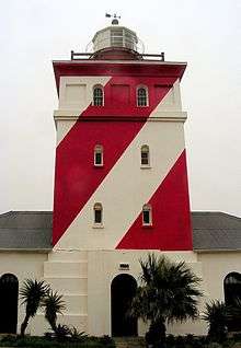 |
| 9/2/018/0057 | BLOUBERGSTRAND LOCAL AREA, GENERAL | Cape Town |
| ||||
| 9/2/018/0062 | Old Wooden Bridge over the Milnerton Lagoon, Milnerton | Type of site: Bridge Current use: Bridge. | Cape Town, Milnerton | The Cape | Provincial Heritage Site | 33°52′53″S 18°29′25″E / 33.881376°S 18.490285°E | 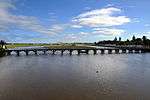 |
| 9/2/018/0064 | was Ellerslie Girls' High School and was Tafelberg School, Main Road, Sea Point, Cape Town | Type of site: School Current use: Redevelopment | Cape Town, Sea Point | The Cape | Provincial Heritage Site | 33°54′57″S 18°23′27″E / 33.915907°S 18.390730°EEllerslie Girls' High School and was Tafelberg School, Main Road, Sea Point, Cape Town) |  |
| 9/2/018/0067 | 38-46 Queens Road, Bantry Bay, Cape Town | Cape Town | 33°55′28″S 18°22′55″E / 33.924564°S 18.381967°E |
| |||
| 9/2/018/0067/001 | 38 Queens Road, Bantry Bay, Cape Town | Cape Town, Bantry Bay | The Cape | Provincial Heritage Site | 33°55′23″S 18°22′50″E / 33.923038°S 18.380568°E |
| |
| 9/2/018/0067/2 | 40 Queens Road, Bantry Bay, Cape Town | Cape Town | 33°55′28″S 18°22′55″E / 33.924564°S 18.381967°E |
| |||
| 9/2/018/0067/3 | 42 Queens Road, Bantry Bay, Cape Town | Cape Town | 33°55′28″S 18°22′55″E / 33.924564°S 18.381967°E |
| |||
| 9/2/018/0067/4 | 44 Queens Road, Bantry Bay, Cape Town | Cape Town | 33°55′28″S 18°22′55″E / 33.924564°S 18.381967°E |
| |||
| 9/2/018/0067/5 | 46 Queens Road, Bantry Bay, Cape Town | Cape Town | 33°55′28″S 18°22′55″E / 33.924564°S 18.381967°E |
| |||
| 9/2/018/0074/001 | 2 Grove Road, Mowbray, Cape Town | These nine houses form part of a unique block consisting of two terraced rows of identical late Victorian double-storeyed semi-detached houses that date from the 1880s. The first and last houses in Albert Road have ornate triangular pedimented gables with | Cape Town, Mowbray | The Cape | Provincial Heritage Site | 33°56′45″S 18°28′22″E / 33.945919°S 18.472858°E | 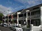 |
| 9/2/018/0074/002 | 4 Grove Road, Mowbray, Cape Town | These nine houses form part of a unique block consisting of two terraced rows of identical late Victorian double-storeyed semi-detached houses that date from the 1880s. The first and last houses in Albert Road have ornate triangular pedimented gables wit | Cape Town, Mowbray | The Cape | Provincial Heritage Site | 33°56′45″S 18°28′22″E / 33.945928°S 18.472796°E | |
| 9/2/018/0074/003 | 6 Grove Road, Mowbray, Cape Town | These nine houses form part of a unique block consisting of two terraced rows of identical late Victorian double-storeyed semi-detached houses that date from the 1880s. The first and last houses in Albert Road have ornate triangular pedimented gables wit | Cape Town, Mowbray | The Cape | Provincial Heritage Site | 33°56′45″S 18°28′22″E / 33.945951°S 18.472750°E | |
| 9/2/018/0074/004 | 8 Grove Road, Mowbray, Cape Town | Type of site: Terraced House. These nine houses form part of a unique block consisting of two terraced rows of identical late Victorian double-storeyed semi-detached houses that date from the 1880s. The first and last houses in Albert Road have ornate triangular pedimented gables wit | Cape Town, Mowbray | The Cape | Provincial Heritage Site | 33°56′46″S 18°28′22″E / 33.945973°S 18.472686°E | |
| 9/2/018/0074/005 | 10 Grove Road, Mowbray, Cape Town | Type of site: Terraced House. These nine houses form part of a unique block consisting of two terraced rows of identical late Victorian double-storeyed semi-detached houses that date from the 1880s. The first and last houses in Albert Road have ornate triangular pedimented gables wit | Cape Town, Mowbray | The Cape | Provincial Heritage Site | 33°56′46″S 18°28′21″E / 33.945991°S 18.472612°E | |
| 9/2/018/0074/006 | 12 Grove Road, Mowbray, Cape Town | Type of site: Terraced House. These nine houses form part of a unique block consisting of two terraced rows of identical late Victorian double-storeyed semi-detached houses that date from the 1880s. The first and last houses in Albert Road have ornate triangular pedimented gables wit | Cape Town, Mowbray | The Cape | Provincial Heritage Site | 33°56′46″S 18°28′21″E / 33.946012°S 18.472564°E | |
| 9/2/018/0075 | Grove House, 4 Grove Street, Green Point, Cape Town | Grove House in its present form dates from the late nineteenth century. As such it is a good example of Victorian architecture. | Cape Town, Green Point | The Cape | Provincial Heritage Site | 33°54′31″S 18°24′20″E / 33.908505°S 18.405470°E | 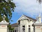 |
| 9/2/018/0076 | St Peter's Cemetery, Main Road, Mowbray, Cape Town | Type of site: Graveyard. | Cape Town, Mowbray | The Cape | Register | 33°56′32″S 18°28′03″E / 33.942299°S 18.467466°E | 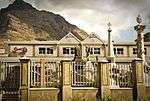 |
| 9/2/018/0077 | Ruth Prowse School of Art, Elson Road, Woodstock, Cape Town | This historic complex of buildings, of which the core of the original dwelling-house dates from the eighteenth century, was built on land originally granted in 1666 to Hendrik Lacus. The group of buildings is at present being used by the Ruth Prowse Art C Type of site: School of Art Previous use: House. Current use: College. | Cape Town, Woodstock | The Cape | Provincial Heritage Site | 33°55′57″S 18°27′17″E / 33.932499°S 18.454860°E |  |
| 9/2/018/0081 | Mowbray Town Hall, 129 - 130 Main Road, Cape Town | Brick and terracotta This impressive town hall with its Flemish Renaissance features was designed by the architect J. C. Tully of Tully and Waters and erected in 1900. Type of site: Town Hall Previous use: Town hall. | Cape Town, Mowbray | The Cape | Provincial Heritage Site | 33°56′57″S 18°28′16″E / 33.949281°S 18.471082°E | 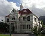 |
| 9/2/018/0083 | 20 Sydney Street, Green Point, Cape Town | Cape Town | 33°54′30″S 18°24′24″E / 33.908408°S 18.406707°E |
| |||
| 9/2/018/0084 | SALT RIVER/WOODSTOCK, GENERAL | Cape Town |
| ||||
| 9/2/018/0090 | 22 St John's Street, Sea Point, Cape Town | Cape Town | 33°55′09″S 18°23′22″E / 33.919294°S 18.389563°E |
| |||
| 9/2/018/0099 | SA Glass Company, cnr Lower Collingwood Road & Oak Street, Observatory | Cape Town | 33°56′10″S 18°28′17″E / 33.936242°S 18.471265°E |
| |||
| 9/2/018/0108 | Ons Huisie, Bloubergstrand, Cape Town | This cottage which for many years was the property of the Stadler family, is a typical example of the simpler form of vernacular architectural style found on the coastal areas of the Western Cape. The periodic additions, the plain side gables and the ove Type of site: House. | Cape Town, Bloubergstrand | The Cape | Provincial Heritage Site | 33°47′58″S 18°27′32″E / 33.799547°S 18.458913°E |  |
| 9/2/018/0109 | The New Laboratory, Green Point, Cape Town | Cape Town, Green Point | The Cape | Provincial Heritage Site | 33°54′14″S 18°24′51″E / 33.903990°S 18.414125°E |
| |
| 9/2/018/0112 | Glen Country Club, Victoria Road, Clifton | Cape Town |
| ||||
| 9/2/018/0116/001 | Zonnebloem Cottages, Cambridge Street, Woodstock, Cape Town | These farm labourer cottages were Victorianised in the early nineteenth century and together with the Zonnebloem College complex form an integral part of an historic area within the City of Cape Town. | Cape Town, Woodstock | The Cape | Provincial Heritage Site | 33°55′31″S 18°25′26″E / 33.925248°S 18.423813°E |
|
| 9/2/018/0129 | ROSEBANK LOCAL AREA GENERAL | Cape Town |
| ||||
| 9/2/018/0130 | "Bingley", 105 Victoria Road, Camps Bay, Cape Town | Cape Town | 33°56′54″S 18°22′44″E / 33.948320°S 18.378821°E |
| |||
| 9/2/018/0136 | St. Mary's Church, Albert Road, Woodstock, Cape Town | Cape Town | 33°55′36″S 18°26′47″E / 33.926751°S 18.446461°E |
| |||
| 9/2/018/0147 | Klein Zoar, 4 Wemys Street, Brooklyn, Cape Town | This type of pioneers house according to its structure and architectural features probably dates back to the 18th century and as such is representative of the old vernacular architectural style. According to tradition "Klein Zoar" is the former homestead Type of site: House Current use: House. | Cape Town, Brooklyn | The Cape | Provincial Heritage Site | 33°54′06″S 18°28′59″E / 33.901629°S 18.482991°E | 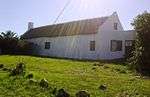 |
| 9/2/018/0148 | OBSERVATORY, GENERAL | Cape Town |
| ||||
| 9/2/018/0153 | Groote Schuur Hospital, Observatory, Cape Town | Main article: Groote Schuur Hospital Type of site: Hospital. Although the facade of the building is an important example of union architecture, groote Schuur Hospital is best known as a landmark, both physically, and symbolically in terms of world medical history. |
Cape Town, Observatory | The Cape | Provincial Heritage Site | 33°56′28″S 18°27′42″E / 33.941038°S 18.461718°EGroote Schuur Hospital, Observatory, Cape Town) |  |
| 9/2/018/0155 | Mowbray Hotel, cnr Rhodes Avenue & Main Road, Mowbray | Cape Town | 33°56′59″S 18°28′18″E / 33.949676°S 18.471713°E |
| |||
| 9/2/018/0157 | President Hotel Site, Sea Point, Cape Town | Cape Town | 33°55′25″S 18°22′46″E / 33.923588°S 18.379367°E |
| |||
| 9/2/018/0164 | Old Military Camp Site, Green Point, Cape Town | Cape Town |
| ||||
| 9/2/018/0166 | 1 Bellevue Road, Sea Point, Cape Town | Cape Town | 33°54′54″S 18°23′32″E / 33.915047°S 18.392125°E |
| |||
| 9/2/018/0167 | SEA POINT LOCAL AREA, GENERAL | Cape Town |
| ||||
| 9/2/018/0169 | Vredehoek Tin Mine, Devil's Peak, Cape Town | Cape Town |
| ||||
| 9/2/018/0171 | Rietvlei, Milnerton | Cape Town |
| ||||
| 9/2/018/0172 | 3 Lincoln Road, Sea Point, Cape Town | Cape Town | 33°54′51″S 18°23′25″E / 33.914273°S 18.390232°E |
| |||
| 9/2/018/0173 | YMCA, Trill Road, Observatory, Cape Town | Cape Town | 33°56′17″S 18°28′24″E / 33.937932°S 18.473322°E |
| |||
| 9/2/018/0174 | Church of St. Luke the Evangelist, Salt River, Cape Town | Cape Town | 33°55′46″S 18°27′47″E / 33.929441°S 18.463091°E |
| |||
| 9/2/018/0176 | Lord Milner Hotel, 37 Milner Road, Woodstock, Cape Town | Cape Town | 33°55′59″S 18°27′12″E / 33.933146°S 18.453372°E |
| |||
| 9/2/018/0185 | Old Municipal Hall, Jansen Street, Milnerton, Cape Town | This unique hall, which was later known as the Casino, dates from 1904 and was originally erected as a concert and dance hall. In particular, the special sunken dance floor is noteworthy. Type of site: Town Hall. | Cape Town, Milnerton | The Cape | Provincial Heritage Site | 33°53′07″S 18°29′37″E / 33.885230°S 18.493547°E | 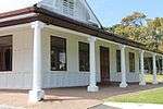 |
| 9/2/018/0206 | Burial Sites, Somerset Rd Precinct (Prestwich), Green Point, Cape Town | Cape Town | 33°55′03″S 18°25′10″E / 33.917536°S 18.419540°E |
| |||
| 9/2/018/0211 | Westoe, Mowbray, Cape Town | Westoe adjoins Coornhoop on its northern side; the land it occupies was a part of the Coornhoop farm. In 1785 the owner of Coornhoop, Helena Jonasse, widow of Claas Coert, bequeathed the old farm jointly to three men. They immediately divided it into three Type of site: House. This property, which came into the possession of Francois Pieter de Necker in 1785, originally formed part of the farm Coornhoop. The Cape Dutch house known as Westoe, which was erected shortly afterwards by De Necker, was restored in 1967. The outbuildin | Cape Town, Mowbray | The Cape | Provincial Heritage Site | 33°56′32″S 18°28′29″E / 33.942194°S 18.474861°E |
|
| 9/2/018/0212 | Koornhoop dovecot, Dixon Road, Mowbray, Cape Town | Cape Town | 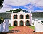 | ||||
| 9/2/018/0212-001 | Dovecot, Koornhoop, Dixon Road, Mowbray, Cape Town | To the left of the wagon road and five kilometres from the Fort, in what is now called Mowbray Jan van Riebeeck granted land between February, 1657 and February 1658, to fourteen free burghers. He was forced to build a row of little forts or redoubts along Type of site: Dovecote. | Cape Town, Mowbray | The Cape | Provincial Heritage Site | 33°56′36″S 18°28′31″E / 33.943469°S 18.475304°E | |
| 9/2/018/0218 | Wrensch House, 77 Lower Wrensch Road, Observatory, Cape Town | This is a Georgianised H-shaped Cape—Dutch house. The land it occupies is of unknown origin which was probably added to the Coornhoop farm in 1741. Later in the eighteenth century the land was acquired by C. Rossouw, who purchased the northern part of the . This building complex, with its Cape-Dutch, Georgian and Victorian features forms a unique architectural unit. The main building as well as some of the outbuildings date from the last quarter of the eighteenth century. | Cape Town, Observatory | The Cape | Provincial Heritage Site | 33°56′23″S 18°28′27″E / 33.939815°S 18.474117°E |
|
| 9/2/018/0221 | GREEN POINT, CAPE TOWN, GENERAL | Cape Town |
| ||||
| 9/2/018/0229 | Treaty Tree, Woodstock, Cape Town | See also: Battle of Blaauwberg This site and the tree are historically related to the second British occupation of the Cape in 1806. In a building which stood adjacent to this land the capitulation conditions were signed on 10 January 1806, whereby the property of the Batavian Gover In 1803 England who had occupied the Cape Colony for seven years, gave it back to the Netherlands which was then known as the Batavian Republic. General J. W. Janssens was appointed as governor. Barely three years later England again sent a fleet to occup Type of site: Tree. In a building which stood adjacent to this land the capitulation conditions were signed on 10 January 1806, whereby the property of the Batavian Government at the Cape was transferred to the commanders of the British forces, Maj-Genl. Sir David Baird a |
Cape Town, Woodstock | The Cape | Provincial Heritage Site | 33°55′34″S 18°27′05″E / 33.926247°S 18.451313°E | 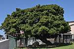 |
| 9/2/018/0230 | Central Redoubt, Trafalgar Park, Woodstock Cape Town | Cape Town |
| ||||
| 9/2/018/0232 | Geological exposure, Sea Point, Cape Town | Below the sea wall at the extreme southern end of Beach Road in Sea Point the rocks show remarkable and unusual geological features. Here one may observe an outstanding example of the contact between dark shales of the Malmesbury Series and Type of site: Geological site or area. | Cape Town, Sea Point | The Cape | Provincial Heritage Site | 33°55′15″S 18°22′43″E / 33.920878°S 18.378628°E |
|
| 9/2/018/0233 | The Glen Country Club, Scenic Reserve, Clifton, Cape Townr | The development and occupation of the steep and rocky inaccessible western coast of the Cape Peninsula took place later and more slowly than the exploitation of the fertile areas of Rondebosch and Wynberg. When, however, this development began, it threat Type of site: Club. | Cape Town, Clifton | The Cape | Provincial Heritage Site | 33°56′37″S 18°22′21″E / 33.943613°S 18.372391°E |
|
| 9/2/018/0238 | Earles Dyke Area, The Glen, Camps Bay, Cape Town | Cape Town |
| ||||
| 9/2/018/0241 | Molenvliet House, Molenvliet Street, Mowbray, Cape Town | The land on which this house is situated originally formed part of the farm Coornhoop, which was granted to Thielman Hendricks in 1661. The subdivided piece of land was given to Francois Pieter de Necker in 1785. De Necker was presumably the builder of th Type of site: Farmhouse. This property originally formed part of the farm Coornhoop, which was granted to Thieman Hendricks in 1661. The predominantly Cape Dutch house was formerly a barn for the Westoe building complex and dates from the early nineteenth century. | Cape Town, Mowbray | The Cape | Provincial Heritage Site | 33°56′33″S 18°28′31″E / 33.942548°S 18.475239°E |
|
| 9/2/018/0243/2 | Conservation areas, Lower Gardens, Cape Town | Cape Town |
| ||||
| 9/2/018/0243/3 | Conservation areas, Woodstock, Salt River & Walmer Estate, Cape Town | Cape Town |
| ||||
| 9/2/018/0243/4 | Conservation areas, Observatory, Cape Town | Cape Town |
| ||||
| 9/2/018/0243/5 | Conservation areas, Loader Street, Cape Town | Cape Town |
| ||||
| 9/2/018/0243/6 | Conservation areas, Green Point & Sea Point, Cape Town | Cape Town |
| ||||
| 9/2/018/0245 | Royal Observatory complex, Observatory, Cape Town | Cape Town | 33°56′05″S 18°28′38″E / 33.934645°S 18.477210°ERoyal Observatory complex, Observatory, Cape Town) |  | |||
| 9/2/018/0252 | Dutch Reformed Church, Regent Square, Woodstock, Cape Town | Cape Town | 33°55′42″S 18°27′04″E / 33.928303°S 18.451230°E |
| |||
| 9/2/018/0254 | MOUILLE POINT LOCAL AREA, GENERAL | Cape Town |
| ||||
| 9/2/018/0256 | 5-7 Bellevue Road, Sea Point, Cape Town | Cape Town | 33°54′54″S 18°23′32″E / 33.915082°S 18.392096°E |
| |||
| 9/2/018/0256/001 | Salisbury House, 5 Bellevue Road, Sea Point, Cape Town | Cape Town, Sea Point | The Cape | Provincial Heritage Site | 33°54′55″S 18°23′33″E / 33.915302°S 18.392541°E |
| |
| 9/2/018/0256/2 | 7 Bellevue Road, Sea Point, Cape Town | Cape Town | 33°54′54″S 18°23′32″E / 33.915103°S 18.392218°E |
| |||
| 9/2/018/0257 | Camp Site of Survivors of the Haarlem, 1647, Milnerton | Cape Town | | ||||
| 9/2/018/0259 | Congregational Church, Sea Point, Cape Town | Cape Town | 33°54′50″S 18°23′27″E / 33.913920°S 18.390799°E |
| |||
| 9/2/018/0260 | Culemborg-Black River Site, Cape Town | Cape Town |
| ||||
| 9/2/018/0261 | MOWBRAY, CAPE TOWN, GENERAL | Cape Town |
| ||||
| 9/2/018/0264/04 | 87 Chiappini Street, Bo-Kaap, Cape Town | Cape Town | 33°55′09″S 18°24′58″E / 33.919237°S 18.416165°E | 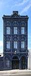 | |||
| 9/2/018/0265 | Tana Baru Muslim Burial Ground, Longmarket Street, Bo-Kaap, Cape Town | Cape Town |
| ||||
| 9/2/018/0269 | Oude Molen Building, Valkenberg Hospital, Observatory | Cape Town | 33°56′15″S 18°28′48″E / 33.937589°S 18.479995°E |
| |||
| 9/2/018/0270 | St James the Great Church, 12 St James Road, Sea Point, Cape Town | Cape Town | 33°54′36″S 18°23′37″E / 33.909996°S 18.393569°E |
| |||
| 9/2/018/0272 | LLUNDUDNO LOCAL AREA, GENERAL | Cape Town |
| ||||
| 9/2/018/0273 | 1-11 Albert Road, Mowbray, Cape Town District | Cape Town | 33°56′44″S 18°28′21″E / 33.945694°S 18.472546°E |  | |||
| 9/2/018/0273/001 | 1 Albert Road, Mowbray, Cape Town | These nine houses form part of a unique block consisting of two terraced rows of identical late Victorian double-storeyed semi-detached houses that date from the 1880s. The first and last houses in Albert Road have ornate triangular pedimented gables with This property forms part of two rows of double-storeyed Victorian terrace houses which stand back to back on a block shared by the Mowbray Presbyterian Church. Each row consists of six units which are semi-detached. Besides slight variations in the filigr | Cape Town, Mowbray | The Cape | Provincial Heritage Site | 33°56′44″S 18°28′22″E / 33.945634°S 18.472726°E | |
| 9/2/018/0273/002 | 3 Albert Road, Mowbray, Cape Town | This property forms part of a unique block consisting of two terraced rows of identical late Victorian double-storey semi-detached houses that date from the 1880s. The first and last houses in Albert Road have ornate triangular pedimented gables with cart This property forms part of two rows of double-storeyed Victorian terrace houses which stand back to back on a block shared by the Mowbray Presbyterian Church. Each row consists of six units which are semi-detached. Besides slight variations in the filigr Type of site: Terraced House. | Cape Town, Mowbray | The Cape | Provincial Heritage Site | 33°56′44″S 18°28′22″E / 33.9456555555°S 18.4726611111°E | |
| 9/2/018/0273/003 | 5 Albert Road, Mowbray, Cape Town | This property forms part of a unique block consisting of two terraced rows of identical late Victorian double-storey semi-detached houses that date from the 1880s. The first and last houses in Albert Road have ornate triangular pedimented gables with cart This property forms part of two rows of double-storeyed Victorian terrace houses which stand back to back on a block shared by the Mowbray Presbyterian Church. Each row consists of six units which are semi-detached. Besides slight variations in the filigr Type of site: Terraced House. | Cape Town, Mowbray | The Cape | Provincial Heritage Site | 33°56′44″S 18°28′21″E / 33.945675°S 18.4726°E | |
| 9/2/018/0273/004 | 7 Albert Road, Mowbray, Cape Town | This property forms part of a unique block consisting of two terraced rows of identical late Victorian double-storey semi-detached houses that date from the 1880s. The first and last houses in Albert Road have ornate triangular pedimented gables with cart This property forms part of two rows of double-storeyed Victorian terrace houses which stand back to back on a block shared by the Mowbray Presbyterian Church. Each row consists of six units which are semi-detached. Besides slight variations in the filigr Type of site: Terraced House. | Cape Town, Mowbray | The Cape | Provincial Heritage Site | 33°56′44″S 18°28′21″E / 33.9456944444°S 18.4725472222°E | |
| 9/2/018/0273/005 | 9 Albert Road, Mowbray, Cape Town | This property forms part of a unique block consisting of two terraced rows of identical late Victorian double-storey semi-detached houses that date from the 1880s. The first and last houses in Albert Road have ornate triangular pedimented gables with cart This property forms part of two rows of double-storeyed Victorian terrace houses which stand back to back on a block shared by the Mowbray Presbyterian Church. Each row consists of six units which are semi-detached. Besides slight variations in the filigr Type of site: Terraced House. | Cape Town, Mowbray | The Cape | Provincial Heritage Site | 33°56′45″S 18°28′21″E / 33.9457194444°S 18.4724861111°E | |
| 9/2/018/0273/006 | 11 Albert Road, Mowbray, Cape Town | These nine houses form part of a unique block consisting of two terraced rows of identical late Victorian double-storeyed semi-detached houses that date from the 1880s. The first and last houses in Albert Road have ornate triangular pedimented gables wi This property forms part of two rows of double-storeyed Victorian terrace houses which stand back to back on a block shared by the Mowbray Presbyterian Church. Each row consists of six units which are semi-detached. Besides slight variations in the filigr | Cape Town, Mowbray | The Cape | Provincial Heritage Site | 33°56′45″S 18°28′21″E / 33.945734°S 18.472420°E | |
| 9/2/018/0276 | 3 Long Street, Mowbray, Cape Town | Cape Town | 33°56′51″S 18°28′25″E / 33.947474°S 18.473507°E |
| |||
| 9/2/018/0278 | MAITLAND LOCAL AREA, GENERAL | Cape Town |
| ||||
| 9/2/018/0278/1 | Erf 154483, Garden Village Primary, Maitland, Cape Town | Cape Town | 33°56′02″S 18°29′08″E / 33.933888°S 18.485649°E |
| |||
| 9/2/018/0279 | Alexandra Institute, Maitland cape Town | Cape Town |
| ||||
| 9/2/018/0279/001 | De Nieuwe Molen, Alexandra Institute, Maitland, Cape Town | The Nieuwe Molen, with its bullet-shaped tower, was erected in the years 1780-1782. In 1928 it was converted into a church and at present it serves as a music room for the Alexandra Institute. 10/2/584. Type of site: Industrial Previous use: Mill. | Cape Town, Maitland | The Cape | Provincial Heritage Site | 33°55′57″S 18°28′56″E / 33.932557°S 18.482342°E | 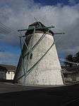 |
| 9/2/018/0280 | Maitland Cemetery, Voortekker Road, Maitland, Cape Town District | Cape Town | 33°55′06″S 18°31′19″E / 33.918435°S 18.521831°E |
| |||
| 9/2/018/0280/1 | Garden of Remembrance, Maitland Cemetery | Cape Town |
| ||||
| 9/2/018/0280/2 | Memorial to Slave Burial Site,Maitland Cemetery | Cape Town |
| ||||
| 9/2/018/0281 | Mile Stone 1V, 282 Voortrekker Road, Maitland, Cape Town | Cape Town | 33°55′24″S 18°29′20″E / 33.923214°S 18.488988°E |
| |||
| 9/2/018/0283 | CLIFTON LOCAL AREA, GENERAL | Cape Town |
| ||||
| 9/2/018/0284 | Dutch Reformed Church, Main Road, Maitland | Cape Town | 33°55′25″S 18°29′07″E / 33.923532°S 18.485278°E |
| |||
| 9/2/018/0286 | CAMPS BAY LOCAL AREA, GENERAL | Cape Town |
| ||||
| 9/2/018/0290 | Trafalgar Park, cnr Searle St & Victoria Rd, Woodstock | Cape Town | 33°55′40″S 18°26′27″E / 33.927895°S 18.440901°E |  | |||
| 9/2/018/0290/001 | Central Redoubt, Trafalgar Park, Woodstock, Cape Town | This fortress was hastily built in 1781, when an attack by British forces on the Cape was expected. A conical kiln, probably for making bricks, was added some 50 years later.
From the beginning of the settlement at the Cape, the commanders were concerned Type of site: Fort. This fortress was hastily built in 1781, when an attack by British forces on the Cape was expected. A conical kiln, probably for making bricks, was added some 50 years later. |
Cape Town, Woodstock | The Cape | Provincial Heritage Site | 33°55′47″S 18°26′30″E / 33.929808°S 18.441631°E | 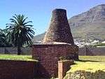 |
| 9/2/018/0295 | BANTRY BAY LOCAL | Cape Town |
| ||||
| 9/2/018/0296 | MELKBOSSTRAND LOCAL AREA | Cape Town |
| ||||
| 9/2/018/0298 | The Homestead ("Casa Felicia"), 60 Llandudno Road, Llandudno | Cape Town | Register (Pending) | 34°00′29″S 18°20′37″E / 34.007948°S 18.343594°E |
| ||
| 9/2/018/0299 | The South African Astronomical Observatory, Mowbray | Cape Town | 33°56′04″S 18°28′38″E / 33.934554°S 18.477103°EThe South African Astronomical Observatory, Mowbray) | 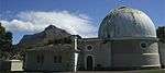 | |||
| 9/2/108/0010/12 | Bungalow 66, Clifton, Cape Town | Clifton | Cape Town |
| |||
| HM\CAPE TOWN METRO\NEWLANDS \DE HEL FOREST | De Hel Forest | Cape Town | The Cape | Provincial Heritage Site |
| ||
| HM\CAPE TOWN METRO\SALT RIVER \COMMUNITY HOUSE | Community House | Main article: Community House (Salt River, Cape Town) |
Cape Town, Salt River | The Cape | Provincial Heritage Site | 33°55′48″S 18°27′27″E / 33.929998°S 18.4576°ECommunity House) |
|
References
- ↑ South African Heritage Resource Agency SARHA - Gazetted Sites database, Accessed on 8 October 2012
- ↑ Heritage Western Cape
| Wikimedia Commons has media related to Cultural heritage monuments in Cape Town. |
Lists of South African Heritage Resources | ||||||||||||||||||||||||||||||||||||
|---|---|---|---|---|---|---|---|---|---|---|---|---|---|---|---|---|---|---|---|---|---|---|---|---|---|---|---|---|---|---|---|---|---|---|---|---|
| SAHRA Heritage sites |
| |||||||||||||||||||||||||||||||||||
| World heritage sites | ||||||||||||||||||||||||||||||||||||