Kings Meadows, Tasmania
| Kings Meadows Launceston, Tasmania | |||||||||||||
|---|---|---|---|---|---|---|---|---|---|---|---|---|---|
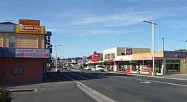
 View south down Hobart Road through Kings Meadows | |||||||||||||
| Population | 3,371 (2011 census)[1] | ||||||||||||
| Postcode(s) | 7249 | ||||||||||||
| Location | 4 km (2 mi) from Launceston, Tasmania | ||||||||||||
| LGA(s) | City of Launceston | ||||||||||||
| State electorate(s) | Bass | ||||||||||||
| Federal Division(s) | Bass | ||||||||||||
| |||||||||||||
King's Meadows is a suburb in the south of Launceston, Tasmania, Australia, with a greater amount of shops than any other suburb within Launceston making it the largest commercial district in Launceston outside of the CBD. It also has the largest indoor shopping centre within Launceston, the Kings Meadows High School, and a hotel. Kings Meadows is located in the floor of a shallow valley, roughly 70m above sealevel, which drains NE towards the small suburb of Punchbowl. Main access to the suburb from the CBD is from Hobart Road via the minor suburb of Sixways.
References
- ↑ Australian Bureau of Statistics (31 October 2012). "Kings Meadows (State Suburb)". 2011 Census QuickStats. Retrieved 2012-01-12.
Coordinates: 41°28′14″S 147°09′47″E / 41.47056°S 147.16306°E
This article is issued from Wikipedia - version of the 10/21/2016. The text is available under the Creative Commons Attribution/Share Alike but additional terms may apply for the media files.