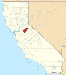
Jesus Maria, California
Coordinates: 38°17′08″N 120°38′51″W / 38.28556°N 120.64750°W
| Jesus Maria | |
|---|---|
| Unincorporated community | |
|
Jesus Maria  Jesus Maria Location in California | |
| Coordinates: 38°17′08″N 120°38′51″W / 38.28556°N 120.64750°W | |
| Country | United States |
| State | California |
| County | Calaveras County |
| Elevation[1] | 1,043 ft (318 m) |
| Reference no. | 284 |
Jesus Maria is an unincorporated community in Calaveras County, California. It lies at an elevation of 1043 feet (318 m) and is located at 38°17′08″N 120°38′51″W / 38.28556°N 120.64750°W. The community is in ZIP code 95222 and area code 209.
The community, the center of a large placer mining section, was named for a Mexican who raised vegetables and melons for the miners. It was settled in the early 1850s with a large population of Mexicans, French, Chileans, and Italians. Now it is only populated by a few families who live together and work for common goals, including a large community garden, basketball court, jungle gym for children, and a windmill to pump water.
Jesus Maria is registered as California Historical Landmark #284.[2]
Politics
In the state legislature, Jesus Maria is in the 8th Senate District, represented by Republican Tom Berryhill,[3] and the 5th Assembly District, represented by Republican Frank Bigelow.[4] Federally, Jesus Maria is in California's 4th congressional district, represented by Republican Tom McClintock.[5]
References
- ↑ U.S. Geological Survey Geographic Names Information System: Jesus Maria, California
- ↑ "Jesus Maria". Office of Historic Preservation, California State Parks. Retrieved 2012-10-06.
- ↑ "Senators". State of California. Retrieved March 21, 2013.
- ↑ "Members Assembly". State of California. Retrieved March 21, 2013.
- ↑ "California's 4th Congressional District - Representatives & District Map". Civic Impulse, LLC. Retrieved March 1, 2013.
