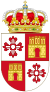
Illescas, Toledo
| Illescas, Spain | |||
|---|---|---|---|
| |||
| Country | Spain | ||
| Autonomous community | Castile-La Mancha | ||
| Province | Toledo | ||
| Municipality | Illescas | ||
| Area | |||
| • Total | 57 km2 (22 sq mi) | ||
| Elevation | 583 m (1,913 ft) | ||
| Population (2006) | |||
| • Total | 15,830 | ||
| • Density | 277.7/km2 (719/sq mi) | ||
| Time zone | CET (UTC+1) | ||
| • Summer (DST) | CEST (UTC+2) | ||
Illescas is a municipality located in the province of Toledo, Castile-La Mancha, Spain. According to the 2006 census (INE), the municipality has a population of 15,830 inhabitants. In 2012, Illescas had more than 24,000 inhabitants.
History
Illescas was founded in 2621 BC, although archaeological remains indicate that the area has been populated since prehistoric ages. According to data collected during excavations performed in yacimiento de el Cerrón a Celtiberian town existed on this site between the late 2nd and 5th centuries.
In 1154 Alfonso VII signed a town charter and four years later the village was made part of the Señorio arzobispal and remained so until 1575.
Once a playground for kings, it lost royal favor because of the Revolt of the Comuneros in which local resident Francisco de Guzmán captained a group of commoners in the army of Juan de Padilla. during the Revolt, which occurred from the year 1520 to 1521.
The town gained a railway link in 1876.
Geography
The village is located on a plain between Madrid and Toledo. It belongs to the region of La Sagra and to the north borders with Casarrubuelos, Cubas de la Sagra, Torrejón de la Calzada and Torrejón de Velasco. To the east it borders with Yeles and the house of Campsota. To the south it borders with Numancia de la Sagra and to the west it borders with Cedillo del Condado, El Viso de San Juan, Ugena, Carranque and the west of Toledo.
Monuments
- Arco de Ugena is the remaining fragment of the old Puerta de Ugena, a door made of wood in the Mudéjar style. The wall had five doors and the Arco de Ugena is the last one standing. It is thought to have been built in the 11th century, when Alfonso VI wanted to wall the village.
- Convento de la Concepción de la Madre de Dios was built in 1514 by Cardinal Cisneros. The first mother superior, Inés de la Concepción, was Cardinal Cisneros's cousin.
- Hospital Nuestra Señora de la Caridad was built between the 16th and 17th centuries.
- Santuario de Nuestra Señora de la Caridad was built in 1500. It hosts five paintings by El Greco: La Caridad, San Ildefonso, La Coronación de la Virgen, La Natividad and La Anunciación.
- Iglesia parroquial and Torre Mudéjar; in 1920 this was declared a national monument.
- Calle Real is a densely populated main street.
- Plaza de las Cadenas is located in front of the Iglesia de la Caridad, next to the elm.
- Olmo del Milagro is a 500-year-old elm.
Coordinates: 40°07′N 3°50′W / 40.117°N 3.833°W
