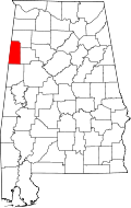
Hightogy, Alabama
| Hightogy, Alabama | |
|---|---|
| Unincorporated community | |
 Hightogy  Hightogy | |
| Coordinates: 33°41′42″N 88°05′41″W / 33.69500°N 88.09472°WCoordinates: 33°41′42″N 88°05′41″W / 33.69500°N 88.09472°W | |
| Country | United States |
| State | Alabama |
| County | Lamar |
| Elevation | 476 ft (145 m) |
| Time zone | Central (CST) (UTC-6) |
| • Summer (DST) | CDT (UTC-5) |
| Area code(s) | 205 |
| GNIS feature ID | 157983[1] |
Hightogy, also known as Ridge Beat or Simmon Town, is an unincorporated community in Lamar County, Alabama, United States. Hightogy is located along Alabama State Route 17, 4.8 miles (7.7 km) south-southeast of Vernon.
History
The community's name is possibly a compound word derived from high and the Middle English word tor, which means "high, craggy hill".[2] A post office operated under the name Hightogy from 1890 to 1909.[3]
References
- ↑ "Hightogy". Geographic Names Information System. United States Geological Survey.
- ↑ Foscue, Virginia (1989). Place Names in Alabama. Tuscaloosa: The University of Alabama Press. p. 71. ISBN 0-8173-0410-X.
- ↑ "Lamar County". Jim Forte Postal History. Retrieved 15 February 2014.
This article is issued from Wikipedia - version of the 7/31/2016. The text is available under the Creative Commons Attribution/Share Alike but additional terms may apply for the media files.
