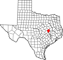
Hammond, Texas
| Hammond | |
|---|---|
| Unincorporated community | |
 Hammond  Hammond | |
| Coordinates: 31°05′43″N 96°42′50″W / 31.09528°N 96.71389°WCoordinates: 31°05′43″N 96°42′50″W / 31.09528°N 96.71389°W | |
| Country | United States |
| State | Texas |
| County | Robertson |
| Elevation | 397 ft (121 m) |
| Time zone | Central (CST) (UTC-6) |
| • Summer (DST) | CDT (UTC-5) |
| Area code(s) | 979 |
| GNIS feature ID | 1358706[1] |
Hammond is an unincorporated community in Robertson County, Texas, United States. Hammond is located on Texas State Highway 6 north of Calvert and south of Bremond.
History
Hammond was originally the site of two plantations purchased by Dr. B.F. Hammond in 1853. After the Civil War, Hammond became a small community which primarily served former slaves from the plantation. In 1869, the Houston and Texas Central Railway built a station in Hammond. Hammond had a post office from 1870 until the 1930s. The population from 1970 to 2000 was estimated as 44.[2]
References
- ↑ "US Board on Geographic Names". United States Geological Survey. 2007-10-25. Retrieved 2008-01-31.
- ↑ "Hammond, Texas". Handbook of Texas Online. Retrieved 4 July 2009.
This article is issued from Wikipedia - version of the 8/25/2016. The text is available under the Creative Commons Attribution/Share Alike but additional terms may apply for the media files.
