Erda, Utah
| Erda, Utah | |
|---|---|
| CDP | |
|
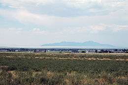
View of Erda looking at the Great Salt Lake and Stansbury Island | |
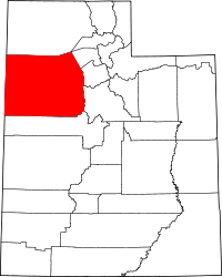
 Location in Tooele County and the state of Utah | |
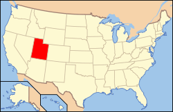
 Location of Utah in the United States | |
| Coordinates: 40°36′26″N 112°18′33″W / 40.60722°N 112.30917°WCoordinates: 40°36′26″N 112°18′33″W / 40.60722°N 112.30917°W | |
| Country | United States |
| State | Utah |
| County | Tooele |
| Area | |
| • Total | 22.5 sq mi (58.2 km2) |
| • Land | 22.5 sq mi (58.2 km2) |
| • Water | 0.0 sq mi (0.0 km2) |
| Elevation | 4,344 ft (1,324 m) |
| Population (2010) | |
| • Total | 4,642 |
| • Density | 210/sq mi (80/km2) |
| Time zone | Mountain (MST) (UTC-7) |
| • Summer (DST) | MDT (UTC-6) |
| ZIP code | 84074 |
| Area code(s) | 435 |
| FIPS code | 49-23640[1] |
| GNIS feature ID | 1437555[2] |
Erda is a census-designated place (CDP) in Tooele County, Utah, United States, located just south of Stansbury Park and just north of the county seat of Tooele. The population was 4,642 at the 2010 census, a significant increase from the 2000 figure of 2,473.
Etymology
Marilyn Shields, a member of the Daughters of Utah Pioneers who works at the nearby Benson Grist Mill, said there are two stories about how Erda, settled in 1851 and originally called Batesville and Rose Springs, earned its official name.
In one version, Shields says, a wheat and alfalfa farmer named Pierre Apollinaire DeRoubaix, who moved to the area in 1870, called it Erda after a town in France where he once lived. Even though there is no city or town in France named Erda, there is a small village named Erdeven which could have been Pierre Droubay's home town.
"The other more well-known story is that the San Pedro-Salt Lake Railroad that ran along the Oquirrh Mountains named the town Erda after a German word that means earth," says Shields.
So which story is correct?
In Richard Wagner's operatic cycle, Der Ring des Nibelungen or “The Ring of the Nibelung,” Erda was the goddess of wisdom and earth. This operatic cycle was based loosely on figures and elements of Germanic folklore, particularly from the Sagas of Icelanders and the Nibelungenlied. Wagner based his interpretation of Erda on Jord, Thor's mother by Odin, and the daughter of Annar and the personification of night, Nótt.
Pierre Apollinaire Droubay is also known as Pierre Apollinaire DeRoubaix, even though his ancestors changed their name to the more Anglicized Droubay while in France. It is possible that they made this change during the French Revolution to mask their royal heritage.
Geography
According to the United States Census Bureau, the CDP has a total area of 22.5 square miles (58.2 km²), all of it land.
Demographics
| Historical population | |||
|---|---|---|---|
| Census | Pop. | %± | |
| 1880 | 145 | — | |
| 1890 | 117 | −19.3% | |
| 1900 | 183 | 56.4% | |
| 1910 | 188 | 2.7% | |
| 1920 | 183 | −2.7% | |
| 1930 | 151 | −17.5% | |
| 1940 | 188 | 24.5% | |
| 1950 | 118 | −37.2% | |
| 1990 | 1,113 | — | |
| 2000 | 2,473 | 122.2% | |
| 2010 | 4,642 | 87.7% | |
| source:[3] | |||
As of the census[1] of 2000, there were 2,473 people, 697 households, and 623 families residing in the CDP. The population density was 110.1 people per square mile (42.5/km²). There were 722 housing units at an average density of 32.2/sq mi (12.4/km²). The racial makeup of the CDP was 96.93% White, 0.28% African American, 0.36% Native American, 0.32% Asian, 0.53% Pacific Islander, 0.61% from other races, and 0.97% from two or more races. Hispanic or Latino of any race were 4.25% of the population.
There were 697 households out of which 54.2% had children under the age of 18 living with them, 81.3% were married couples living together, 5.0% had a female householder with no husband present, and 10.6% were non-families. 9.3% of all households were made up of individuals and 2.4% had someone living alone who was 65 years of age or older. The average household size was 3.55 and the average family size was 3.81.
In the CDP the population was spread out with 38.0% under the age of 18, 8.1% from 18 to 24, 28.9% from 25 to 44, 21.1% from 45 to 64, and 3.9% who were 65 years of age or older. The median age was 30 years. For every 100 females there were 105.2 males. For every 100 females age 18 and over, there were 103.6 males.
The median income for a household in the CDP was $62,286, and the median income for a family was $65,494. Males had a median income of $42,386 versus $30,574 for females. The per capita income for the CDP was $18,649. About 3.5% of families and 3.6% of the population were below the poverty line, including 2.3% of those under age 18 and 9.8% of those age 65 or over.
References
- 1 2 "American FactFinder". United States Census Bureau. Retrieved 2008-01-31.
- ↑ "US Board on Geographic Names". United States Geological Survey. 2007-10-25. Retrieved 2008-01-31.
- ↑ "CENSUS OF POPULATION AND HOUSING (1790-2000)". U.S. Census Bureau. Retrieved 2010-07-31.

