Duck Key, Florida
| Duck Key, Florida, | |
|---|---|
| Census-designated place (CDP) & Unincorporated community | |
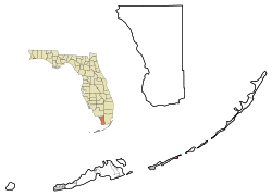
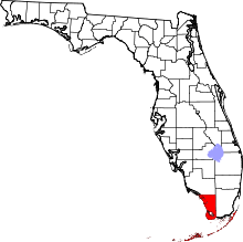
 Location in Monroe County and the state of Florida | |
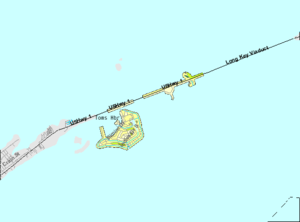
 U.S. Census Bureau map showing CDP boundaries | |
| Coordinates: 24°46′32″N 80°54′39″W / 24.77556°N 80.91083°WCoordinates: 24°46′32″N 80°54′39″W / 24.77556°N 80.91083°W | |
| Country |
|
| State |
|
| County | Monroe |
| Area | |
| • Total | 0.9 sq mi (2.3 km2) |
| • Land | 0.9 sq mi (2.2 km2) |
| • Water | 0 sq mi (0.1 km2) |
| Elevation | 3 ft (1 m) |
| Population (2000) | |
| • Total | 443 |
| • Density | 492.2/sq mi (192.6/km2) |
| Time zone | Eastern (EST) (UTC-5) |
| • Summer (DST) | EDT (UTC-4) |
| ZIP code | 33050 |
| Area code(s) | 305 |
| FIPS code | 12-18425[1] |
| GNIS feature ID | 1853245[2] |
Duck Key is a census-designated place and unincorporated community in Monroe County, Florida, United States, on an island of the same name in the middle Florida Keys. The CDP also includes the neighboring island of Conch Key. As of the 2000 census, the CDP had a total population of 443.
Geography
Duck Key is located oceanside of U.S. 1 (or the Overseas Highway), at approximately mile marker 61, between Conch and Grassy Keys at 24°46′32″N 80°54′39″W / 24.775623°N 80.910972°W.[3]
According to the United States Census Bureau, the CDP has a total area of 2.4 km² (0.9 mi²), of which 2.2 km² (0.9 mi²) is land and 0.1 km² (0.1 mi²) (5.49%) is water.
History
The key was the site of a salt manufacturing operation in the 1820s & 1830s. Occupation of the island ceased after the Labor Day Hurricane of 1935 and did not resume until the key was connected to the highway by a causeway in 1953. J.W. Norie, in his Piloting Directions for the Gulf of Florida, The Bahama Bank & Islands (1828) states: "Duck Key - Some two miles (3 km) long, low, rocky, & covered with mangroves; some small patches of good land with a little timber. This island formerly saltworks but they were transferred latterly to Key West, owned by Mr. Howe, who is also possessor of this Key."
Duck Key was bypassed by the railroad in 1912 and the Overseas Highway when rebuilt after the 1935 Hurricane. As it is today at MM 61, it is a new Key. Bryan Newkirk purchased the island in 1956 and with a consortium of partners pumped several million dollars along with many million cubic yards of fill.
Like most of the Keys, Duck Key was unnamed on early Spanish charts. It was included as one of the "Key Vaccas", or Cow Keys. It is not specifically named on the 1733 Spanish treasure recovery maps. A 1772 chart by DeBrahm labels it as Reynolds; however, William Gerard de Brahm, a Swiss, gave many the Keys his own names. He was the first Surveyor General for British East Florida.
It took George Gauld to name it Duck Key in his chart of 1775. Gauld names the west end of "Duck Key" as a fresh water source in his "Of the Watering Places on the Florida Keys." Gauld did a credible job of surveying the Keys; however, was interrupted by the Revolutionary War of 1776.
Key Vaca and four small islands were granted to Don Francisco Ferreira by a Spanish Land Grant in 1814. Therefore, Duck Key was part of one of two Spanish land grants in the Keys, Key West being the other. While under Spanish ownership, Ferreira of St. Augustine petitioned on January 4, 1814 "To his Excellency the Governor. . . ."to grant him ". . . in absolute property a Key situated among those called the Florida Keys, and is also known as Key Baca and also four small islands which are situated in the vicinity. . ." It was approved the next day "As the services rendered by the petitioner are well known, and in consideration of the great losses which he has suffered by the Revolution. . ." Duck Key belonged to Ferreira.
When Florida became an American possession in 1821 and its Board of Florida Land Commissioners accepted Ferreira's claim which was later approved by an Act of Congress, May 26, 1830. Others in the U. S. and Florida governments treated the five islands as public domain and transferred ownership for various programs. The positive legal ownership debate goes on and on, but was evidently resolved in 1899.
Duck Key was excluded from some of the legal discussions as Ferreira had sold Key Vaca to Isaac Cox for $3,000 on September 4, 1824, (Deed book E, St. Johns County, Florida) which was $1,000 more than the selling price of Key West. Three years later, Cox sold Key Vaca (all five islands) to Charles Howe of Indian Key fame for $1,500. However, another case of the Spanish owners selling land twice as they did Key West, Ferreira also sold Duck Key to Sol Snyder on June 11, 1823.
State surveyor Charles Smith's note was really meant for Grassy Key a part of which was on the same survey chart. Grassy Key, Key Vacca, Hog Key and Knight's Key owners fought land title battles until 1899. For the researcher, Lewis W. Pierce and Horatio Crain, Charles Howe's son-in-law were prominent players.
There are references to salt ponds on Duck Key in the early 1800s. The industry is well documented in Key West involving some the city leaders as Simonton, Fitzpatrick, Whitehead, Fleming, etc. The Lafayette Salt Company was incorporated in 1829 and began production in earnest in 1834.
Today, the American society is trying to reduce salt intake; however, if necessary many acclaimed chefs still suggest the natural element of sea salt or "fleur de sel." Before refrigeration, salt was absolutely necessary for prolonged food preservation, processing and shipment.
It is believed that salt production was the goal for Charles Howe's acquiring Duck Key in 1827. The Key West Register on April 9, 1829 printed: "Election Notice - In pursuance of law . . . the following named persons to be the judges of the election, which will be held the first Monday in May, next for a - Delegate to Congress on Indian Key, the store of Thomas Gibson - judges: Charles Howe, Joseph Prince and Thomas Gibson. . . ."
It is about 30 miles from Indian Key to Duck Key and Indian Key had the only store next to Key West; therefore, was it possible for him to be living on Duck Key? The 1830 census, which did not list specific locations and only the name of the head of the household, listed Charles Howe as a household of 13 members, five of which were slaves. Therefore, the slaves could have been operating the salt ponds.
Early salt production was labor-intensive. Generally the lower technology consisted of gates to allow seawater to enter evaporation vats at high tide, close the gates, allow evaporation, allow more seawater, etc. until a brine was obtained, siphon off the brine into a separate pickle vat, then to a crystallizing vat, where the salt was raked off, dried and bagged. As this required considerable construction, a simpler method was used at Duck Key.
Charles Howe was appointed and confirmed a Monroe County Justice of the Peace on January 18, 1831.
John Lee Williams in his 1837 Territory of Florida wrote: "Duck Key is a narrow rocky islet, containing some fine salt ponds. Mr. Howe, from Charleston, made a considerable establishment on the island for the purpose of making salt, but having died since, the project has been abandoned. It is about two miles long."
The Charles Howe of Indian Key was born August 12, 1801 in Massachusetts and married his first wife, Ann Cole on April 20, 1825, had three children, Sarah, Edward and Charles Jr., and he died January 27, 1873 in Hadley, Mass. His son Charles Jr. married in 1852 a Mary Ann Johnson of Duck Key.
The land deed of Isaac N. Cox to Charles Howe of Key Vacas, ". . . Charles Howe, of the city of Charleston, the state of South Carolina." However, Horatio Crain, Howe's son-in-law, in 1885 stated to the land commission that "my father-in-law, Charles Howe, who had the salt works there and who subsequently sold to William C. Dennis whose heirs hold the title."
Of interest are excerpts from the Charleston Daily Courier dated January 10, 1858, of a voyage made to Knight's Key with Charles Howe: "... Commenced with Knight's Key, containing about one hundred and twenty-five acres of arable [plowable] land, and has a comfortable house and cistern. On this Key we have twelve hundred cocoanut trees and about fifty thousand Sisal hemp plants, most of which are fit to cut and manufacture into hemp ..." They sailed on "... Passed Duck Key, where much money was expended on forming a salt pond ..."
Regardless, there were salt ponds on Duck Key and later Charles Howe obtained controlling interest in the salt works in Key West in 1843, then sole ownership after the hurricane of 1846.
Duck Key took a herculean leap forward in 1951. Bryan W. Newkirk, an internationally know financier and mining executive purchased the island for about $47,000 to make it a 400-acre island community. Newkirk had made Coral Gables, Florida his winter home since 1924 and had definite ideas for the island's amenities. An airport was available 12 miles away at Marathon; however, a golf course and yacht club would be needed and an improved 160 foot entrance causeway.
By 1952 a wooden bridge connected Duck Key to highway U.S. 1 and construction took off with Alonzo Cothron of Islamorada as the principal contractor. The interconnecting canals were the source of landfill.
On January 2, 1953, the million dollar causeway from US 1 to Duck Key was officially opened for vehicle traffic. State Representative Bernie C. Papy was the master of ceremony.
Newkirk was smarter than other developers in the Keys and made all his canals through waterways so they could flush with the tidal changes. He carved out five islands, Indies, Centre, Harbour, Plantation and Yacht Club islands. There are about 10 miles of paved roads and four decorative stone bridges designed by Key West artist Gene Otto.
Newkirk then constructed a one story workshed and nursery building (1952). As the island was largely scarified from canal building and landfilling Newkirk had much landscaping to do. The nursery started with 6 acres of young trees and plants. As the plants grew and flourished they were transplanted to other parts of the island which were barren.
The oldest remaining structure and a dominant focal point on Duck Key is the resort's Administration Building which is built in a West Indian style. This charming architectural prize rests peacefully just off Duck Key Drive and the entrance to Hawk's Cay. Surrounded by a green jungle of tropical trees, palms, and banana plants, the building gives a feeling of solidity and permanence as though it must have been on the island since the days of wreckers in the Florida Keys.
Built in 1954, this patioed and balconied structure typifies the Caribbean architecture and atmosphere the builders of Duck Key were trying to create. The interior of the Administration Building's upper floor has undergone many changes from its original design, but the upper chambers still surround a narrow spiral steel stairway leading to what was once an observation deck from which guests and prospective buyers could view the island.
Visitors entered rooms shaded by plantation blinds and looked out windows which were of double hung sash construction. Fifties-style aluminum jalousie windows were not considered as they did not fit the West Indian architectural theme. The interior walls were hung with a tropical wall paper picturing vines and monkeys. Built to last and at considerable expense the building has stood the test of time.
The Caribbean theme was the inspiration of Gene Otto, a widely known Key West artist. According to Otto, all the houses were to have "earth-colored tile roofs, with wide overhanging eaves like so many older houses encountered at Key West, Jamaica and other Caribbean islands." The first private residences built all kept to the West Indian architectural theme.
Newkirk formed the Florida Southern Land Company in 1956 and sold stock to raise money for the building of the Indies Inn. The Indies Inn opened in January 1960.
Bryan Newkirk, wanted the hotel to have a West Indian theme. Lucille, Newkirk's wife, was instrumental in the selection of Morris Lapidus as the architect for the hotel on Duck Key. Lucile while on a trip to the island of Jamaica liked the Arawak Hotel which has been designed by the architect Lapuidus. The Newkirks selected the name "Indies House" for their new hotel building, and Lapidus gave the Indies House a tropical island feel. Lapidus also designed the Fontainebleu Hotel in Miami Beach.
A 1961 article in the Miami News provides the name for the Lapidus designed cocktail loungeat Indies House. Identified as Drakes Cove Cocktail Lounge, Lapidus created a sea-like atmosphere with a mural under-water scene on the wall behind the oval bar. Colored filtered lights created unusual patterns.
The article in the Miami News described the hotel as "luxrious Indies House on spacious Duck Key". Duck Key is described as a site "transformed into five interconnected islands with sites for plush homes, hotels, and apartments. . . . strategically located near the world's most famous fishing waters. The flats around the island are teeming with bonefish."
The large octagonal dining room was identified as the "Fundo Mundo' room, which roughly translates to "American world".
There are many stories that the Indies House was built as a place for gambling. The first week it was opened, the top floor of the resort was filled with casino equipment. There was a gaming wheel on its side. After Haydon Burns was elected governor in 1965, he changed his mind about gambling and the plans for the top floor casino evaporated.[4]
Ownership of Newkirk's Indies Inn changed in 1983 when the Pompano Beach Barrington Group purchased the holdings and made extensive changes. The nine-hole par 3 course designed by Robert Trent Jones was removed to make room for a resort expansion approved in 1986. The resort name was changed to Hawk's Cay Resort and Marina. Additional swimming pools and recreational facilities were added in the late 1990s.
The Singh Company of Key West, well known for the Truman Annex, entered the Upper Keys in the middle 1990s and began Hawk's Cay Village. This added several hundred Caribbean style cottages all with water views, porches and the traditional white picket fence.
There are presently 381 homes, multiple recreational facilities and complete convention facilities.
Demographics
As of the census[1] of 2000, there were 443 people, 235 households, and 141 families residing in the CDP. The population density was 198.9/km² (514.2/mi²). There were 828 housing units at an average density of 371.7/km² (961.1/mi²). The racial makeup of the CDP was 98.65% White, 0.45% African American, 0.23% Asian, and 0.68% from two or more races. Hispanic or Latino of any race were 2.93% of the population.
There were 235 households out of which 8.9% had children under the age of 18 living with them, 56.6% were married couples living together, 3.0% had a female householder with no husband present, and 39.6% were non-families. 33.2% of all households were made up of individuals and 14.9% had someone living alone who was 65 years of age or older. The average household size was 1.89 and the average family size was 2.32.
In the CDP the population was spread out with 8.8% under the age of 18, 2.3% from 18 to 24, 20.8% from 25 to 44, 40.0% from 45 to 64, and 28.2% who were 65 years of age or older. The median age was 54 years. For every 100 females there were 101.4 males. For every 100 females age 18 and over, there were 101.0 males.
The median income for a household in the CDP was $39,125, and the median income for a family was $39,708. Males had a median income of $50,341 versus $26,429 for females. The per capita income for the CDP was $29,007. About 23.4% of families and 16.6% of the population were below the poverty line, including 6.9% of those under age 18 and 15.4% of those age 65 or over.
References
- 1 2 "American FactFinder". United States Census Bureau. Retrieved 2008-01-31.
- ↑ "US Board on Geographic Names". United States Geological Survey. 2007-10-25. Retrieved 2008-01-31.
- ↑ "US Gazetteer files: 2010, 2000, and 1990". United States Census Bureau. 2011-02-12. Retrieved 2011-04-23.
- ↑ http://www.duckkeyonline.com/duck_key_history/resort_growth.htm
