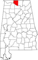
Belle Mina, Alabama
| Belle Mina, Alabama | |
|---|---|
| Unincorporated community | |
 Belle Mina, Alabama  Belle Mina, Alabama | |
| Coordinates: 34°39′24″N 86°52′45″W / 34.65667°N 86.87917°W | |
| Country | United States |
| State | Alabama |
| County | Limestone |
| Elevation | 600 ft (183 m) |
| Time zone | Central (CST) (UTC-6) |
| • Summer (DST) | CDT (UTC-5) |
| ZIP code | 35756 |
| Area code(s) | 256 |
| GNIS feature ID | 151675[1] |
Belle Mina is an unincorporated community in southeastern Limestone County, Alabama, United States.
History
The community of Belle Mina was named for the plantation of the same name that belonged to Governor Thomas Bibb, the second governor of the state of Alabama. It was originally called "Belle Manor", but because of southern pronunciation, the spelling changed over time. The name is derived from the French word "belle", meaning "beautiful". The plantation was situated along the Southern Railroad, and there was a station at or near the plantation. A post office was established in Belle Mina in 1878.[2] The community served as the rail stop for Mooresville.
References
- ↑ "Belle Mina". Geographic Names Information System. United States Geological Survey.
- ↑ Foscue, Virginia. Place Names in Alabama. University: U of Alabama Press, 1989.
Coordinates: 34°39′16″N 86°52′46″W / 34.6544°N 86.8794°W
This article is issued from Wikipedia - version of the 7/31/2016. The text is available under the Creative Commons Attribution/Share Alike but additional terms may apply for the media files.
