Zaheerabad
| Zaheerabad జహీరాబాద్ ظھیر آباد | |
|---|---|
| Town | |
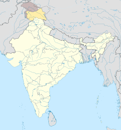
 Zaheerabad  Zaheerabad Location in Telangana, India | |
| Coordinates: 17°41′N 77°37′E / 17.68°N 77.62°ECoordinates: 17°41′N 77°37′E / 17.68°N 77.62°E | |
| Country | India |
| State | Telangana |
| District | Sangareddy |
| Area[1] | |
| • Town | 21.78 km2 (8.41 sq mi) |
| Elevation | 622 m (2,041 ft) |
| Population (2011)[2] | |
| • Town | 100,532 |
| • Density | 4,600/km2 (12,000/sq mi) |
| • Metro[3] | 71,166 |
| Languages | |
| • Official | Telugu / Urdu |
| Time zone | IST (UTC+5:30) |
| ISO 3166 code | IN-TG |
| Vehicle registration | TS–15 |
Zahirabad is a town and Revenue division in Sangareddy district of the Indian state of Telangana.[4] It is located in Zahirabad mandal of Sangareddy district.[3]:12
Etymology
The name of the city was coined by a Paigah noble called Mohammad Zaheeruddin Khan (Nawab Zaheer Yar Jung Bahadur). He was the eldest son of Nawab Moin-ud-Dowlah Bahadur and the Amir-i-Paigah (lord) of the Asman Jahi (his family estate). The Paigah family or clan were a Sufi Islamic aristocratic family of Hyderabad state.
History
Important points in the history of Zaheerabad include the drought of 1972 and the Hyderabad Police Action of 1949.[5]
Demographics
In 2001, the census population of Zaheerabad was 140,160. Sixteen percent of people were under six years of age. The rate of literacy was 59.5 percent, higher than the national average. Women were less literate than men (55 percent to 69 percent). The common languages spoken are Telugu, Urdu, Kannada and Marathi.
As of 2011 census of India, the urban agglomeration population of the city was 71,166.[3]
Government and politics
Civic administration
Zaheerabad Municipality was constituted in 1952 and is classified as a third grade municipality with 24 election wards. The jurisdiction of the civic body is spread over an area of 21.78 km2 (8.41 sq mi).[1] The urban agglomeration includes the municipality of Zahirabad, the census town of Alliput, out growths of Pastapur, Tamadpalle, Hyderabad, Hothi (K) and partly out growths of Buchnelli village.[3]:13,44
Economy
Zaheerabad is an agricultural area. Farming has struggled due to dry lands becoming fallow and the loss of a variety of crop types such as cereals, pulses and oilseeds. The Deccan Development Society (DDS) has assisted local women to become empowered in the economy and in society. In small groups called sangams, they have succeeded in developing food security and making charity endeavours.[6][7]
See also
Zahirabad (Lok Sabha constituency) Mahindra & Mahindra has their Auto and Tractor plants in Zaheerabad.
References
- 1 2 "Urban Local Body Information" (PDF). Directorate of Town and Country Planning. Government of Telangana. Retrieved 28 June 2016.
- ↑ "Census 2011". The Registrar General & Census Commissioner, India. Retrieved 25 July 2014.
- 1 2 3 4 "District Census Handbook - Karimnagar" (PDF). Census of India. p. 44. Retrieved 22 September 2015.
- ↑ "District Level Mandal wise list of villages in Medak district" (PDF). Chief Commissioner of Land Administration. National Informatics Centre. Archived from the original (PDF) on 2 April 2015. Retrieved 5 March 2016.
- ↑ Chevalier J. M. and Buckles D. J. "Participatory action research - theory and methods for engaged enquiry." Routledge, 2013. ISBN 0415540313, 9780415540315. p207. Accessed at Google Books 8 December 2013.
- ↑ Energy and Resources Institute. "Environment Chronicles: the best of TerraGreen." TERI Press, 2011. ISBN 817993358X, 9788179933589 p162. Accessed at Google Books 8 December 2013.
- ↑ Apte T. "An Activist Approach to Biodiversity Planning: A Handbook of Participatory Tools Used to Prepare India's National Biodiversity Strategy and Action Plan." International Institute for Environment and Development 2005. ISBN 1843695480, 9781843695486. p77. Accessed at Google Books 8 December 2013.