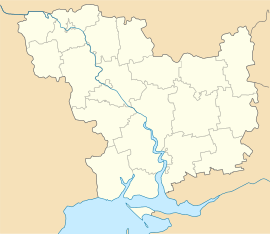
Vradiivka
| Vradiivka Врадіївка | |||
|---|---|---|---|
| Urban-type settlement | |||
| |||
 Vradiivka | |||
| Coordinates: UA 47°51′42″N 30°35′35″E / 47.86167°N 30.59306°ECoordinates: UA 47°51′42″N 30°35′35″E / 47.86167°N 30.59306°E | |||
| Country | Ukraine | ||
| Oblast | Mykolaiv Oblast | ||
| Raion | Vradiivka Raion | ||
| Population (2015) | |||
| • Total | 8,396[1] | ||
| Time zone | EET (UTC+2) | ||
| • Summer (DST) | EEST (UTC+3) | ||
Vradiivka (Ukrainian: Врадіївка, Russian: Врадиевка) is an urban-type settlement in the northwest of Mykolaiv Oblast, Ukraine. It serves as the administrative center of Vradiivka Raion. Population: 8,396 (2015 est.)[1]
Vradiivka is located on the right bank of the Kodyma River, a right tributary of the Southern Bug.
History
Aryeh Leib Schochet, a Chassidic scholar, became a rabbi in Vradiivka in the 19th century.
In the 1920s, the current area of the district belonged to Odessa Governorate. In 1923, uyezds in Ukrainian Soviet Socialist Republic were abolished, and the governorates were divided into okruhas. In 1923, Velyka Vradiivka Raion with the administrative center in Vradiivka was established. It belonged to Pervomaisk Okruha. In 1925, the governorates were abolished, and okruhas were directly subordinated to Ukrainian SSR. In 1930, okruhas were abolished, and on 27 February 1932, Odessa Oblast was established, and Velyka Vradiivka was included into Odessa Oblast.[2] In February 1954, Velyka Vradiivka Raion was transferred to Mykolaiv Oblast. In January 1963, during the abortive Khrushchyov administrative reform, Velyka Vradiivka Raion was abolished and merged into Kryve Ozero Raion. In 1964, Velyka Vradiivka was renamed Vradiivka. On 8 December 1966 Vradiivka Raion with the administrative center in Vradiivka was established on the lands previously belonging to Kryve Ozero Raion. In 1967, Vradiivka was granted urban-type settlement status.[3]
In June 2013, a rape of a local resident by policemen caused riots in Vradiivka and nationwide, after the authorities initially failed to charge the perpertators.[4]
Economy
Transportation
Vradiivka railway station in the settlement has connections to Pervomaisk and Kotovsk.[5]
References
- 1 2 "Чисельність наявного населення України (Actual population of Ukraine)" (PDF) (in Ukrainian). State Statistics Service of Ukraine. Retrieved 1 July 2016.
- ↑ Украиньска РСР - Адмiнiстративно-терiториальний подiл на 1 вересня 1946 року (in Ukrainian). Kiev: Ukrainian Soviet Encyclopedia. 1979.
- ↑ "Районы Николаевской области" (in Russian). Николаевская область. Электронная историческая энциклопедия. Retrieved 6 March 2016.
- ↑ "На Украине задержали милиционера-насильника". polit.ru. 2 July 2013. Retrieved 13 March 2016.
- ↑ Украинская ССР - Административно-территориальное деление на 1 января 1979 года. Kiev: Ukrainian Soviet Encyclopedia. 1979.

