Vidor, Texas
| Vidor, Texas | ||
|---|---|---|
| City | ||
| ||
|
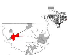
Location of Vidor, Texas | ||
 | ||
| Coordinates: 30°7′53″N 93°59′47″W / 30.13139°N 93.99639°WCoordinates: 30°7′53″N 93°59′47″W / 30.13139°N 93.99639°W | ||
| Country | United States | |
| State | Texas | |
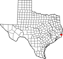
| County | Orange | |
| Area | ||
| • Total | 10.6 sq mi (27.4 km2) | |
| • Land | 10.6 sq mi (27.3 km2) | |
| • Water | 0.0 sq mi (0.0 km2) | |
| Elevation | 23 ft (7 m) | |
| Population (2000) | ||
| • Total | 11,440 | |
| • Density | 1,083.6/sq mi (418.4/km2) | |
| Time zone | Central (CST) (UTC-6) | |
| • Summer (DST) | CDT (UTC-5) | |
| ZIP codes | 77662, 77670 | |
| Area code(s) | 409 | |
| FIPS code | 48-75476[1] | |
| GNIS feature ID | 1349270[2] | |
Vidor (/ˈvaɪdər/ VYE-der) is a city in western Orange County, Texas, United States. A city of Southeast Texas, it lies at the intersection of Interstate 10 and Farm to Market Road 105, six miles east of Beaumont. The town is mainly a bedroom community for the nearby refining complexes in Beaumont and Port Arthur and is part of the Beaumont-Port Arthur Metropolitan Statistical Area. The population was 10,579 at the 2010 census.
History
The area was heavily logged after the construction of the Texarkana and Fort Smith Railway that was later part of a line that ran from Kansas City to Port Arthur, Texas. The city was named after lumberman Charles Shelton Vidor, owner of the Miller-Vidor Lumber Company and father of director King Vidor. By 1909 the Vidor community had a post office and four years later a company tram road was built. Almost all Vidor residents worked for the company. In 1924 the Miller-Vidor Lumber Company moved to Lakeview, just north of Vidor, in search of virgin timber. A small settlement remained and the Miller-Vidor subdivision was laid out in 1929.
In 2005 and 2008, Vidor and surrounding areas suffered extensive damage from Hurricane Rita and Hurricane Ike. A mandatory evacuation was imposed upon its residents for about two weeks.
Vidor was known as a "sundown town," where African Americans were not allowed after sunset; it has also long been a haven for the Ku Klux Klan. In 1993, after the U.S. federal government attempted to bring African Americans into Vidor's public housing, the Klan held a march in the community, prompting African American families to move out within a matter of months.[3] It is still considered a haven for the "KKK".
Geography
Vidor is located at 30°7′53″N 93°59′47″W / 30.13139°N 93.99639°W (30.131492, -93.996292).[4]
According to the United States Census Bureau, the city has a total area of 10.6 square miles (27 km2), of which, 10.6 square miles (27 km2) of it is land and 0.09% is water.
Demographics
| Historical population | |||
|---|---|---|---|
| Census | Pop. | %± | |
| 1970 | 9,738 | — | |
| 1980 | 11,834 | 21.5% | |
| 1990 | 10,935 | −7.6% | |
| 2000 | 11,440 | 4.6% | |
| 2010 | 10,579 | −7.5% | |
| Est. 2015 | 10,945 | [5] | 3.5% |
As of the census[1] of 2000, there were 11,440 people, 4,222 households, and 3,158 families residing in the city. The population density was 1,083.6 people per square mile (418.3/km²). There were 4,652 housing units at an average density of 440.6 per square mile (170.1/km²). The racial makeup of the city was 97.33% White, 0.07% African American, 0.52% Native American, 0.19% Asian, 0.03% Pacific Islander, 0.66% from other races, and 1.21% from two or more races. Hispanic or Latino of any race were 3.49% of the population.
There were 4,222 households out of which 34.7% had children under the age of 18 living with them, 56.3% were married couples living together, 13.4% had a female householder with no husband present, and 25.2% were non-families. 22.0% of all households were made up of individuals and 10.3% had someone living alone who was 65 years of age or older. The average household size was 2.66 and the average family size was 3.09.
In the city the population was spread out with 26.7% under the age of 18, 9.9% from 18 to 24, 27.4% from 25 to 44, 21.9% from 45 to 64, and 14.1% who were 65 years of age or older. The median age was 35 years. For every 100 females there were 91.5 males. For every 100 females age 18 and over, there were 87.1 males.
The median income for a household in the city was $31,982, and the median income for a family was $37,572. Males had a median income of $35,781 versus $21,054 for females. The per capita income for the city was $15,381. About 10.7% of families and 14.5% of the population were below the poverty line, including 19.5% of those under age 18 and 8.9% of those age 65 or over.
Education
The City of Vidor is served by the Vidor Independent School District, which is the largest school district in the county.
References
- 1 2 "American FactFinder". United States Census Bureau. Retrieved 2008-01-31.
- ↑ "US Board on Geographic Names". United States Geological Survey. 2007-10-25. Retrieved 2008-01-31.
- ↑ "Texas city haunted by 'no blacks after dark' past". Retrieved 28 December 2014.
- ↑ "US Gazetteer files: 2010, 2000, and 1990". United States Census Bureau. 2011-02-12. Retrieved 2011-04-23.
- ↑ "Annual Estimates of the Resident Population for Incorporated Places: April 1, 2010 to July 1, 2015". Retrieved July 2, 2016.
- ↑ "Census of Population and Housing". Census.gov. Retrieved June 4, 2015.
Notable people
- Tracy Byrd, country music artist
- Dean Corll, prolific 1970s Houston serial killer
- David Ray Harris, suspected murderer featured in the documentary The Thin Blue Line (and later executed for a separate murder)
- George Jones, country music artist
- Roger Mobley, former child actor, is a former police detective in Vidor; reported living in Little Rock, Arkansas, as of 2015.
- Don Rollins, songwriter, co-author of the hit country tune "It's Five O'Clock Somewhere"
- Billie Jo Spears, country music artist
- Clay Walker, country music artist
External links
- City of Vidor - Official site.
- Miller-Vidor Logging Camp
- Vidor Independent School District
- Vidor Chamber of Commerce
- Vidor, Texas from the Handbook of Texas Online

