Ma'ale Tzviya
| Ma'ale Tzviya | |
|---|---|
 | |
 Ma'ale Tzviya | |
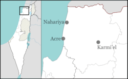
| Coordinates: 32°53′21.84″N 35°19′53.04″E / 32.8894000°N 35.3314000°ECoordinates: 32°53′21.84″N 35°19′53.04″E / 32.8894000°N 35.3314000°E | |
| District | Northern |
| Council | Misgav |
| Founded | 1979 |
| Population (2015)[1] | 310 |
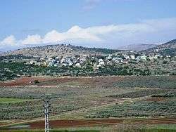
Ma'ale Tzviya (Hebrew: מַעֲלֵה צְבִיָּה, lit. Zvia Heights), also Tzviya, is a communal settlement in northern Israel. Located in the Galilee to the south-east of Karmiel, it falls under the jurisdiction of Misgav Regional Council. In 2015 it had a population of 310.
History
The village was established in 1979 as a kibbutz, and was named after Zivia Lubetkin, one of the leaders of the Jewish underground in Nazi-occupied Warsaw. The kibbutz was closed in 1986 and the site taken over by members of the "Atid" (lit. Future) gar'in, who founded a communal settlement with the assistance of the Jewish Agency.
The founders defined the settlement as "a Jewish Israeli settlement according to the way of Emin".
References
- ↑ "List of localities, in Alphabetical order" (PDF). Israel Central Bureau of Statistics. Retrieved 16 October 2016.
External links
- Ma'ale Tzviya Galilee Development Authority (Hebrew)
This article is issued from Wikipedia - version of the 10/23/2016. The text is available under the Creative Commons Attribution/Share Alike but additional terms may apply for the media files.