Taromske
| Taromske Таромське | |
|---|---|
| Former urban-type settlement | |
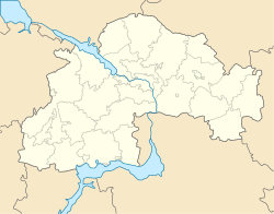
 Taromske Location of Taromske in Dnipropetrovsk Oblast | |
| Coordinates: 48°27′42″N 34°46′58″E / 48.46167°N 34.78278°ECoordinates: 48°27′42″N 34°46′58″E / 48.46167°N 34.78278°E | |
| Country |
|
| Municipality | Dnipropetrovsk Municipality |
| Urban district | Leninskyi District |
| Settlement status | 1938 |
| Liquidated | September 2001 |
| Area | |
| • Total | 75 km2 (29 sq mi) |
| Population (2005) | |
| • Total | 15,500 |
| • Density | 210/km2 (540/sq mi) |
| Time zone | EET (UTC+2) |
| • Summer (DST) | EEST (UTC+3) |
| Postal code | 69061 |
| Area code | +380 61 |
Taromske (Ukrainian: Таромське) was an urban-type settlement (and constituent unit of its own settlement council) of the Leninskyi District (urban district) of the Dnipropetrovsk Municipality in southern Ukraine. Its population was 15,500 in 2005.
History
In 1885, the populated settlement of Taromske was a village. In 1938, it was given the status of an urban-type settlement. Since 1970, the settlement was included into the boundaries of Dniproperovsk.
From 1992–2001, the settlement was an autonomous settlement that was subordinate to the Dnipropetrovsk Municipality. In September 2001, its status of an urban-type settlement was liquidated and it was absorbed into the city's Leninskyi District.
This article is issued from Wikipedia - version of the 5/23/2016. The text is available under the Creative Commons Attribution/Share Alike but additional terms may apply for the media files.