Taitao Peninsula

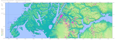
The Taitao Peninsula (Spanish: Península de Taitao) is a westward projection of the mainland of Chile, with which it is connected by the narrow Isthmus of Ofqui, over which the natives and early missionaries were accustomed to carry their boats between the Moraleda Channel and Gulf of Penas. It is situated in the Aysén del General Carlos Ibáñez del Campo Region and a part of this peninsula is located inside the boundaries of Laguna San Rafael National Park. The Presidente Ríos Lake, with a surface area of 352 km², lies in the middle of the peninsula. A southward incurving projection of the outer shore-line of this peninsula is known as Tres Montes peninsula, the most southern point of which is a cape of the same name.
Sources
![]() This article incorporates text from a publication now in the public domain: Chisholm, Hugh, ed. (1911). "article name needed". Encyclopædia Britannica (11th ed.). Cambridge University Press.
This article incorporates text from a publication now in the public domain: Chisholm, Hugh, ed. (1911). "article name needed". Encyclopædia Britannica (11th ed.). Cambridge University Press.
Coordinates: 46°30′S 74°25′W / 46.500°S 74.417°W