St. George, Staten Island

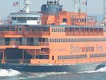
St. George is a neighborhood on the northeastern tip of Staten Island in New York City, where the Kill Van Kull enters Upper New York Bay. It is the most densely developed neighborhood on Staten Island, and the location of the administrative center for the borough and for the coterminous Richmond County. The Staten Island terminal of the Staten Island Ferry is located here, as well as the northern terminus of the Staten Island Railway. St. George is bordered on the south by the neighborhood of Tompkinsville and on the west by the neighborhood of New Brighton.
History
Colonial days
Fort Hill,[1][2] one of the hills overlooking the harbor, was the location on Duxbury's Point or Ducksberry Point [3] fortified by the British during the American Revolutionary War. The area was primarily rural through the early 19th century.
The name was derived not from the dragon-slaying saint, but from George Law, a developer who acquired rights to the waterfront at bargain prices. According to island historians Charles Leng and William T. Davis, it was only after another prominent businessman, Erastus Wiman, promised to "canonize" him in the town's name that Law agreed to relinquish the land rights for a ferry terminal.[1] In the late 1880s, Wiman operated the Staten Island Amusement Company in the neighborhood, offering public athletic events, an illuminated fountain, and pageants. The St. George Cricket Grounds was part of that complex, but only lasted a few years.
The heyday
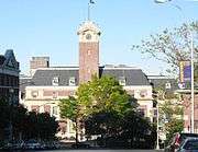
In the 1830s, the area facing the Kill Van Kull became a fashionable resort area, with the construction of several elegant hotels along St. Mark's Place across from the present site of Curtis High School (the oldest high school on Staten Island). The grandest and last of these hotels was the Hotel Castleton, built in 1889 and destroyed by fire in 1907. In 1918, the Staten Island Institute of Arts and Sciences moved to its present location in the neighborhood. The United States Coast Guard operated a facility in the neighborhood until moving to Governors Island in 1967. The Office Building and U.S. Light-House Depot Complex was added to the National Register of Historic Places in 1978.[4] In the early 20th century the neighborhood grew rapidly: municipal ferry service to Manhattan began in 1905. The neighborhood had several elegant buildings by the architectural firm of Carrère and Hastings. These included a branch of the New York Public Library (1906), the present Staten Island Borough Hall (1906), and the Richmond County Courthouse (1919).
In 1924, the "Saint George" telephone exchange was established in the new North Staten Island building of New York Telephone; this became "SAint George 7" when New York City's service underwent a major upgrade six years later. This three-digit prefix, now identified by numbers — "727" — is the only one of five exchanges which existed immediately prior to the aforementioned upgrade that is still in service on the island (in addition to St. George itself, this numeric designation is encountered in many other North Shore communities, as far away as Mariners Harbor to the west and South Beach and Grasmere to the south).
Revival
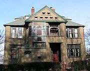
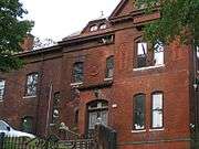
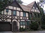
The community underwent a revival in the late 1990s and property values have continued to rise since 2000. In 1994, the New York City Landmarks Preservation Commission designated a St. George Historic District. The historic district consists of 78 houses and one church—St. Peters Roman Catholic, the oldest parish on Staten Island—and is a mix of Victorian styles, such as Queen Anne, Shingle style, Colonial Revival, and Tudor. Currently, the area of Fort Hill comprises the remains of the streets and homes where the descendants of the Tompkins, Westervelt and Low families lived. Here originally stood the mansion of Vice President and former New York State Governor Daniel D. Tompkins, the Anson Phelps-Stokes mansion and the Daniel Low mansion. Another prominent landowner was August Belmont, whose name is enshrined in Belmont Place. Many of the houses remaining today represent the homes and summer homes of the Low-Tompkins extended family and friends.
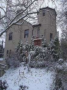
The residential Fort Hill area is home to many professionals who commute daily to Manhattan on the ferry, and includes many well-tended examples of Victorian, Tudor, and art deco architecture, in addition to one house modeled after a Spanish castle.[5][6] Another popular upscale residential development, Bay Street Landing, abuts the bay between the ferry terminal and the head of Victory Boulevard. Many condominium buildings are currently being built along the shore, and near the ferry terminal, as they offer unsurpassed views of lower Manhattan and easy access via the free Staten Island Ferry.
The National Lighthouse Museum [7] (listed on the National Register of Historic Places) and the adjacent St. George post office are immediately east of the St. George ferry terminal.
The Richmond County Bank Ballpark, the home of the Staten Island Yankees, a minor league farm club of the New York Yankees opened in 2001. The stadium offers dramatic views of the harbor and the Manhattan skyline.
The renovated St. George Ferry terminal has panoramic views of the harbor and incoming ferries.[8]
The Hyatt Street side of a municipal parking lot faces the St. George Theater. This part of the lot is noted for the greenmarket held on it during spring, summer and fall. The lot encompasses a paved over graveyard of the former quarantine that has led to some controversy.[9]
| Houses in St. George | ||||||||
|---|---|---|---|---|---|---|---|---|
|
Culture
Museums and memorials
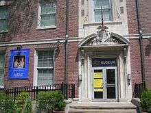

The Staten Island Institute of Arts & Sciences is located just two blocks west of the Staten Island Ferry Terminal, It explores the arts, natural science, and local history of the island.
In 1997 lighthouse organizations across the United States banded together to create a National Lighthouse Museum, which will tell the story of the United States Lighthouse Service. The museum will feature interactive exhibits and displays on the history, technology, and architecture of lighthouses, lightships and other aids to navigation, from primitive fire beacons to the Global Positioning System. The site selected is the old USLHS/US Coast Guard “super depot” at St. George, which was the major center for lighthouse supply, maintenance and experimentation for nearly 150 years. The site consists of 10 acres (40,000 m2) of waterfront property with five historic USLHS buildings, a public plaza and an 850-foot (260 m) pier.
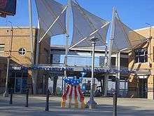
The St. George waterfront is the location of the Postcards September 11 memorial.
Fine arts
In 2007, several media reports noted that artists and musicians were moving to Staten Island's North Shore so they could be near Manhattan but afford more space to live and work in.[10][11][12]
St. George Theater
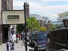

Construction began on the 2,800-seat St. George Theater in August 1928; the doors of this picture palace and office complex opened on December 4, 1929. The cost was $2 million, $500,000 of which was for the theater. The project was the brainchild of Solomon Brill, who owned several other theaters on the Island and 15 in the greater New York area. He envisioned the St. George as a show house to rival Manhattan's cinema palaces, and promised to bring top-of-the-line vaudeville to the borough for 75 cents a ticket. Brill sold the theater within three years to William Fox, whose name lives on in the Fox Television Network and 20th Century Fox film studio.
The main architect was Eugene De Rosa; he was assisted by Staten Island resident James Whitford, who was known as the “dean of Staten Island architects.” Whitford also designed the Ritz, Liberty and Victory theaters, none of which exist today. The ornate interior of the theater was designed by Nestor Castro, the art director for the Libman-Spanjer Corporation, which designed the interiors of many theaters in the Times Square area. Most of the elaborate architecture visible to theater patrons is Castro's work. The interior is a variety of Spanish and Italian Baroque styles. The movie and vaudeville house outshone most of its competitors, including Manhattan's Capitol Theater on Broadway. The theater has unobstructed seating, a $25,000 Wurlitzer organ, an advanced cooling and heating system, one of the largest cantilevered balconies ever built, velvet seats, gilded balconies, and grand staircases.
Renovated in 2004, St. George Theatre is a landmarked building. A variety of activities, including educational programs, architectural tours, television and film shoots, concerts, comedy, Broadway touring companies, and children's shows take place there.[13]
In popular culture
When the movie industry was centered on Long Island, scenes in many films were shot on Staten Island, and several actors had residences in St. George, or built houses for their relatives.
Among St. George's recent appearances is the murder scene in Brian De Palma's 1973 film Sisters with Margot Kidder playing both separated conjoined twins, Danielle and Dominique (the doppelgänger) took place in the apartment building on Hamilton Avenue between Stuyvesant Place and Academy Place. The opening scenes of the 1981 horror film "Wolfen" starring Albert Finney were shot in St. George, and the area has served as a stand-in for many nameless small towns, as was the case in the low-budget 1984 film "Death Mask" starring Farley Granger as a medical examiner who becomes obsessed with finding out the ID of a young boy found dead. The finale of the 2003 Jack Black film “School of Rock” was shot at The St. George Theater.
Notable residents
Actor Paul Newman and his wife, actor Joanne Woodward, lived in the Art Deco building The Ambassador on Daniel Low Terrace between Crescent Avenue and Fort Hill Circle in their early days in film. Actor Martin Sheen lived in the same building, and his son Emilio Estevez was born there.
Education
Curtis High School is located on 105 Hamilton Ave. Ralph R. McKee Career & Technical Education High School is located on 206 Saint Marks Place.
New York Public Library operates the St. George Library Center at 5 Central Avenue, near Borough Hall.[14]
Transportation
The Saint George Terminal is the hub of most Staten Island bus routes. All local bus routes feed into St. George except for the S53, S54, S55, S56, S57, S59, S79, S89. St. George is also the terminal for the Staten Island Railway[15] and the Staten Island Ferry.
St. George is expected to be served by the Citywide Ferry Service[16] at a date not yet determined.[17][18]
See also
References
- 1 2 "Best of the Web | The New York Public Library". Nypl.org. 2014-05-19. Retrieved 2014-05-23.
- ↑ "RELICS OF THE REVOLUTION - Historical Society Unearths Rich Store at Fort Hill Site on Staten Island Buttons Reveal Large Garrison. No Trace of Barracks. - View Article - NYTimes.com". New York Times. 1919-11-02. Retrieved 2014-05-23.
- ↑ NYPL Old Names on Staten Island
- ↑ National Park Service (2009-03-13). "National Register Information System". National Register of Historic Places. National Park Service.
- ↑ "Looking For a House And a Turret". The New York Times. 18 September 2005. Retrieved 25 April 2016.
- ↑ Archived December 11, 2007, at the Wayback Machine.
- ↑ "Welcome To The National Lighthouse Museum". Lighthousemuseum.org. Retrieved 2014-05-23.
- ↑ "Nyc Dot". Nyc.gov. Retrieved 2014-05-23.
- ↑ "Honoring the Bones". The New York Times. 23 September 2007. Retrieved 25 April 2016.
- ↑ "Bohemia by the Bay". The New York Times. 7 October 2007. Retrieved 25 April 2016.
- ↑ "Hipsters on Staten Island - Video - NYTimes.com". 40.755978;-73.990396: Video.on.nytimes.com. Retrieved 2014-05-23.
- ↑ (2007-04-28). "Artists Hope To Revitalize St. George, Stapleton Areas". NY1. Retrieved 2014-05-23.
- ↑ "Staten Island, New York". St.George Theatre. Retrieved 2014-05-23.
- ↑ "St. George Library Center." New York Public Library. Retrieved on December 22, 2008.
- ↑ "Staten Island Bus Map January 2013" (PDF). MTA. January 2013. Retrieved February 3, 2013.
- ↑ DNAinfoNewYork. "Proposed Routes for NYC's Expanded Ferry Service". Scribd. Retrieved September 22, 2016.
- ↑ "Citywide Ferry Service to Launch in June 2017, Official Says". DNAinfo New York. 2016-03-03. Retrieved 2016-09-22.
- ↑ "New York City's Ferry Service Set to Launch in 2017". NBC New York. Retrieved 9 May 2016.
External links
Coordinates: 40°38′36″N 74°04′44″W / 40.64333°N 74.07889°W
