Soleil Island
| Nickname: Ile Soleil | |
|---|---|
 Soleil Island | |
| Geography | |
| Location | Seychelles, Indian Ocean |
| Coordinates | 4°39′S 55°31′E / 4.650°S 55.517°ECoordinates: 4°39′S 55°31′E / 4.650°S 55.517°E |
| Archipelago | Inner Islands, Seychelles |
| Adjacent bodies of water | Indian Ocean |
| Total islands | 1 |
| Major islands |
|
| Area | 0.136 km2 (0.053 sq mi) |
| Length | 0.65 km (0.404 mi) |
| Width | 0.25 km (0.155 mi) |
| Coastline | 1.5 km (0.93 mi) |
| Highest elevation | 3 m (10 ft) |
| Administration | |
| Group | Granitic Seychelles |
| Sub-Group | Mahe Islands |
| Sub-Group | Anonyme Islands |
| Districts | Anse-aux-Pins |
Largest settlement |
Soleil camp (population 10) |
| Demographics | |
| Demonym | Creole |
| Population | 10 (2014) |
| Pop. density | 20 /km2 (50 /sq mi) |
| Ethnic groups | Creole, French, East Africans, Indians. |
| Additional information | |
| Time zone | |
| Official website |
www |
| ISO Code = SC-20 | |
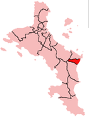
Ile Soleil is a small artificial island (0.14 km²) in the Seychelles, lying 50m off the east coast of Mahé, near the runway of the Seychelles International Airport.
History
The island was reclaimed in 2008 after the Dubai Dredger finished its work in the Victoria Port islands. The local Anse-aux-Pins mayor decided he wanted an artificial island as well. There are plans to build a new terminal on the island, due to housing problems.[1]
Administration
The island belongs to Anse-aux-Pins District.[2]
Tourism
The future of the island is unclear, although it is proposed to have an oriental tourism industry.[3]
Dempgraphy
The island's southern part is the location of a new luxurious neighborhood.[4][5][6]
Transport
Soleil is linked to the mainland by a causeway.[7][8]
Image gallery
 Map 1
Map 1 District Map
External links
References
This article is issued from Wikipedia - version of the 12/1/2016. The text is available under the Creative Commons Attribution/Share Alike but additional terms may apply for the media files.