Sokuluk District
| Sokuluk District Сокулук району | |
|---|---|
| Raion | |
|
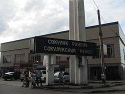
The border to Sokuluk rayon from Alamüdün rayon along the Osh-Bishkek highway | |
 | |
| Country | Kyrgyzstan |
| Region | Chuy Region |
| Population (2009)[1] | |
| • Total | 158,137 |
| de facto population | |
| Time zone | GMT +5 (UTC+5) |
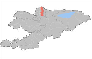
Sokuluk District (Kyrgyz: Сокулук району; Russian: Сокулукский район) is a raion (district) of the Chuy Region in northern Kyrgyzstan. The capital lies at Sokuluk village.[2]
Towns, rural communities, and villages
For 2009, Sokuluk District comprised 1 town and 68 villages in 19 rural communities (aiyl okmotus). Each rural community includes one or several villages. The rural communities in Sokuluk District and settlements are as follows:[3]
- town Shopokov
- At-Bashi aiyl okmotu (center - village Manas, and also villages Ak-Jol, Lesnoe, Tert-Kol)
- Tosh-Bulak aiyl okmotu ( center - village Tosh-Bulak, and also villages Beryulyu, Chetindi)
- Voenno-Antonovka aiyl okmotu (center - village Voyenno-Antonovskoye)
- Gavrilovka aiyl okmotu (center - village Gavrilovka, and also villages Jylamysh, Romanovka, Shalta)
- Jany-Jer aiyl okmotu (center - village Jany-Jer, and also villages Verhnevostochnoe, Zapadnoe, Zelenoe, Nizhnevostochnoe)
- Jany-Pahta aiyl okmotu (center - village Jany-Pahta, and also villages Ak-Kashat, Zarya, Mayskoe, Mirnyi)
- Kamyshanovka aiyl okmotu (center - village Kamyshanovka)
- Asylbash aiyl okmotu (center - village Asylbash, and also village Kirovskoe)
- Kuntuu aiyl okmotu (center - village Kuntuu, and also villages Dostuk, Malaya Shalta, Shalta, Chong-Jar)
- Imeni Krupskoy aiyl okmotu (center - village Sokuluk, and also villages Aral Blizhniy, Aral Dal'niy, Pervoe Maya)
- Kyzyl-Tuu aiyl okmotu (center - village Kyzyl-Tuu, and also villages Kara-Sakal, Malovodnoye, Novoe, Tokbay)
- Nizhnechuyskoe aiyl okmotu (center - village Nizhnechuyskoe, and also villages Mirnoe, Sadovoe, Severnoe, Stepnoe, Taltak)
- Novopavlovka aiyl okmotu (center - village Novopavlovka, and also village Uchkun)
- Saz aiyl okmotu (center - village Saz, and also village Konush)
- Orok aiyl okmotu (center - village Jal, and also villages Verhniy Orok, Kaltar, Kashka-Bash, Nizhniy Orok, Plodovoe, Sarban, Selektsionnoe)
- Pervomayskoe aiyl okmotu (center - village Pervomayskoe, and also villages Natsional'noe, Imeni Panfilova)
- Sokuluk aiyl okmotu (center - village Sokuluk)
- Frunze aiyl okmotu (center - village Imeni Frunze, and also villages Komsomol'skoe, Ozernoe, Studencheskoe)
- Imeni Kaynazarovoy aiyl okmotu (center - village Chat-Kel, and also villages Belek, Tyuz)
References
- ↑ Population and Housing Census 2009. Book 3 (in tables). Provinces of Kyrgyzstan: Chuy Province (Перепись населения и жилищного фонда Кыргызской Республики 2009. Книга 3 (в таблицах). Регионы Кыргызстана: Чуйская область (PDF), Bishkek: National Committee on Statistics, 2010
- ↑ Enrin.grida.no
- ↑ List of Rural Communities of Kyrgyzstan
Coordinates: 42°51′09″N 74°13′16″E / 42.8526°N 74.221°E
This article is issued from Wikipedia - version of the 7/13/2016. The text is available under the Creative Commons Attribution/Share Alike but additional terms may apply for the media files.

