Silsilah ye Koh e Hindukush
| Silsilah-ye Koh-e Hindukush | |
|---|---|
| (Persian: سلسلۀ کوه هندوکش ) | |
 Silsilah-ye Koh-e Hindukush Location in the Hindu Kush | |
| Highest point | |
| Elevation | 4,353 m (14,281 ft) |
| Parent peak | Hindu Kush |
| Coordinates | 35°16′26.3″N 68°50′36.6″E / 35.273972°N 68.843500°ECoordinates: 35°16′26.3″N 68°50′36.6″E / 35.273972°N 68.843500°E [1] |
| Geography | |
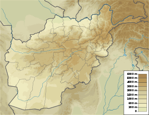
| Location | Parwan, Parwan Province, Afghanistan |
| Parent range | Hindu Kush |
Silsilah ye Koh-e Hindukush (Persian: سلسلۀ کوه هندوکش Range of the mountain of Hindukush ) is a mountain of the Hindu Kush in Parwan Province, near Baghlan, Afghanistan. It is localed near of Koh e Siah Sang, Band e Hindukush und Kotal e Hindukush. Kapisa, Parwan, Panjschir etc. belonged before 1930 to Kabul and Kabul was a large province of the Seven later nine major provinces (Herat, Junubi, Mashreqi, Kandahar, Turkestan, Balch, Badakhchan and Qataghan and Markazi = Hazarajat ). In the time of Abdul Rahman Khan of Afghanistan had 6 administrative divisions. Today, Afghanistan has 34 provinces.
References
- ↑ "Silsilah-ye Koh-e Hindukush Near Baghlan". http://www.mbendi.com/a_sndmsg/facility.asp?I=2262151. Retrieved February 23, 2014. External link in
|work=(help)
This article is issued from Wikipedia - version of the 12/7/2015. The text is available under the Creative Commons Attribution/Share Alike but additional terms may apply for the media files.