Siguiri
| Siguiri | |
|---|---|
|
A village outside Siguri | |
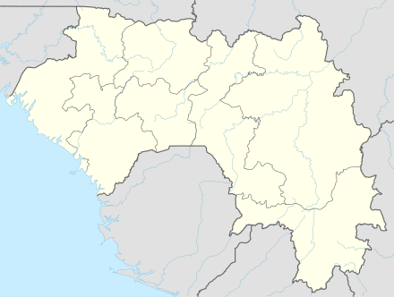
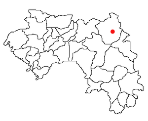
 Siguiri Location in Guinea | |
| Coordinates: 11°25′N 9°10′W / 11.417°N 9.167°WCoordinates: 11°25′N 9°10′W / 11.417°N 9.167°W | |
| Country |
|
| Region | Kankan Region |
| Population (2008) | |
| • Total | 28,319 |
Siguiri is a city in northeastern Guinea on the River Niger. It is a sub-prefecture and capital of Siguiri Prefecture in the Kankan Region.[1] Its population was estimated at 28,319 in 2008.[2]

Siguiri children
It is known for its goldsmiths and as the birthplace of Sekouba Bambino Diabaté. It also has a former French fort, built in 1888, and an airport, Siguiri Airport.
Climate
| Climate data for Siguiri | |||||||||||||
|---|---|---|---|---|---|---|---|---|---|---|---|---|---|
| Month | Jan | Feb | Mar | Apr | May | Jun | Jul | Aug | Sep | Oct | Nov | Dec | Year |
| Average high °C (°F) | 36.4 (97.5) |
38.4 (101.1) |
39.4 (102.9) |
40.0 (104) |
38.5 (101.3) |
35.7 (96.3) |
32.5 (90.5) |
31.8 (89.2) |
33.1 (91.6) |
34.7 (94.5) |
34.2 (93.6) |
35.6 (96.1) |
35.9 (96.6) |
| Daily mean °C (°F) | 24.9 (76.8) |
27.7 (81.9) |
29.9 (85.8) |
30.9 (87.6) |
29.5 (85.1) |
26.9 (80.4) |
25.4 (77.7) |
25.2 (77.4) |
25.4 (77.7) |
26.7 (80.1) |
26.3 (79.3) |
24.8 (76.6) |
27.0 (80.6) |
| Average low °C (°F) | 12.8 (55) |
15.2 (59.4) |
17.7 (63.9) |
20.0 (68) |
19.2 (66.6) |
18.5 (65.3) |
18.7 (65.7) |
18.9 (66) |
18.8 (65.8) |
18.7 (65.7) |
14.7 (58.5) |
13.0 (55.4) |
17.2 (63) |
| Average precipitation mm (inches) | 0 (0) |
2 (0.08) |
4 (0.16) |
32 (1.26) |
85 (3.35) |
160 (6.3) |
248 (9.76) |
287 (11.3) |
234 (9.21) |
95 (3.74) |
12 (0.47) |
1 (0.04) |
1,160 (45.67) |
| Average precipitation days (≥ 1.0 mm) | 0 | 0 | 1 | 3 | 8 | 12 | 16 | 18 | 16 | 8 | 0 | 0 | 82 |
| Average relative humidity (%) | 31 | 28 | 33 | 41 | 54 | 71 | 79 | 80 | 78 | 70 | 49 | 35 | 54 |
| Mean monthly sunshine hours | 268 | 244 | 206 | 237 | 236 | 227 | 198 | 174 | 204 | 240 | 261 | 258 | 2,753 |
| Source: NOAA[3] | |||||||||||||
References
- ↑ "Subprefectures of Guinea". Statoids. Retrieved April 20, 2009.
- ↑ World Gazetteer, Retrieved on June 18, 2008
- ↑ "Siguiri Climate Normals 1961–1990". National Oceanic and Atmospheric Administration. Retrieved July 6, 2015.
External links
- Spinning around the source. Slumbering stories in and around Siguiri. Article by Rachel Laget based on anthropological field research. (www.xpeditions.eu)
- Mining for Gold in Siguiri: A Close Look at a High-Risk Population - USAID
This article is issued from Wikipedia - version of the 9/5/2016. The text is available under the Creative Commons Attribution/Share Alike but additional terms may apply for the media files.


