Sankhu, Sikar
| Sankhu सांखू Sankhoo | |
|---|---|
| Village | |
 Sankhu Location in Rajasthan, India | |
| Coordinates: 27°54′05″N 75°10′26″E / 27.901294°N 75.173814°ECoordinates: 27°54′05″N 75°10′26″E / 27.901294°N 75.173814°E | |
| Country |
|
| State | Rajasthan |
| District | Sikar |
| Government | |
| • Body | Panchayat |
| • Sarpanch | [1] |
| Elevation | 424.24 m (1,391.86 ft) |
| Languages | |
| • Official | Hindi |
| Time zone | IST (UTC+5:30) |
| PIN | 332401 [2] |
| Telephone code | 91-1573 |
| Vehicle registration | RJ-23 |
| Nearest city | Nawalgarh, Mukandgarh and Laxmangarh |
| Distance from Nawalgarh | 11 kilometres (6.8 mi) (land) |
| Distance from Sikar | 42 kilometres (26 mi) (land) |
| Distance from Jhunjhunu | 33 kilometres (21 mi) (land) |
| Distance from Dundlod | 7 kilometres (4.3 mi) (land) |
| Distance from Bidsar | 5 kilometres (3.1 mi) (land) |
| Avg. summer temperature | 46-48 °C |
| Avg. winter temperature | 0-1 °C |
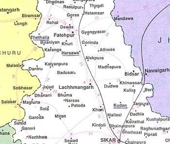
Sankhu or Sankhoo (Hindi: सांखू, Rajasthani: सांखू) is a village in the Laxmangarh administrative region of the Sikar district of Rajasthan state in India.[3] The village lies 17 kilometres (11 mi) east of Laxmangarh and 9 kilometres (5.6 mi) from Nawalgarh. The bordering villages and towns include Bidsar, Mirzwas, Dundlod, Kheri Radan, Churi Miyan and Balaran, Sikar.
Village government
Sankhu falls under Churi Miyan Panchayat.[4] The title of leader is Sarpanch.
Village economy
About 63% of the population are engaged in farming. Village agriculture is dependent on the monsoon rains although today many farms use artesian wells for irrigation.[5]
Climate
Sankhu has a hot summer, scanty rainfall, a chilly winter season and a general dryness of the air, except in the brief monsoon season. The average maximum and minimum temperatures are 28-30 and 15–16 degrees Celsius, respectively.
Transportation
Sankhu is connected by a two lane asphalt road to Laxmangarh, Mukandgarh and Nawalgarh. Nawalgarh Railway station 12 kilometres (7.5 mi) from Sankhu, which is well connected from Jaipur, Delhi and other cities.[6] Asphalt roads connect the village to surrounding villages and to Laxmangarh.
Camel carts and bullock carts were formerly the chief means of transportation and are being replaced by bicycles and other automobiles. Quite a few villagers walked to Nawalgarh and other surrounding places. In the rainy season, womenfolk bring grass on their heads for cows and buffaloes.
Education
The villagers claim to be fully literate while all children now attend school. However, many women remain illiterate, although literacy rates are improving. Many students of the village have obtained admission to pioneering engineering institutes as well as into medical colleges through various competitions run by the IIT, AIEEE etc. Besides these, other careers such as teaching, nursing, and the defense forces are also popular.
Religion
Majority of the citizenry practises Hinduism. Jats, [[meghwal ]]s, Brahmins live in the village.
Society and culture
Village society is governed solely by Hindu rituals although the younger generation has been affected by western cultural influences.
Music and entertainment
Folk songs are sung by women during weddings and on other social occasions. Menfolk sing dhamaal (traditional Holi songs). Many villagers own TVs as well as radios and satellite dishes. The sound of popular Hindi music emanating from stereos and other devices is heard from different houses during the afternoon and evening.
Games and sports
Most of the children play cricket. Some villagers also play volleyball and football. Villagers can be seen playing cards in chaupal (village common area).
Festivals
Villagers celebrate all major Hindu festivals. Some of the major festivals are Holi, Deepawali, Makar Sankranti, Raksha Bandhan, Sawan, Teej, and Gauga Peer, Gangaur.
Location
 |
Balaran, Sikar, | Churi Miyan, | Mukandgarh, | |
| Madhopura, | |
Dundlod, | ||
| ||||
| | ||||
| Kheri Radan, | Mirzwas, | Bidsar, |
Religious places
- Sankhu Hanuman Mandir
- Gogamedi Mandir
References
- ↑ Details of Sarpanch in Sikar
- ↑ "Pin code search option, India Post". indiapost.gov.in. Retrieved 2011-12-30.
- ↑ http://www.onefivenine.com/india/villages/Sikar/Lachhmangarh/Sankhu
- ↑ Delimitation Commission Report
- ↑
- ↑
External links
- List of Sarpanch elected in 2010
- List of villages and Panchayat Samiti in Rajasthan
- Official website of Sikar District