Ruacana Power Station
| Ruacana Power Station | |
|---|---|
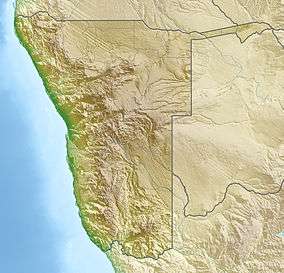
 Location of Ruacana Power Station in Namibia | |
| Country | Namibia |
| Location | Ruacana, Ruacana Constituency, Omusati Region |
| Coordinates | 17°23′40.23″S 14°13′9.22″E / 17.3945083°S 14.2192278°ECoordinates: 17°23′40.23″S 14°13′9.22″E / 17.3945083°S 14.2192278°E |
| Status | Operating |
| Commission date | 1978/2012 |
| Owner(s) | NamPower |
| Thermal power station | |
| Primary fuel | Water |
| Power generation | |
| Units operational | 3 x 80 MW (110,000 hp), 1 x 90 MW Francis-type |
| Nameplate capacity | 330 MW (440,000 hp) |
The Ruacana Power Station is a hydroelectric power plant near Ruacana in northwest Namibia, close to the Angolan border. Water for the power station is stored in a dam just above the Ruacana Falls along the Cunene River in Angola. Several dams upstream help regulate the Cunene River to help the power station operate more efficiently. The Calueque Dam in Calueque, Angola is under construction. Further up is the Gove Dam in west-central Angola and the Olushandja Dam, on the tributary, Etaka River, is in Namibia.[1] The power station is located underground near the bottom of the falls and has an installed capacity of 330 megawatts (440,000 hp).[2]
The power station is operated by Namibia's national power utility company, NamPower. The first three 80 MW Francis turbine-generators were commissioned in 1978 and the fourth Francis turbine-generator at 90 MW was commissioned on 5 April 2012.[3][4]
References
- ↑ C.Michael Hogan. 2012. Kunene River. eds. P.Saundry & C.Cleveland. Encyclopedia of Earth. National Council for Science and the Environment. Washington DC.
- ↑ "Ruacana Hydroelectric Power Station". www.afdevinfo.com. 2009-07-25. Retrieved 2009-08-01.
- ↑ "Ruacana Power Station". NamPower. Retrieved 22 January 2015.
- ↑ "Ruacana fourth turbine commissioned". The Namibian. 6 April 2012. Retrieved 22 January 2015.