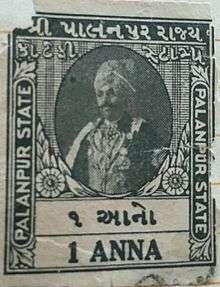
Palanpur State
| Palanpur State પાલનપુર રિયાસત पालनपुर रियासत | |||||
| Princely State of British India | |||||
| |||||
|
Flag | |||||
 | |||||
| History | |||||
| • | Established | 1370 | |||
| • | Accession to the Union of India | 1948 | |||
| Area | |||||
| • | 1940 | 1,766 km2 (682 sq mi) | |||
| Population | |||||
| • | 1940 | 315,855 | |||
| Density | 178.9 /km2 (463.2 /sq mi) | ||||
| Today part of | India | ||||
| | |||||
Palanpur State was a princely state of India during the British Raj. It was a Salute state with the Nawab of Palanpur having a hereditary salutes of 13-guns. It was the main state of the Palanpur Agency. Palanpur State became a British protectorate in 1809/17; its capital was the city of Palanpur.
Geography
The state encompassed an area of 1766 km² (682 mi²) and had a population of 222,627 in 1901. The town of Palanpur housed a population of only 8,000 people that year. The state commanded a revenue of approximately Rs.50,000/- per year.
Palanpur State was traversed by the main line of the Rajputana-Malwa Railway, and contained the British cantonment of Deesa. Wheat, rice and sugar-cane were the chief products. Watered by the Sabarmati river, the state was heavily forested in its northern end (the present-day Jessore Sanctuary) but undulating and open in the south and east. The country was on the whole somewhat hilly, being at the edge of the Aravalli Range. In 1940 Palanpur State had a population of 315,855.[1]
History
According to tradition Palanpur state was founded in 1370[2] and was ruled by the pashtun tribe of Lohani of Jhalori dynasty. 'While the earlier history of the family is who established themselves in Bihar during the twelfth century and ruled there as Sultans. Malik Khurram Khan, the founder of the Palanpur house, left Bihar and entered the service of Vishaldev of Mandore during the late fourteenth century. Appointed Governor of Songad or Jhalor, he took control of that place in the confusion that followed the death of the Mandore ruler';[3] a forebear of the family is reputed to have wed the foster-sister of the Mughal emperor Akbar and received Palanpur and surrounding areas as dowry. However, the family comes into historical prominence during the period of instability that followed the demise of Aurangzeb in the early 18th century. It was overrun soon afterwards by the Marathas; the Lohanis followed the trend of seeking recourse in the British East India Company against them and finally entered the subsidiary alliance system in 1817, along with all other neighbouring states, becoming a British protectorate. Palanpur State was dissolved in 1949.[4]
Rulers


The rulers of Palanpur State belonged to the Pathan Lohani tribe of Jalori dynasty.[5]
Diwans
- 1688 - 1704 Firuz Kamal Khan (2nd time)
- 1704 - 1708 Kamal Khan (b. 16... - d. 1708)
- 1708 - 1719 Firuz Khan II (b. ... - d. 1719)
- 1719 - 1732 Karim Dad Khan (b. ... - d. 1732)
- 1732 - 1743 Pahar Khan II (b. ... - d. 1743)
- 1743 - 1768 Bahadur Khan (b. ... - d. 1768)
- 1768 - 1781 Salim Khan I (b. ... - d. 1781)
- 1781 - 1788 Shir Khan (b. ... - d. 1788)
- 1788 - 1793 Mubariz Khan II
- 1793 - 1794 Shamshir Khan
- 1794 - 1812 Firuz Khan III (b. 17... - d. 1812)
- 1812 - 1813 Fateh Mohammad Khan (1st time) (b. 1799 - d. 1854)
- 1813 - 22 Dec 1813 Shamshir Mohammad Khan (b. ... - d. 1834) (then regent for successor to 10 Oct 1817)
- 22 Dec 1813 - 11 Jul 1854 Fateh Mohammad Khan (2nd time) (s.a.)
- 11 Jul 1854 - 28 Aug 1878 Zorawar Khan (b. 1822 - d. 1878)
- 28 Aug 1878 - 1910 Zobdat al-Molk Shir Mohammad Khan (b. 1852 - d. 1918)
Nawab Sahibs
- 1910 - 28 Sep 1918 Zobdat al-Molk Shir Mohammad Khan (s.a.)
- 28 Sep 1918 - 15 Aug 1947 Zobdat al-Molk Taley Mohammad Khan (b. 1883 - d. 1957)
See also
References
- ↑ Columbia-Lippincott Gazeteer. p. 1413.
- ↑ Princely States - Palanpur
- ↑ Royalark - Palanpur State
- ↑ Princely States of India
- ↑ States before 1947 K-W
External links
 Media related to Palanpur State at Wikimedia Commons
- Heraldry of the princely states of Gujarat
Coordinates: 24°10′N 72°26′E / 24.17°N 72.43°E
