National Register of Historic Places listings in DeKalb County, Georgia
This is a list of properties and districts in DeKalb County, Georgia that are listed on the National Register of Historic Places (NRHP).
- This National Park Service list is complete through NPS recent listings posted December 16, 2016.[1]
Current listings
| [2] | Name on the Register | Image | Date listed[3] | Location | City or town | Description |
|---|---|---|---|---|---|---|
| 1 | Robert A. Alston House | 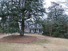 |
(#04000683) |
2420 Alston Dr., SE, off Eastlake Rd. 33°44′51″N 84°18′29″W / 33.7475°N 84.308056°W |
Atlanta | Meadow Nook, one of the few extant antebellum homes in Atlanta in its original location |
| 2 | Avondale Estates Historic District | 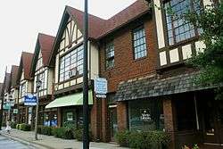 |
(#86003669) |
Roughly bounded by Avondale Rd., Lakeshore Dr., Kingstone, Clarendon, and Fairchild Dr., also Lake Avondale 33°46′19″N 84°16′04″W / 33.771944°N 84.267778°W |
Avondale Estates | |
| 3 | Blair-Rutland Building | 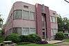 |
(#02001492) |
215 Church St. 33°46′25″N 84°17′40″W / 33.773611°N 84.294444°W |
Decatur | |
| 4 | Bond Family House | 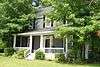 |
(#08000909) |
1226 Rock Chapel Rd. 33°45′21″N 84°04′51″W / 33.755828°N 84.080811°W |
Lithonia | |
| 5 | Briarcliff | 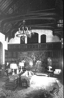 |
(#88001167) |
1260 Briarcliff Rd., NE 33°47′22″N 84°20′27″W / 33.789444°N 84.340833°W |
Atlanta | |
| 6 | Briarcliff-Normandy Apartments | 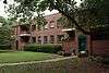 |
(#03000136) |
Roughly along Briarcliff Rd., Normandy Dr. and Chalmette Dr. 33°47′18″N 84°20′31″W / 33.788333°N 84.341944°W |
Atlanta | |
| 7 | Brookhaven Historic District | 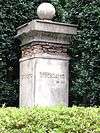 |
(#86000134) |
E of Peachtree-Dunwoody and N and E of Peachtree Rds. 33°51′49″N 84°21′02″W / 33.863611°N 84.350556°W |
Atlanta | |
| 8 | Callanwolde | 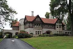 |
(#73002137) |
980 Briarcliff Rd., NE 33°46′54″N 84°20′44″W / 33.781667°N 84.345556°W |
Atlanta | |
| 9 | Cameron Court District | 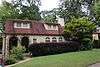 |
(#82004662) |
E of Atlanta at Braircliff Rd. 33°47′03″N 84°20′26″W / 33.784167°N 84.340556°W |
Atlanta | |
| 10 | Candler Park Historic District | 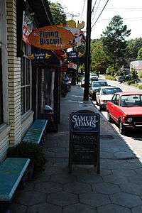 |
(#83000191) |
Roughly bounded by Moreland, DeKalb, McLendon, and Harold Aves., Mathews St., and Clifton Terr. 33°45′56″N 84°20′22″W / 33.765556°N 84.339444°W |
Atlanta | Historic district encompasses the Candler Park neighborhood and part of the Lake Claire neighborhood. |
| 11 | Cheek-Spruill House | .jpg) |
(#00000639) |
5455 Chamblee-Dunwoody Rd. 33°56′53″N 84°20′03″W / 33.948056°N 84.334167°W |
Dunwoody | |
| 12 | Decatur Cemetery | 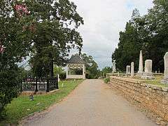 |
(#97000459) |
229 Bell St. 33°46′56″N 84°17′32″W / 33.782222°N 84.292222°W |
Decatur | |
| 13 | Decatur Downtown Historic District | 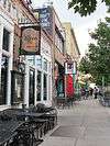 |
(#12000281) |
Roughly bounded by N. McDonough St., E. Howard Ave., Hillyer, & Commercial Sts., & E. Ponce De Leon Ave. 33°46′25″N 84°17′37″W / 33.773538°N 84.293729°W |
Decatur | |
| 14 | Decatur Heights-Glennwood Estates-Sycamore Street Historic District | Upload image | (#16000382) |
Roughly Bounded by Forkner Dr., Sycamore Dr., Sycamore St., and the E. boundary of Decatur Cemetery 33°46′57″N 84°17′16″W / 33.782567°N 84.287774°W |
Decatur | |
| 15 | Decatur Waterworks | 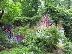 |
(#06000123) |
1400 McConnell Dr., Mason Mill Park 33°48′28″N 84°18′08″W / 33.807778°N 84.302222°W |
Decatur | |
| 16 | DeKalb Avenue-Clifton Road Archeological Site | Upload image | (#78003094) |
Address Restricted |
Atlanta | |
| 17 | Donaldson-Bannister House and Cemetery | 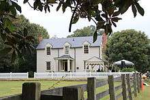 |
(#09000585) |
4831 Chamblee-Dunwoody Rd. 33°55′58″N 84°19′02″W / 33.932722°N 84.317253°W |
Dunwoody | |
| 18 | Druid Hills Historic District | 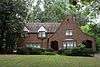 |
(#79000715) |
U.S. 29 33°46′44″N 84°19′47″W / 33.778889°N 84.329722°W |
Atlanta | |
| 19 | Druid Hills Parks and Parkways | Upload image | (#75002070) |
Both sides of Ponce de Leon Ave. between Briarcliff Rd. and the Seaboard Coast Line RR tracks 33°46′24″N 84°19′58″W / 33.773333°N 84.332778°W |
Atlanta | Within or near Druid Hills, Georgia, a CDP |
| 20 | Emory Grove Historic District | 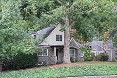 |
(#00000300) |
Centered on N. Decatur Rd. bet. the CSX RR and the University Park-Emory Highlands-Emory Estates HD 33°47′38″N 84°18′54″W / 33.793889°N 84.315°W |
Decatur | |
| 21 | Emory University District | 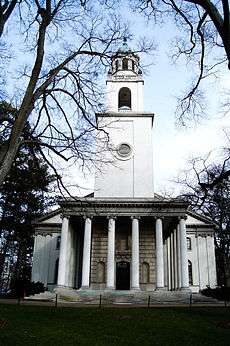 |
(#75002071) |
N. Decatur Rd. 33°47′28″N 84°19′12″W / 33.791111°N 84.32°W |
Atlanta | |
| 22 | Neville and Helen Farmer Lustron House | 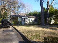 |
(#96000211) |
513 Drexel Ave. 33°46′17″N 84°18′31″W / 33.771389°N 84.308611°W |
Decatur | |
| 23 | Dr. Luther C. and Lucy Hurt Fischer House | 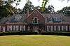 |
(#11000331) |
4146 Chamblee Dunwoody Rd. 33°54′48″N 84°18′46″W / 33.913333°N 84.312778°W |
Atlanta | |
| 24 | Mary Gay House | 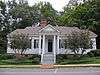 |
(#75002072) |
716 W. Trinity Pl. 33°46′34″N 84°17′54″W / 33.776111°N 84.298333°W |
Decatur | |
| 25 | William T. Gentry House | 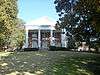 |
(#85000935) |
132 E. Lake Dr., SE 33°44′53″N 84°18′04″W / 33.748056°N 84.301111°W |
Atlanta | |
| 26 | Cora Beck Hampton Schoolhouse and House | 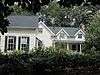 |
(#92000366) |
213 Hillyer Pl. 33°46′25″N 84°17′24″W / 33.773611°N 84.29°W |
Decatur | |
| 27 | Inman Park-Moreland Historic District | 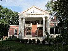 |
(#86001209) |
Roughly bounded by N. Highland, Seminole and Euclid, DeKalb, and Degress and Nashita Aves. Boundary increase (listed October 13, 2003, refnum 03001016): Roughly bounded by Cleburne, Moreland and DeKalb Aves., Battery Place and a city park 33°45′50″N 84°21′07″W / 33.763889°N 84.351944°W |
Atlanta | A historic district that spans the DeKalb County-Fulton County border |
| 28 | Kirkwood Historic District | 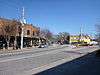 |
(#09000749) |
Roughly bounded by Memorial Dr., Montgomery St., Hosea Williams Dr., Rogers St., CSX RR., & city limits 33°45′02″N 84°20′02″W / 33.750672°N 84.334017°W |
Atlanta | |
| 29 | Kirkwood School | Upload image | (#02001045) |
138 Kirkwood Rd. 33°45′27″N 84°19′20″W / 33.7575°N 84.322222°W |
Atlanta | |
| 30 | Klondike Historic District | Upload image | (#07001001) |
Klondike and S. Goddard Rds. 33°39′06″N 84°07′30″W / 33.651544°N 84.125069°W |
Klondike | |
| 31 | Agnes Lee Chapter House of the United Daughters of the Confederacy | 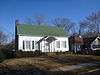 |
(#85001621) |
120 Avery St. 33°46′15″N 84°17′25″W / 33.770833°N 84.290278°W |
Decatur | |
| 32 | Lithonia Historic District | Upload image | (#16000639) |
Centered on jct. of CSX RR. & Main St. 33°42′44″N 84°06′20″W / 33.712132°N 84.105643°W |
Lithonia | |
| 33 | McDonough-Adams-Kings Highway Historic District | Upload image | (#13000965) |
Bounded by W. College Ave., Kings Hwy., Oakview Rd. & McDonough St. 33°45′56″N 84°17′53″W / 33.765627°N 84.29816°W |
Decatur | |
| 34 | Northwoods Historic District | 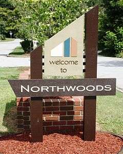 |
(#14000322) |
Roughly bounded by Buford Hwy., Chamblee-Tucker & Shallowford Rds., I-85 & I-285 33°53′23″N 84°16′34″W / 33.889811°N 84.276045°W |
Doraville | Large, intact example of mid-century and contemporary architecture. Developed to provide affordable homes for middle-class workers in nearby industries. Includes a mix of uses as a planned use development. |
| 35 | Oglethorpe University Historic District | 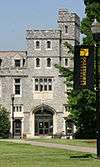 |
(#94000779) |
4484 Peachtree Rd. NE. 33°52′26″N 84°19′55″W / 33.873889°N 84.331944°W |
Atlanta | |
| 36 | Old DeKalb County Courthouse |  |
(#71001016) |
Court Sq. 33°46′30″N 84°17′48″W / 33.775°N 84.296667°W |
Decatur | |
| 37 | William and Minnie Pearce House | 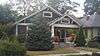 |
(#11001055) |
125 Madison Ave. 33°45′37″N 84°18′43″W / 33.760153°N 84.312033°W |
Decatur | |
| 38 | Ponce de Leon Terrace-Ponce de Leon Heights-Clairmont Estates Historic District | 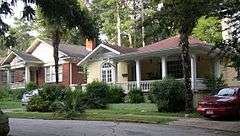 |
(#11000774) |
Roughly bounded by Ponce de Leon Pl., Scott Blvd., Nelson Ferry Rd., Ponce de Leon & Clairmont Aves. 33°46′37″N 84°17′26″W / 33.776944°N 84.290556°W |
Decatur | Expansion in 2014, renamed from Ponce de Leon Court Historic District |
| 39 | Pythagoras Lodge No. 41, Free and Accepted Masons | 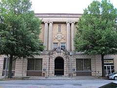 |
(#82004664) |
136 E. Ponce de Leon Ave. 33°46′32″N 84°17′47″W / 33.775556°N 84.296389°W |
Decatur | |
| 40 | Scottish Rite Hospital for Crippled Children | 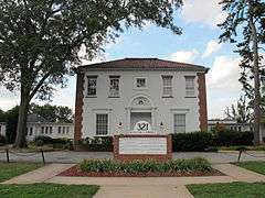 |
(#04000929) |
321 W. Hill St. 33°45′36″N 84°18′09″W / 33.76°N 84.3025°W |
Decatur | |
| 41 | Scottish Rite Hospital for Crippled Children |  |
(#82004665) |
321 W. Hill St. 33°45′36″N 84°18′09″W / 33.76°N 84.3025°W |
Decatur | |
| 42 | The Seminary | Upload image | (#78003097) |
6886 Main St. 33°42′36″N 84°06′34″W / 33.7101°N 84.1094°W |
Lithonia | |
| 43 | Smith-Benning House | 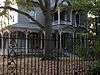 |
(#82004663) |
520 Oakdale Rd., NE 33°46′05″N 84°20′32″W / 33.768056°N 84.342222°W |
Atlanta | |
| 44 | Soapstone Ridge | Upload image | (#73002138) |
Address Restricted |
Atlanta | |
| 45 | South Candler Street-Agnes Scott College Historic District | 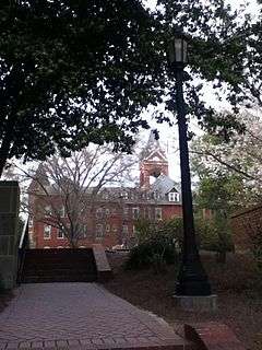 |
(#94000787) |
Roughly bounded by E. College, S. McDonough, S. Candler, E. Hill and E. Davis Sts. 33°45′54″N 84°17′37″W / 33.765°N 84.293611°W |
Decatur | |
| 46 | Steele-Cobb House | 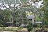 |
(#82004666) |
2632 Fox Hills Dr. 33°48′15″N 84°16′52″W / 33.804167°N 84.281111°W |
Decatur | |
| 47 | Stone Mountain Historic District | Upload image | (#00001476) |
Roughly bounded by Stone Mountain Cemetery, Stone Mountain Memorial Park, Lucie St. CSX RR, VFW Dr., and Stone Mtn City 33°48′27″N 84°10′15″W / 33.8075°N 84.170833°W |
Stone Mountain | |
| 48 | Swanton House | 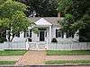 |
(#78000977) |
720 Swanton Way 33°46′19″N 84°18′19″W / 33.771944°N 84.305278°W |
Decatur | |
| 49 | United States Post Office-Decatur, Georgia | 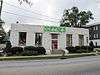 |
(#00000753) |
141 Trinity Place 33°46′35″N 84°18′13″W / 33.776389°N 84.303611°W |
Decatur | |
| 50 | University Park-Emory Highlands-Emory Estates Historic District | Upload image | (#97001638) |
Roughly bounded by N. Decatur Rd., Durand Dr., Peavine Cr., and the Druid Hills Historic District 33°47′24″N 84°18′57″W / 33.79°N 84.315833°W |
Decatur | |
| 51 | Villa MiraFlores | 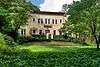 |
(#15000964) |
1214 Villa Dr. 33°47′26″N 84°20′24″W / 33.790498°N 84.340093°W |
Atlanta | |
| 52 | Winnona Park Historic District | 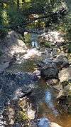 |
(#02000565) |
Roughly bounded by E. College Ave., Avery St., S. Columbia Dr., and Mimosa Dr. 33°46′02″N 84°17′17″W / 33.767222°N 84.288056°W |
Decatur | |
| 53 | Zuber-Jarrell House | 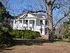 |
(#97001194) |
810 Flat Shoals Ave., SE 33°44′03″N 84°20′17″W / 33.734167°N 84.338056°W |
Atlanta |
Former listing
| [2] | Name on the Register | Image | Date listed | Date removed | Location | City or town | Summary |
|---|---|---|---|---|---|---|---|
| 1 | Russell and Nelle Pines Lustron House | Upload image | (#96000207) | 2081 Sylvania Dr. 33°48′50″N 84°18′16″W / 33.813889°N 84.304444°W |
Decatur |
References
- ↑ "National Register of Historic Places: Weekly List Actions". National Park Service, United States Department of the Interior. Retrieved on December 16, 2016.
- 1 2 Numbers represent an ordering by significant words. Various colorings, defined here, differentiate National Historic Landmarks and historic districts from other NRHP buildings, structures, sites or objects.
- ↑ The eight-digit number below each date is the number assigned to each location in the National Register Information System database, which can be viewed by clicking the number.
| Wikimedia Commons has media related to National Register of Historic Places in DeKalb County, Georgia. |
| Topics | |
|---|---|
| Lists by states |
|
| Lists by insular areas | |
| Lists by associated states | |
| Other areas | |
| |
This article is issued from Wikipedia - version of the 10/9/2016. The text is available under the Creative Commons Attribution/Share Alike but additional terms may apply for the media files.