National Register of Historic Places listings in Cobb County, Georgia
This is a list of properties and districts in Cobb County, Georgia that are listed on the National Register of Historic Places (NRHP).
- This National Park Service list is complete through NPS recent listings posted December 2, 2016.[1]
Current listings
| [2] | Name on the Register | Image | Date listed[3] | Location | City or town | Description |
|---|---|---|---|---|---|---|
| 1 | Acworth Downtown Historic District | 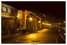 |
(#06000286) |
Roughly bounded by Southside Dr., Federal and Lemon Sts, and Senator Richard B. Russell Ave. 34°03′58″N 84°40′44″W / 34.066111°N 84.678889°W |
Acworth | |
| 2 | Atlanta-Frasier Street Historic District | 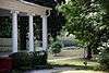 |
(#95000737) |
Atlanta and Frasier Sts. between GA 120 Loop and Dixie Ave. 33°56′43″N 84°32′47″W / 33.945278°N 84.546389°W |
Marietta | |
| 3 | J. C. Bankston Rock House | Upload image | (#94001387) |
901 Industrial Dr., Dobbins Air Reserve Base 33°55′31″N 84°31′37″W / 33.925278°N 84.526944°W |
Marietta | |
| 4 | Bethel AME Church | 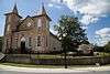 |
(#02000453) |
4683 Bell St. 34°04′07″N 84°40′41″W / 34.068611°N 84.678056°W |
Acworth | |
| 5 | Big Shanty Village Historic District | 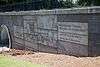 |
(#80000995) |
Park Ave., Whitfield Pl., Main, Harris, Lewis, and Cherokee Sts. 34°01′27″N 84°36′54″W / 34.024167°N 84.615°W |
Kennesaw | |
| 6 | Braswell-Carnes House | 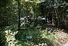 |
(#84000974) |
2430 Burnt Hickory Rd., NW 33°58′01″N 84°37′24″W / 33.966944°N 84.623333°W |
Marietta | |
| 7 | Arnoldus Brumby House | 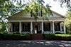 |
(#77000417) |
472 Powder Springs St. 33°56′37″N 84°33′08″W / 33.943611°N 84.552222°W |
Marietta | |
| 8 | Hiram Butler House | 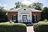 |
(#94001637) |
2382 Pine Mountain Rd., NW. 34°00′35″N 84°37′47″W / 34.009722°N 84.629722°W |
Kennesaw | |
| 9 | Butner-Mctyre General Store | 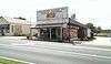 |
(#05001593) |
4455 Marietta St. 33°51′32″N 84°41′04″W / 33.858889°N 84.684444°W |
Powder Springs | |
| 10 | Camp McDonald | 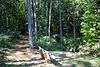 |
(#80000996) |
Off U.S. 41 34°01′18″N 84°37′05″W / 34.021667°N 84.618056°W |
Kennesaw | |
| 11 | J. H. Carmichael Farm and General Store | Upload image | (#80001002) |
SE of Smyrna at 501 Log Cabin Rd. 33°50′36″N 84°29′02″W / 33.843333°N 84.483889°W |
Smyrna | |
| 12 | Israel Causey House | 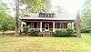 |
(#75000584) |
5909 Maxham Rd. 33°48′36″N 84°37′05″W / 33.81°N 84.618056°W |
Austell | |
| 13 | Andrew J. Cheney House | 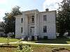 |
(#79000713) |
SW of Marietta at Powder Springs and Bankstone Rds. 33°53′06″N 84°37′07″W / 33.885°N 84.618611°W |
Marietta | |
| 14 | Cherokee Street Historic District | 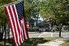 |
(#80000997) |
Cherokee St. 34°01′34″N 84°36′36″W / 34.026111°N 84.61°W |
Kennesaw | |
| 15 | Church Street-Cherokee Street Historic District | Upload image | (#85003059) |
Roughly bounded by Margaret Ave. and Chicopee Dr., DeSoto Ave., Montgomery and Brumby, and Campbell Hill Sts. 33°57′44″N 84°32′53″W / 33.962222°N 84.548056°W |
Marietta | |
| 16 | Clarkdale Historic District | 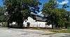 |
(#87002134) |
Powder Springs-Austell Rd. 33°49′48″N 84°39′15″W / 33.83°N 84.654167°W |
Clarkdale | |
| 17 | Collins Avenue Historic District | 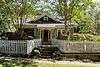 |
(#01000707) |
Collins Ave. 34°04′00″N 84°41′10″W / 34.066667°N 84.686111°W |
Acworth | |
| 18 | Stephen D. Cowen House | 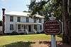 |
(#02001299) |
4940 Cowen Rd. 34°04′24″N 84°39′18″W / 34.073333°N 84.655°W |
Acworth | |
| 19 | Frobel-Knight-Borders House | Upload image | (#95000901) |
1001 Allgood Rd. 33°58′31″N 84°31′25″W / 33.975278°N 84.523611°W |
Marietta | |
| 20 | The General | 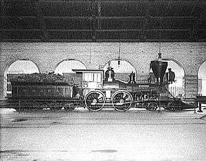 |
(#73000617) |
Big Shanty Museum of Cherokee St. 34°01′25″N 84°36′52″W / 34.023611°N 84.614444°W |
Kennesaw | Subject of the Great Locomotive Chase of the American Civil War |
| 21 | Gilgal Church Battle Site | 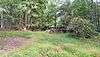 |
(#75000585) |
9 mi (14 km) W of Marietta on Sandtown Rd. 33°58′18″N 84°39′54″W / 33.971667°N 84.665°W |
Marietta | |
| 22 | Glover-McLeod-Garrison House | Upload image | (#77000418) |
250 Garrison Rd., SE 33°56′07″N 84°32′51″W / 33.935278°N 84.5475°W |
Marietta | |
| 23 | Johnston's RiverLine | Upload image | (#73000618) |
SE of Mableton off U.S. 78 at Chattachooche River 33°47′31″N 84°31′23″W / 33.791944°N 84.523056°W |
Mableton | Boundary increase May 18, 2015. |
| 24 | Kennesaw Mountain National Battlefield Park | 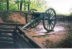 |
(#66000063) |
2 mi (3.2 km) W of Marietta 33°56′59″N 84°35′37″W / 33.949722°N 84.593611°W |
Marietta | administered by the National Park Service |
| 25 | Lake Acworth Beach and Bathhouse | 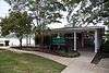 |
(#09001202) |
Lakeshore Dr. 34°03′39″N 84°40′56″W / 34.060706°N 84.682208°W |
Acworth | |
| 26 | Robert Mable House and Cemetery | 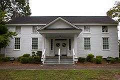 |
(#87001345) |
5239 Floyd Rd. 33°49′37″N 84°34′25″W / 33.826944°N 84.573611°W |
Mableton | |
| 27 | Marietta National Cemetery | 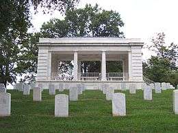 |
(#98001170) |
500 Washington Ave. 33°57′04″N 84°32′27″W / 33.951111°N 84.540833°W |
Marietta | |
| 28 | William Gibbs McAdoo House | 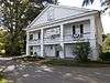 |
(#78000975) |
SW of Marietta on GA 5 33°54′28″N 84°36′15″W / 33.907778°N 84.604167°W |
Marietta | |
| 29 | Midway Presbyterian Church and Cemetery | 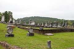 |
(#86003526) |
4635 Dallas Hwy./GA 120 SW 33°56′37″N 84°41′15″W / 33.943611°N 84.6875°W |
Powder Springs | |
| 30 | Tarleton Moore House | 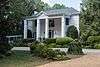 |
(#06000453) |
4784 Northside Dr. 34°04′12″N 84°41′12″W / 34.07°N 84.686667°W |
Acworth | |
| 31 | North Main Street Historic District | 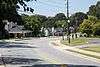 |
(#80000999) |
N. Main St. 34°01′33″N 84°37′14″W / 34.025833°N 84.620556°W |
Kennesaw | |
| 32 | Northwest Marietta Historic District | Upload image | (#75000586) |
Roughly bounded by RR tracks, NW along Kennesaw Ave., McDonald St., and Whitlock Ave. 33°57′36″N 84°33′22″W / 33.96°N 84.556111°W |
Marietta | |
| 33 | Solomon and Penelopy Pace House | Upload image | (#09000325) |
3057 Paces Mill Rd. 33°52′00″N 84°27′53″W / 33.866692°N 84.464678°W |
Vinings | |
| 34 | George A. Power House | 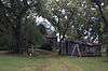 |
(#01000720) |
Hyde Rd. 33°57′38″N 84°23′42″W / 33.960556°N 84.395°W |
Marietta | |
| 35 | John W. Rice Summer Cottage | 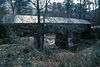 |
(#83000189) |
254 Concord Rd. 33°50′59″N 84°33′33″W / 33.849722°N 84.559167°W |
Smyrna | |
| 36 | Riverview Carousel at Six Flags Over Georgia | 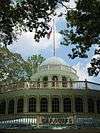 |
(#94001639) |
7561 Six Flags Pkwy. 33°46′00″N 84°33′03″W / 33.766667°N 84.550833°W |
Austell | A carousel at Six Flags Over Georgia |
| 37 | William and Hannah Root House |  |
(#14000061) |
145 Denmead St., NW. 33°57′16″N 84°33′07″W / 33.9545515°N 84.5518412°W |
Marietta | |
| 38 | Ruff's Mill and Concord Covered Bridge | 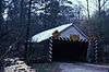 |
(#80001001) |
10 Concord Rd., SW 33°50′56″N 84°33′30″W / 33.848889°N 84.558333°W |
Smyrna | |
| 39 | Smith-Manning House |  |
(#14000969) |
360 Manning Rd. 33°56′38″N 84°34′56″W / 33.943866°N 84.582099°W |
Marietta | |
| 40 | Sope Creek Ruins | 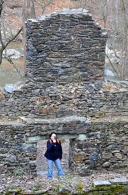 |
(#73000619) |
Address Restricted |
Marietta | |
| 41 | Summers Street Historic District |  |
(#80001000) |
Summers St. 34°01′10″N 84°36′49″W / 34.019444°N 84.613611°W |
Kennesaw | |
| 42 | Taylor-Brawner House and Brawner Sanitarium | Upload image | (#12000149) |
3180 Atlanta Rd 33°52′33″N 84°30′16″W / 33.875827°N 84.504561°W |
Smyrna | |
| 43 | Union Field Fortifications at Henderson Road | Upload image | (#15000223) |
6000 Henderson Rd., SE. 33°48′24″N 84°31′21″W / 33.8066°N 84.5225°W |
Mableton vicinity | |
| 44 | Washington Avenue Historic District | Upload image | (#89001102) |
Roughly bounded by Lawrence St., Rigsby St., Washington Ave., and Haynes St. 33°57′09″N 84°32′36″W / 33.9525°N 84.543333°W |
Marietta | |
| 45 | Whitlock Avenue Historic District | Upload image | (#89001218) |
Roughly bounded by McCord St., Oakmont St., Whitlock Ave., Powder Springs Rd., Trammel St., Maxwell Ave., and Hazel St. 33°57′04″N 84°33′26″W / 33.951111°N 84.557222°W |
Marietta | |
| 46 | Zion Baptist Church |  |
(#90001026) |
149 Haynes St. 33°57′18″N 84°32′51″W / 33.955°N 84.5475°W |
Marietta |
Former listing
| [2] | Name on the Register | Image | Date listed | Date removed | Location | City or town | Summary |
|---|---|---|---|---|---|---|---|
| 1 | John S. Gibson Farmhouse | Upload image | (#80000998) | 3370 Cherokee St. 34°02′07″N 84°36′18″W / 34.0353°N 84.605°W |
Kennesaw |
References
- ↑ "National Register of Historic Places: Weekly List Actions". National Park Service, United States Department of the Interior. Retrieved on December 2, 2016.
- 1 2 Numbers represent an ordering by significant words. Various colorings, defined here, differentiate National Historic Landmarks and historic districts from other NRHP buildings, structures, sites or objects.
- ↑ The eight-digit number below each date is the number assigned to each location in the National Register Information System database, which can be viewed by clicking the number.
| Wikimedia Commons has media related to National Register of Historic Places in Cobb County, Georgia. |
This article is issued from Wikipedia - version of the 9/23/2016. The text is available under the Creative Commons Attribution/Share Alike but additional terms may apply for the media files.