Nakanoshima (Kagoshima)
| Native name: <span class="nickname" ">Japanese: 中之島 | |
|---|---|
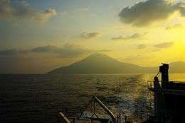
 Dawn at Nakanoshima (May 2007) | |
 | |
| Geography | |
| Location | East China Sea |
| Coordinates | 29°51′0″N 129°52′12″E / 29.85000°N 129.87000°E |
| Archipelago | Tokara Islands |
| Area | 34.47 km2 (13.31 sq mi) |
| Length | 9 km (5.6 mi) |
| Width | 5 km (3.1 mi) |
| Coastline | 31.8 km (19.76 mi) |
| Highest elevation | 979 m (3,212 ft) |
| Highest point | Otake |
| Administration | |
|
Japan | |
| Kagoshima Prefecture | |
| Demographics | |
| Population | 167 (2004) |
| Pop. density | 4.84 /km2 (12.54 /sq mi) |
| Ethnic groups | Japanese |
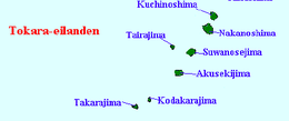
Nakanoshima (中之島), is a volcanic island located in the Tokara Islands, part of the Kagoshima Prefecture, Japan. It is the largest and most populous island of the islands in Toshima village.[1] The island, 34.47 km² in area, had 167 inhabitants as of 2005.[2] The island has no airport, and access is normally by ferry to the city of Kagoshima on the mainland, seven hours away. The islanders are dependent mainly on agriculture, fishing and seasonal tourism. The island's attractions include hot springs, a lighthouse, an observatory and a museum of local history and folklore.
Geography
Nakanoshima is the largest island in the Tokara archipelago, with dimensions of 9 kilometres (5.6 mi) by 5 kilometres (3.1 mi). It is located 150 kilometres (81 nmi) south from Kyushu.
The northern end of the island is dominated by Otake (御岳 O-take),[3] an active volcano which last erupted in 1914. The mountain was mined for sulphur until 1944. With a height of 979 metres (3,212 ft) above sea level, the mountain is the exposed cone of an active stratovolcano arising from the ocean floor.
A small plateau separates Otake from eroded remains of another volcano.[4] The local climate is classified as subtropical, with a rainy season from May through September.
History
Nakanoshima has been populated for several thousand years. The island was once part of the Ryukyu Kingdom. During the Edo period, Nakanoshima was part of Satsuma Domain and was administered as part of Kawabe District. In 1896, the island was transferred to the administrative control of Ōshima District, Kagoshima, and from 1911 was administered as part of the village of Toshima, Kagoshima. From 1946-1952, the island was administered by the United States as part of the Provisional Government of Northern Ryukyu Islands. Until 1956, the village hall for Toshima Village was located on Nakanoshima. It was then relocated to within the city of Kagoshima.
In early 1950, a small herd of wild horses in the south of the island were identified as a separate species, named the Tokara pony. This species only occurs on Nakanoshima and is believed to have been brought to the island around 1890 from Kikaijima, an island near Amami Ōshima. After World War II, the species almost became extinct, and survivors were removed to a ranch operated by Kagoshima University on mainland Kagoshima for protection . Today, some have been reintroduced to Nakanoshima.[5]
See also
References
- National Geospatial Intelligence Agency (NGIA). Prostar Sailing Directions 2005 Japan Enroute. Prostar Publications (2005). ISBN 1577856511
External links
| Wikimedia Commons has media related to Nakanosima, Kagoshima. |
Notes
- ↑ 中之島(ナカノシマ). Official Website of Toshima Village (in Japanese). Toshima Village, Kagoshima. Retrieved 2009-04-24.
- ↑ "人口" (PDF). Population Statistics. Tokara Village, Kagoshima. 2004-03-31. Retrieved 2009-04-24.
- ↑ "NAKANO-SHIMA". Quaternary Volcanoes in Japan. Geological Survey of Japan, AIST. 2006. Retrieved 2009-04-24.
- ↑ "Nakano-shima". Global Volcanism Program. Smithsonian National Museum of Natural History. Retrieved 2009-04-24.
- ↑ Oklahoma State University - Breeds of Livestock - Tokara Horse