Mount Q'umir Qucha (Bolivia)
This article is about the mountain in Bolivia. For other uses, see Q'umir Qucha.
| Q'umir Qucha | |
|---|---|
 Q'umir Qucha | |
| Highest point | |
| Elevation | 5,020 m (16,470 ft) |
| Coordinates | 19°47′11″S 65°39′59″W / 19.78639°S 65.66639°WCoordinates: 19°47′11″S 65°39′59″W / 19.78639°S 65.66639°W |
| Geography | |
| Location |
Bolivia Potosí Department |
| Parent range | Andes, Anta Q'awa mountain range |
Q'umir Qucha (Quechua q'umir green, qucha lake, "green lake", other spellings Comer Cocha, Khomer Khocha) is a mountain in the Bolivian Andes, about 5,020 m (16,470 ft) high.[1] It is located in the Anta Q'awa mountain range, the southern part of the Potosí mountain range. Q'umir Qucha is situated south-east of Potosí in the Potosí Department, in the north of the José María Linares Province. Q'umir Qucha lies north-west of the mountain Khunurana and the Yana Urqu group and south-west of the mountain Anta Q'awa. The small lake Q'umir Qucha lies at its feet, east of it. The larger lake south of Q'umir Qucha is Santa Catalina.[2]
References
Capital: Potosí | ||
| Provinces | 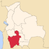 | |
| Municipalities (and seats) |
| |
This article is issued from Wikipedia - version of the 12/6/2015. The text is available under the Creative Commons Attribution/Share Alike but additional terms may apply for the media files.