Mount Guiwan
| Mount Guiwan | |
|---|---|
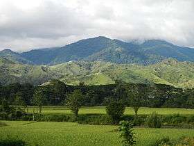 The mountain as seen from the Alfonso Castañeda Municipal Hall | |
| Highest point | |
| Coordinates | 15°56′43″N 121°17′11″E / 15.94528°N 121.28639°ECoordinates: 15°56′43″N 121°17′11″E / 15.94528°N 121.28639°E |
| Geography | |
.svg.png) Mount Guiwan Location within the Philippines | |
| Country | Philippines |
| Region | Cagayan Valley |
| Province | Nueva Vizcaya |
| Municipality | Alfonso Castañeda |
| Parent range | Sierra Madre |
Mount Guiwan is a mountain in the Sierra Madre range in Alfonso Castañeda, Nueva Vizcaya, Philippines. It is probably the highest peak of Sierra Madre mountain range with a height of 1,915 metres (6,283 ft) above sea level according to NAMRIA topographic map. Bugkalots have long established trails which they use when hunting.
No scientific survey has yet been conducted in the area but recent expedition to the mountain by the Nueva Vizcaya Mountaineering Society, Inc. led by NVMSI President Raymond Zamora in September 2012 proved that civets, monkeys, and other wildlife still thrive in the forests of Mt. Guiwan. Its streams still have abundant eels. A waterfalls estimated to be one km long from its first drop down to the bottom flows from near the summit of the mountain.
In October 2012, Zamora and another climber, with guides from the Bugkalot tribe, returned and successfully summitted the mountain passing through a mossy forest and a route they called Zamora trail. It took them three days to hike from the jump-off point in Alfonso Castaneda.
Underneath Mt. Guiwan, a tunnel that diverts water from the Casecnan River in Brgy. Pelaway to Pantabangan Dam in Nueva Ecija was constructed by the Casecnan Multi-Purpose Transbasin and Power project contracted by California Energy.
See also
| Wikimedia Commons has media related to Mount Guiwan. |