Moretonhampstead railway station
| Moretonhampstead Station | |
|---|---|
|
Moretonhampstead station circa 1909 | |
| Location | |
| Place | Moretonhampstead |
| Area | Teignbridge |
| Operations | |
| Post-grouping | Great Western Railway |
| Platforms | 1 |
| History | |
| 4 July 1866 | Opened[1] |
| 2 March 1959 | Closed to passengers[1] |
| 1964 | Line closed to goods traffic |
| Disused railway stations in the United Kingdom | |
|
Closed railway stations in Britain A B C D–F G H–J K–L M–O P–R S T–V W–Z | |
|
| |
Moretonhampstead and South Devon Railway | |
|---|---|
Legend
|
Moretonhampstead railway station was the terminus of the Moretonhampstead and South Devon Railway at Moretonhampstead, Devon, England.
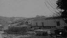
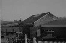
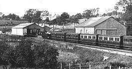
The station was situated on the south side of the town by the road to Bovey Tracey. The platform was 300 feet long and mostly covered by a wooden train shed. Beyond the train shed was a short platform with cattle pens.
South of the station was a goods shed and engine shed. The signal box was unusually built onto the side of the engine shed.


In 1929 the Great Western Railway, which now owned the line, opened the Manor House Hotel just outside Moretonhampstead. Set in 193 acres (0.78 km2), it boasted a golf course and also attracted holidaymakers to visit Dartmoor.
After the railway closed to passengers on 28 February 1959, regular goods trains continued until 6 April 1964, although British Railways continued to use the station as a base for its road goods services until the end of the year. The goods and engine sheds for many years continued to be used by a commercial road haulage business.
| Preceding station | Disused railways | Following station | ||
|---|---|---|---|---|
| Lusteigh | Newton Abbot to Moretonhampstead Great Western Railway |
Terminus | ||
References
- Notes
- Sources
- Beck, Keith; Copsey, John (1990). The Great Western in South Devon. Didcot: Wild Swan Publications. ISBN 978-0-906867-90-7.
- Butt, R (1995). The Directory of Railway Stations: details every public and private passenger station, halt, platform and stopping place, past and present (1st ed.). Sparkford: Patrick Stephens Ltd. ISBN 1-8526-0508-1.
- Jenkins, S C; Pomroy, L J (1989). The Moretonhampstead and South Devon Railway. Oxford: Oakwood Press. ISBN 978-0-85361-389-3.
Coordinates: 50°39′28″N 3°45′38″W / 50.6577°N 3.7606°W
