Melville Bay
| Melville Bay Qimusseriarsuaq | |
|---|---|
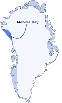 Location of Melville Bay in Northwest Greenland | |
| Location | Arctic |
| Coordinates | 75°45′N 61°00′W / 75.750°N 61.000°WCoordinates: 75°45′N 61°00′W / 75.750°N 61.000°W |
| Ocean/sea sources | Baffin Bay |
| Basin countries | Greenland |
| Max. length | 300 km (190 mi) |
| Max. width | 100 km (62 mi) |
| Frozen | Between October and late July |
Melville Bay (Greenlandic: Qimusseriarsuaq), is a large bay off the coast of northwestern Greenland. Located to the north of the Upernavik Archipelago, it opens to the south-west into Baffin Bay. Its Kalaallisut name, Qimusseriarsuaq, means "the great dog sledding place".[1]
Geography
Melville Bay is delimited by Cape York in the northeast and Wilcox Head, the western promontory on Kiatassuaq Island in the south.[2] Some islands of the Upernavik Archipelago are in the Melville Bay area, such as Kiatassuaq Island, Kullorsuaq Island, Saarlia Island and Saqqarlersuaq Island.
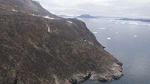 Aerial view of Wilcox Head |
History
In the 19th century Melville Bay was an important place for whaling fleets.
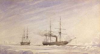 View of two ships in Melville Bay by Edward Augustus Inglefield. |
_-_Hunting_by_steam_in_Melville_Bay%2C_the_party_after_a_day's_sport_killing_six_Polar_bears_within_the_t..._-_Google_Art_Project.jpg) 1869 photograph of a steamer and a party of hunters in Melville Bay. |
See also
References
- ↑ "Melville Bay". Danish Polar Center. Retrieved 2008-05-29.
- ↑ Upernavik Avannarleq, Saga Map, Tage Schjøtt, 1992
External links
 Media related to Melville Bay at Wikimedia Commons
- Satellite image. Source: WikiMapia
This article is issued from Wikipedia - version of the 8/13/2016. The text is available under the Creative Commons Attribution/Share Alike but additional terms may apply for the media files.