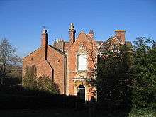
Loxley, Warwickshire

Loxley, Warwickshire is a village and civil parish near Stratford-upon-Avon, Warwickshire, England. The population taken at the 2011 census was 399.[1] Loxley gave its name to a hall of residence at the University of Warwick, within the Westwood campus.
The settlement is first mentioned in the late 8th century, as king Offa of Mercia gave it to the Cathedral at Worcester. The Domesday Book records the community as including a resident priest. Ownership later passed to Kenilworth Abbey. The parish church was consecrated in 1286, built on the foundation of the earlier Anglo-Saxon church. In 1538, Loxley manor was owned by Robert Croft, later passing to the Underhill family and in 1664 to Edward Nash of East Greenwich. A village school was built in the 1830s. In the 1850s, the former parish lands were divided between seven farms. In 1910 the village had 59 households. As of 2011, there were 150 households with a total population of 399.[2]
While the Robin Hood is mostly associated with Loxley, South Yorkshire, Graham Phillips and Martin Keatman in their Robin Hood The Man Behind The Myth (1995) suggested that a certain Robert Fitz Oto of Loxley manor was "the true Robin Hood".[3] Historian David Baldwin in his Robin Hood: The English Outlaw Unmasked (2010) proposed Roger Godberd, who is buried in Loxley.[4]
Notable residents
- George Huddesford had "the living" at Loxley at the beginning of the nineteenth century.[5]
References
| Wikimedia Commons has media related to Loxley, Warwickshire. |
- ↑ "Civil Parish population 2011". Retrieved 29 December 2015.
- ↑ 2011 Census Profile for Loxley CP with Stratford
- ↑ In the Footsteps of Robin Hood, Vhannel4.com, accessed February 2010
- ↑ PARSONS, CHRIS (2 April 2011). "Is this the grave of Robin Hood? Historian claims farmer buried in an unmarked tomb is the outlaw behind the legend". Daily Mail. Retrieved 18 August 2013.
- ↑ W. P. Courtney, ‘Huddesford, George (bap. 1749, d. 1809)’, rev. S. C. Bushell, Oxford Dictionary of National Biography, Oxford University Press, 2004. Retrieved 6 February 2010.
External links
Coordinates: 52°10′20″N 1°37′28″W / 52.17222°N 1.62444°W