Lower Tenthill, Queensland
| Lower Tenthill Queensland | |||||||||||||
|---|---|---|---|---|---|---|---|---|---|---|---|---|---|
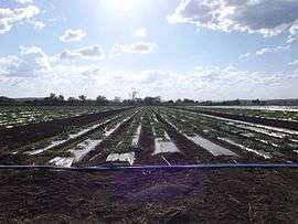
 Crops along Gatton Clifton Road, 2014 | |||||||||||||
 Lower Tenthill | |||||||||||||
| Coordinates | 27°36′20″S 152°14′21″E / 27.60556°S 152.23917°ECoordinates: 27°36′20″S 152°14′21″E / 27.60556°S 152.23917°E | ||||||||||||
| Population | 333 (2011)[1] | ||||||||||||
| Postcode(s) | 4343 | ||||||||||||
| LGA(s) | Lockyer Valley Region | ||||||||||||
| State electorate(s) | Lockyer | ||||||||||||
| Federal Division(s) | Wright | ||||||||||||
| |||||||||||||
Lower Tenthill is a locality in the Lockyer Valley Region of South East Queensland, Australia. At the 2011 Australian Census the locality recorded a population of 333.[1]
Agriculture has developed along Tenthill Creek which also forms part of both the western and eastern boundary of Lower Tenthill. Lower Tenthill Weir on Tenthill Creek, has a storage capacity of 70 ML and is used for the purpose of recharging groundwater supplies.[2] The northern boundary follows Lockyer Creek. Two other creeks cross the area - Ma Ma Creek and Deep Creek.
Tent Hill Lower State School opened in 1873.[3]
References
- 1 2 Australian Bureau of Statistics (31 October 2012). "Lower Tenthill (State Suburb)". 2011 Census QuickStats. Retrieved 15 October 2014.
- ↑ "Strategic Asset Management Plan" (PDF). Seqwater. 18 May 2009. p. 26. Retrieved 15 October 2014.
- ↑ "Tent Hill Lower State School". Department of Education, Training and Employment. Retrieved 15 October 2014.
External links
![]() Media related to Tenthill, Queensland at Wikimedia Commons
Media related to Tenthill, Queensland at Wikimedia Commons
This article is issued from Wikipedia - version of the 9/29/2016. The text is available under the Creative Commons Attribution/Share Alike but additional terms may apply for the media files.