Lower Birchwood
| Lower Birchwood | |
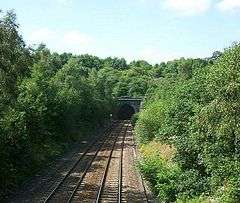 Tunnel. Lower Birchwood. |
|
 Lower Birchwood |
|
| OS grid reference | SK436539 |
|---|---|
| District | Amber Valley |
| Shire county | Derbyshire |
| Region | East Midlands |
| Country | England |
| Sovereign state | United Kingdom |
| Post town | ALFRETON |
| Postcode district | DE55 |
| Police | Derbyshire |
| Fire | Derbyshire |
| Ambulance | East Midlands |
| EU Parliament | East Midlands |
|
|
Coordinates: 53°04′52″N 1°21′00″W / 53.081°N 1.350°W
Lower Birchwood is a village in Derbyshire, England.[1] Lower Birchwood lies east of the town of Alfreton but the population is included in the civil parish of Somercotes.
References
This article is issued from Wikipedia - version of the 4/14/2016. The text is available under the Creative Commons Attribution/Share Alike but additional terms may apply for the media files.