List of ghost towns in Nevada
This is a list of ghost towns in Nevada in the United States of America. Most ghost towns in Nevada are former mining boomtowns that were abandoned when the mines closed. Those that weren't set up as mining camps were usually established as locations for mills, or supply points for nearby mining operations. In Clark County settlements along the Colorado River have been submerged underneath the reservoirs of Lake Mead or Lake Mohave.
Conditions
Ghost towns can include sites in various states of disrepair and abandonment. Some sites no longer have any trace of buildings or civilization and have reverted to empty land. Other sites are unpopulated but still have standing buildings. Still others may support full-time residents, though usually far less than at their historical peak, while others may now be museums or historical sites.
For ease of reference, the sites listed have been placed into one of the following general categories.
- Barren site
- Site is no longer in existence
- Site has been destroyed, covered with water, or reverted to empty land
- May have a few difficult to find foundations/footings at most
- Neglected site
- Little more than rubble remains at the site
- Dilapidated, often roofless buildings remain at the site
- Abandoned site
- Building or houses still standing, but all or almost all are abandoned
- No population, with the possible exception of a caretaker
- Site no longer in use, except for one or two buildings
- Semi-abandoned site
- Buildings or houses still standing, but most are abandoned
- A few residents may remain
- Historic site
- Buildings or houses still standing
- Site has been converted to a historical site, museum, or tourist attraction
- Still a busy community, but population is smaller than its peak years
List of ghost towns in Nevada
| Town | Image | County | Established | Disestablished | Status | Notes |
|---|---|---|---|---|---|---|
| Aurora | 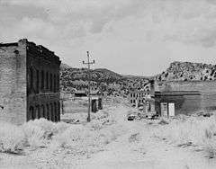 | Mineral | 1860 | Neglected site | ||
| Alturas | Clark | 1861 | In El Dorado Canyon (Nevada) near Techatticup Mine in the Colorado Mining District. | |||
| Belleville | Mineral | 1872 | ||||
| Belmont | 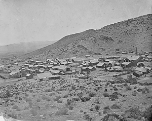 | Nye | 1865 | Former Nye County courthouse in Belmont is preserved as Belmont Courthouse State Historic Park[1] | ||
| Beowawe | Eureka | 1868 | ||||
| Berlin | 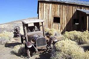 | Nye | 1897 | 1911 | Preserved within Berlin–Ichthyosaur State Park[2] | |
| Bermond Station |  | Churchill | Post Office from 1920-26. Location on 1910 USGS map | |||
| Blair | Esmeralda | |||||
| Bristol | Lincoln | |||||
| Broken Hills | Mineral | |||||
| Bullfrog |  | Nye | ||||
| Bullionville | Lincoln | |||||
| Cactus Springs | Nye | |||||
| Callville | Clark | 1864 | 1869 | Submerged under Callville Bay of Lake Mead | Steamboat landing, County seat of Pah-Ute County, Arizona Territory (1865-67), Post office (1867-69) | |
| Candelaria | Mineral | |||||
| Caselton | Lincoln | |||||
| Chafey | Pershing | |||||
| Charleston | Elko | |||||
| Coaldale | Esmeralda | |||||
| Cobre | 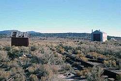 | Elko | ||||
| Colorado City | Clark | 1861 | Submerged under Lake Mohave | Steamboat landing near the mouth of El Dorado Canyon (Nevada) in the Colorado Mining District. | ||
| Columbus | Esmeralda | |||||
| Como | Lyon | 1861 | 1930's | Post office 1879-1881, 1903-1905; townsite occupied intermittently, activity finally ceasing in the 1930s after the closing of a sawmill | ||
| Cortez | Lander | |||||
| Crystal Springs | 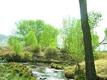 | Lincoln | ||||
| Currant | Nye | |||||
| Daveytown | Humboldt | |||||
| Deeth | Elko | |||||
| Delano | Elko | |||||
| Delamar | Lincoln | |||||
| Dixie Valley | 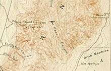 | Churchill | 1861 | |||
| Dun Glen | Pershing | |||||
| El Dorado City | Clark | 1863 | 1880's | Barren site | Mining camp in El Dorado Canyon (Nevada) in the Colorado Mining District. Site of the El Dorado Mills. | |
| Etna | Pershing | |||||
| Fairview |  | Churchill | 1904 | 1919 | ||
| Ferguson | Lincoln | |||||
| Fish Lake Valley | Esmeralda | |||||
| Flanigan | 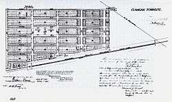 | Washoe | 1909 | 1973 | ||
| Fort Churchill | 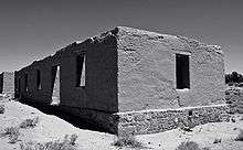 | Lyon | Preserved within Fort Churchill State Historic Park[3] | |||
| Gold Acres | Lander | |||||
| Gold Butte | Clark | 1908 | ||||
| Gold Center | 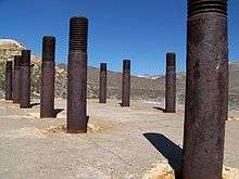 | Nye | ||||
| Gold Point | 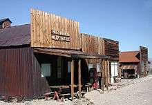 | Esmeralda | ||||
| Goldfield |  | Esmeralda | ||||
| Grantsville | Nye | |||||
| Hamilton | 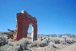 | White Pine | ||||
| Helene | Lincoln | |||||
| Henry | Elko | |||||
| Hiko | 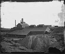 | Lincoln | ||||
| Ione | Nye | |||||
| Johnnie | Nye | |||||
| Jungo |  | Humboldt | 1911 | 1952 | Barren | Post Office from January 1911 until May 1952.[4] |
| Jessup |  | Churchill | 1908 | |||
| Lahontan City | Churchill | 1911 | 1915 | Developed to house workers during the construction of Lahontan Dam[5] | ||
| Logan | Lincoln | |||||
| Louisville | Clark | 1861 | 1862? | In El Dorado Canyon (Nevada) near the Techatticup Mine in the Colorado Mining District. | ||
| Lucky Jim Camp | Clark | 1862 | Barren | In El Dorado Canyon (Nevada) near the Techatticup Mine in the Colorado Mining District. | ||
| Mazuma | Pershing | 1907 | 1912 | Post office: 1907-1912. Site of flash flood that killed at least 8. | ||
| Marietta | Mineral | |||||
| Metropolis | Elko | |||||
| Midas | Elko | |||||
| Miller's | Esmeralda | |||||
| Miriam |  | Churchill | Non-agency station of the SPRR[6] | |||
| Mountain City | Elko | |||||
| Mule Lick | Nye | 1890 | ||||
| Nevada City | Churchill | 1916 | 1919 | A coöperative colony | ||
| Ocala |  | Churchill | ||||
| Osceola | White Pine | |||||
| Palisade | Eureka | |||||
| Palmetto | 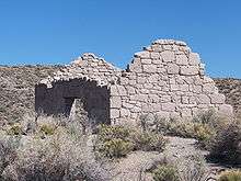 | Esmeralda | ||||
| Parran |  | Churchill | 1910 | A telegraph station and post office. PO closed 1913[7] | ||
| Pine Grove Site |  | Lyon | 1866-1918 | Several buildings | ||
| Pioneer | _ruins.jpg) | Nye | 1908 | Post office 1909–1931 | ||
| Poeville | Washoe | 1864 | 1880 | Post office 1874–1878 | ||
| Potosi | Clark | |||||
| Quartz Mountain | Nye | |||||
| Ragtown | Churchill | 1854 | Leeteville may be the same location | |||
| Rawhide | 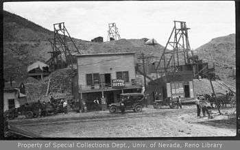 | Mineral | Town was founded in Esmeralda County before the creation of Mineral | |||
| Rochester | Pershing | |||||
| Rhyolite | 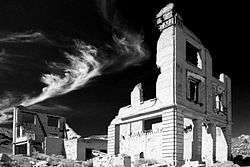 | Nye | 1904 | Post office closed 1913 | ||
| Rio Tinto | Elko | 1932 | 1948 | A few houses and the school remain. | ||
| Rioville | Clark | 1869 | 1906 | Site is now under Lake Mead. | Originally Junction City, Rioville had a post office from 1881 to 1906. | |
| Ruby Hill | Eureka | 1873 | 1910 | |||
| Ruth | White Pine | |||||
| San Juan | Clark | 1860's | In the upper part of El Dorado Canyon (Nevada) in the Colorado Mining District. | |||
| Scossa | Pershing | |||||
| Seven Troughs | Pershing | |||||
| Silver Canyon | Lincoln | |||||
| Simonsville | Clark | 1865 | 1870's | Barren | Originally called Mill Point, located west of the south end of Overton Airport and east of the Muddy River. | |
| Sprucemont |  | Elko | ||||
| Saint Joseph | Clark | 1865 | 1868 | Barren | Site located west of the north end of Overton Airport and east of the Muddy River. It burned down in 1868. Town name and population moved to what is now Logandale, Nevada. | |
| St. Thomas | Clark | Submerged beneath Lake Mead. Ruins became visible when water level of Lake Mead were lowered. | ||||
| Star City | Pershing | |||||
| Stillwater | 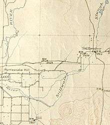 | Churchill | 1862 | |||
| Sulphur | Lyon | |||||
| Tempiute | Lincoln | |||||
| Tenabo | Lander | |||||
| Treasure City | White Pine | |||||
| Tybo | Nye | |||||
| Unionville | 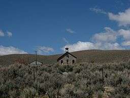 | Pershing | ||||
| Vernon | Pershing | |||||
| Vya | Washoe | |||||
| White Cloud City |  | Churchill | Also known as Coppereid | |||
| White Plains |  | Churchill | 1879 | 1909 | "No vegetation meets the eye when gazing on the vast expanse of dirty white alkali"[8] | |
| Wonder |  | Churchill | 1906 | Post office closed 1920 |
References
- ↑ Belmont Courthouse State Historic Park
- ↑ Berlin–Ichthyosaur State Park
- ↑ Fort Churchill State Historic Park
- ↑ "Jungo Post Office (historical)". Geographic Names Information System. United States Geological Survey. 1991-09-01. Retrieved 2016-01-03.
- ↑ Lahontan City
- ↑ Carlson, Helen S. (1985). Nevada place names : a geographical dictionary. Reno: University of Nevada Press. p. 169. ISBN 087417094X.
- ↑ Carlson, Helen S. (1985). Nevada place names : a geographical dictionary. Reno: University of Nevada Press. p. 187. ISBN 087417094X.
- ↑ Carlson, Helen S. (1985). Nevada place names : a geographical dictionary. Reno: University of Nevada Press. p. 245. ISBN 087417094X.
External links
- Forgotten Nevada - Abandoned and historical sites in Nevada. Pictures and directions
- Southern Nevada: The Boomtown Years 1900-1925