List of Pennsylvania state historical markers in Chester County
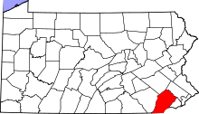
Location of Chester County in Pennsylvania
This is a list of the Pennsylvania state historical markers in Chester County.
This is intended to be a complete list of the official state historical markers placed in Chester County, Pennsylvania, by the Pennsylvania Historical and Museum Commission (PHMC). The locations of the historical markers, as well as the latitude and longitude coordinates as provided by the PHMC's database, are included below when available. There are 63 historical markers located in Chester County.[1]
Historical markers
| Marker title | Image | Date dedicated | Location | Marker type | Topics |
|---|---|---|---|---|---|
| American Light Infantry (The) | 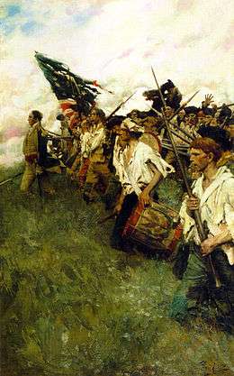 |
September 11, 1915 | US 1 (N side), 1 mile W of Chadds Ford | Plaque | American Revolution, Military |
| Ann Preston, M.D. (1813-1872) | 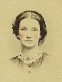 |
March 22, 2008 | 225 State Rd., West Grove 39°49′13″N 75°48′46″W / 39.8204°N 75.8127°W |
Roadside | African American, Medicine & Science, Religion, Underground Railroad, Women |
| Baptist Church in the Great Valley, The | 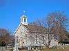 |
April 21, 1951 | SR 1007 (Valley Forge Rd.), .4 mile SE of Pa. 252, Tredyffrin Twp. 40°06′00″N 75°27′47″W / 40.10007°N 75.46307°W |
Roadside | Religion |
| Battle of Brandywine |  |
March 18, 1952 | Pa. 842 at intersection SR 3061 SW of West Chester | Roadside | American Revolution, Military |
| Battle of Brandywine | |
March 18, 1952 | U.S. 1, 1 mile E of Kennett Square 39°51′30″N 75°41′23″W / 39.8582°N 75.68982°W |
Roadside | American Revolution, George Washington, Military |
| Battle of Brandywine | |
March 18, 1952 | U.S. 1, 1 mile E of Kennett Square | Roadside | American Revolution, George Washington, Military |
| Battle of Brandywine | |
March 18, 1952 | Pa. 926 at intersection SR 1001 (Birmingham Rd.) W of Darlington Corners, West Chester | Roadside | American Revolution, Military |
| Bayard Rustin | 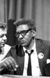 |
February 16, 1995 | At the school, Lincoln & Montgomery Aves., West Chester | City | African American, Civil Rights, Education |
| Birmingham Friends Meeting House | 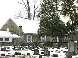 |
September 1915 | Wall of Meetinghouse, SR 2001 (Birmingham Rd.), .5 mile SE of PA 926, West Chester | Plaque | American Revolution, Buildings, Medicine & Science, Military, Religion |
| Brandywine Mansion |  |
July 25, 1985 | 102 S. 1st Ave., Coatesville 39°58′50″N 75°49′18″W / 39.98052°N 75.82168°W |
Roadside | Buildings, Business & Industry, Iron, Mansions & Manors |
| Chester County | 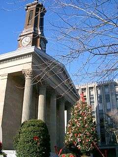 |
October 26, 1982 | County Courthouse, N. High St., West Chester 39°57′36″N 75°36′17″W / 39.95997°N 75.60482°W |
City | American Revolution, Early Settlement, Government & Politics, Government & Politics 17th Century, Military, William Penn |
| Chester Springs | 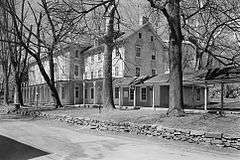 |
May 13, 1948 | Pa. 113 at Chester Springs 40°05′43″N 75°37′03″W / 40.0953°N 75.61762°W |
Roadside | American Revolution, George Washington, Medicine & Science, Military, Sports |
| Dilworthtown - PLAQUE |  |
September 1915 | SR 2001 (Birmingham Rd.) & Old Wilmington Pike, Dilworthtown 39°53′59″N 75°34′02″W / 39.8996°N 75.5671°W |
Plaque | American Revolution, Military |
| Dr. Charlotte Moore Sitterly (1898-1990) | September 24, 2005 | 640 Buck Run Rd., East Fallowfield Township | Roadside | Medicine & Science, Religion, Women | |
| Duffy's Cut Mass Grave | 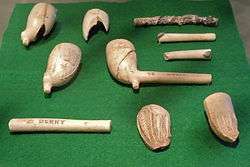 |
June 18, 2004 | King Rd. at Sugartown Rd., Malvern 40°02′01″N 75°31′47″W / 40.0335°N 75.5296°W |
Roadside | Business & Industry, Ethnic & Immigration, Labor, Medicine & Science, Railroads |
| Evan Pugh, Ph.D. |  |
September 26, 1964 | Jordan Bank Elem. School, S. Fifth and Hodgson streets, Oxford | City | Agriculture, Education, Environment, Medicine & Science, Professions & Vocations |
| Frederick Douglass (1818-1895) | 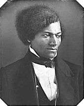 |
February 1, 2006 | West Chester Univ. campus, between Library and Main Hall, facing High St. 39°57′08″N 75°35′50″W / 39.95235°N 75.59732°W |
Roadside | African American, Civil Rights, Education, Government & Politics 19th Century, Military, Publishing |
| G. Raymond Rettew |  |
September 17, 2002 | Walnut & Chestnut Streets, West Chester 39°57′43″N 75°36′17″W / 39.96182°N 75.60485°W |
Roadside | Business & Industry, Medicine & Science, Military, Military Post-Civil War, Professions & Vocations |
| Gen. Anthony Wayne |  |
April 13, 1949 | U.S. 30 at junction Pa. 252 E of Paoli 40°02′31″N 75°28′36″W / 40.042°N 75.4767°W |
Roadside | American Revolution, French & Indian War, Military, Native American |
| General Lafayette |  |
June 9, 1951 | NW corner, N. Church & W. Lafayette Sts., West Chester 39°57′55″N 75°36′36″W / 39.96523°N 75.61°W |
City | American Revolution, Military |
| General Sir William Howe |  |
August 19, 1947 | U.S. 202, 2.9 miles NE of Paoli (Missing) | Roadside | American Revolution, Military |
| Great Minquas Path | June 26, 1951 | Business U.S. 322, 1 mile SE of West Chester 39°56′54″N 75°35′38″W / 39.9483°N 75.5938°W |
Roadside | Native American, Paths & Trails, Transportation | |
| Great Trail (The) - Minquas or Susquehanna Indians- PLAQUE | November 14, 1925 | US 202 & 322, at Church Ave., 1/2 mile S of West Chester 39°56′54″N 75°35′38″W / 39.9483°N 75.5938°W |
Plaque | Early Settlement, Ethnic & Immigration, Native American, Paths & Trails | |
| Great Valley Mill | 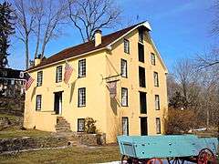 |
August 19, 1947 | U.S. 202, 1.5 miles NE of Paoli (Missing) | Roadside | Buildings, Business & Industry, Mills |
| Hopewell Historic District | 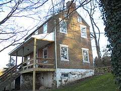 |
November 10, 1996 | Intersection of Hopewell & Lower Hopewell Roads, Lower Oxford & E. Nottingham Twps. | Roadside | Agriculture, Business & Industry, Education |
| Hopewell Village | 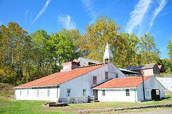 |
August 5, 1948 | Pa. 345 at Warwick, just N of junction Pa. 23 39°46′47″N 76°01′01″W / 39.7796°N 76.017°W |
Roadside | Business & Industry, Furnaces, Iron |
| Horace Pippin | June 9, 1979 | 327 Gay St., West Chester 39°57′30″N 75°36′37″W / 39.9583°N 75.61037°W |
City | African American, Artists | |
| Hosanna Meeting House | May 9, 1992 | Old U.S. 1 (Baltimore Pike) N of Lincoln University campus, Lower Oxford Twp. 39°48′41″N 75°55′31″W / 39.8115°N 75.9253°W |
Roadside | African American, Houses & Homesteads, Religion, Underground Railroad | |
| Ida Ella Ruth Jones (1874-1959) | October 23, 2004 | Pa. 82 (Doe Run Rd.) at Rokeby Rd., East Fallowfield 39°56′23″N 75°49′58″W / 39.93978°N 75.83278°W |
Roadside | African American, Artists, Women | |
| Indian Hannah (1730-1802) - PLAQUE | September 1925 | PA 52 (E side), .2 mile N of junction US 1, Kennett Square 39°52′21″N 75°40′07″W / 39.8724°N 75.6687°W |
Plaque | Government & Politics 18th Century, Native American, Religion | |
| John Beale Bordley | 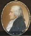 |
February 25, 1953 | SR 3062 (Strasburg Rd.) just off Pa. 162, 1.6 miles W of Marshalltown | Roadside | Agriculture, Environment, Invention, Professions & Vocations |
| John F. Fritz | August 16, 1954 | Pa. 41, 2.8 miles SE of Cochranville (Missing) | Roadside | Business & Industry, Invention, Iron, Professions & Vocations, Steel | |
| John G. Parke | 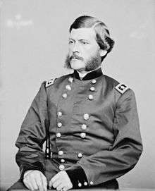 |
July 22, 1968 | Business US 30 at Veterans Hospital, near N Caln Rd., E of Coatesville 39°59′19″N 75°47′36″W / 39.98853°N 75.79345°W |
Roadside | Civil War, Environment, Government & Politics, Military, Professions & Vocations |
| Joseph T. Rothrock | 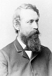 |
June 9, 1952 | NW corner, N. Church St. & W. Lafayette St., West Chester 39°57′49″N 75°36′33″W / 39.9635°N 75.60922°W |
City | Environment, Medicine & Science, Professions & Vocations |
| Lightfoot Mill (Mill at Anselma) | 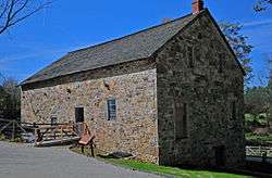 |
October 13, 2007 | 1730 Conestoga Rd. (W side of state hwy. 401), Chester Spgs. | Roadside | Business & Industry, Mills |
| Lincoln Biography | 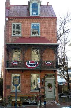 |
September 17, 1952 | 28 W. Market St., West Chester 39°57′33″N 75°36′19″W / 39.95928°N 75.60515°W |
City | Abraham Lincoln, Government & Politics, Government & Politics 19th Century, Publishing |
| Lincoln University |  |
January 25, 1967 | SR 3026 (old U.S. 1), 2 miles NE of Oxford 39°48′38″N 75°55′41″W / 39.8106°N 75.9281°W |
Roadside | African American, Education |
| Lynching of Zachariah Walker, The | December 9, 2006 | Rt. 82 south, approx. 1/4 mile from Coatesville city limits | Roadside | African American, Civil Rights, Government & Politics 20th Century | |
| Minguannan Indian Town - PLAQUE | October 1924 | Intersection SR 3006 (Yeatman Station Rd.) & SR 3034 (London tract Rd.), 1.5 miles NE of Strickersville | Plaque | Cities & Towns, Early Settlement, Government & Politics 17th Century, Native American, William Penn | |
| Okehocking Indian Town - PLAQUE |  |
June 1924 | PA 3 (West Chester Pike), .5 mile E of PA 926 & 4 miles W of Newtown Square | Plaque | Cities & Towns, Early Settlement, Native American, William Penn |
| Osborne's Hill - PLAQUE | |
September 1915 | Sr 2001 (Birmingham Rd.) at driveway to Osborne Hill, 1 mile S of Strodes Mill | Plaque | American Revolution, Military |
| Pennhurst State School & Hospital | 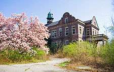 |
April 10, 2010 | Schuylkill Rd. (PA 174) near Bridge St., Spring City | Roadside | Civil Rights, Education, Government & Politics 20th Century |
| Pennsylvania |  |
December 12, 1948 | U.S. 1, approx. .6 miles from state line | Roadside | Government & Politics, Government & Politics 17th Century, William Penn |
| Pennsylvania | |
December 12, 1948 | Pa. 41, approx. .7 miles from state line | Roadside | Government & Politics, Government & Politics 17th Century, William Penn |
| Peter Bezellon | October 14, 1954 | SR 3064 (West Chester Rd.) at Oak St., S end Coatesville 39°58′55″N 75°48′17″W / 39.98185°N 75.8048°W |
City | Early Settlement, Native American, Professions & Vocations | |
| Philadelphia & Lancaster Turnpike |  |
November 20, 1999 | E Lincoln Hwy. (Bus. Rt. 30), near Veterans Dr., Caln Twp., just E of Coatesville 39°59′19″N 75°47′31″W / 39.98848°N 75.79208°W |
Roadside | Government & Politics, Roads, Transportation |
| Phoenix Iron Company |  |
October 29, 2005 | Main St., Phoenixville, near municipal parking lot and P.I.C. site | City | Business & Industry, Civil War, Iron, Military |
| Queonemysing Indian Town (PLAQUE) | October 4, 1924 | PA 100, ~.1 mile N of state line, and at Delaware County line (MISSING) | Plaque | Cities & Towns, Early Settlement, Native American, William Penn | |
| Samuel Barber | 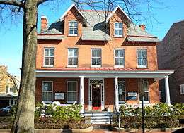 |
March 9, 1996 | 107 S. Church St., West Chester 39°34′42″N 75°36′16″W / 39.57833°N 75.6045°W |
City | Music & Theater |
| Sconnelltown - PLAQUE | |
September 1, 1915 | Near junction SR 3061 & 2001, just off PA 842 SW of West Chester 39°56′08″N 75°37′30″W / 39.93555°N 75.62505°W |
Plaque | American Revolution, Military |
| Springton Manor | 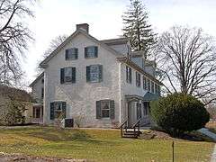 |
October 5, 1984 | SR 4023 (Springton Rd.) & Highspire Rd., 1 mile N of U.S. 322, Wallace Twp. | Roadside | Government & Politics, Government & Politics 18th Century, Mansions & Manors, William Penn |
| Star of the West (Tent#6) | 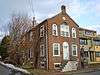 |
May 15, 1995 | 113 S Adams St., West Chester 39°57′41″N 75°35′51″W / 39.96137°N 75.59757°W |
City | African American, Women |
| Steyning Manor - PLAQUE | October 1926 | SR 3048 (old US 1) southbound, .5 mile W of Kennett Square | Plaque | Government & Politics, Mansions & Manors, Native American, William Penn | |
| The British Attack - PLAQUE | |
September 1915 | PA 926 at intersection SR 2001 (Birmingham Rd.), West Chester | Plaque | American Revolution, Military |
| Thomas B. Read | 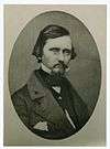 |
May 12, 1948 | US 322 at Corner Ketch Lyndell Rd.(SR 4037), NW of Downingtown | Roadside | Artists, Writers |
| Thomas McKean |  |
October 26, 1974 | Pa. 896 NW of Pa. 841, Franklin | Roadside | Government & Politics, Government & Politics 18th Century, Governors |
| Trimble's Ford - PLAQUE | 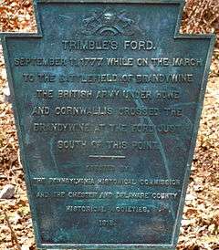 |
September 1, 1915 | SR 3023 (Camp Linden Rd.), .2 mile E of SR 3058, Marshallton 39°56′03″N 75°40′50″W / 39.9341°N 75.68042°W |
Plaque | American Revolution, Military |
| Village of Valley Forge |  |
September 17, 1960 | Valley Forge Rd. (PA 23) near Owen Dr., at E end of village and Montgomery Co. line | Roadside | Early Settlement, George Washington, Government & Politics, Government & Politics 18th Century, Iron |
| Village of Valley Forge | |
n/a | Valley Forge Rd. (PA 23) near Valley Park Rd., W end of village 40°06′05″N 75°28′28″W / 40.10125°N 75.47447°W |
Roadside | American Revolution, Business & Industry, Cities & Towns, George Washington, Iron, Military |
| Warwick Furnace |  |
May 12, 1948 | Pa. 23 between Warwick & Knauertown | Roadside | Business & Industry, Furnaces, Iron |
| Whittier C. Atkinson (1893-1991) |  |
April 14, 2007 | 824 E Chestnut St., Coatesville | City | African American, Medicine & Science |
| William Darlington |  |
April 11, 1952 | 13 N. High St. between Market & Gay Sts., West Chester 39°57′36″N 75°36′17″W / 39.96013°N 75.60477°W |
City | Environment, Government & Politics 19th Century, Medicine & Science, Professions & Vocations |
| Woman's Rights Convention of 1852 |  |
October 13, 2003 | 225 N. High St., West Chester 39°57′43″N 75°36′24″W / 39.96203°N 75.6066°W |
City | Civil Rights, Education, Professions & Vocations, Women |
See also
- List of Pennsylvania state historical markers
- National Register of Historic Places listings in Chester County, Pennsylvania
References
- ↑ "PHMC Historical Markers Search" (Searchable database). Pennsylvania Historical and Museum Commission. Commonwealth of Pennsylvania. Retrieved 2010-07-19.
External links
This article is issued from Wikipedia - version of the 4/23/2016. The text is available under the Creative Commons Attribution/Share Alike but additional terms may apply for the media files.